
 We’ve explored the northern part of the Olympic Peninsula and Olympic National Park on a handful of occasions, including a long weekend motorcycle trip to Forks, Ruby Beach and the Hoh Rainforest with a loop to Cape Flattery and a scenic ride along the Strait of Juan de Fuca a couple of years back.
Since then we’ve talked about returning on the bikes to explore the southern part of the Olympic Peninsula, which no one seems to talk about. We determined that was either because no one goes or because there is nothing to report, hoping the silence is attributable to the former.
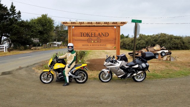
This Labor Day we finally had an opportunity to explore this area of Washington when our plans to hike Mount St. Helens fell through. I found an article in our AAA magazine about a restored inn in Tokeland that became our destination for our first night, and Brian discovered a yurt on AirBnB that we could call home our second night. With those anchors in place, I was able to research a few hikes and places to eat, Brian was able to scour Roadside America for absurd places to stop, and a 436-mile motorcycle trip around the southern Olympic Peninsula was born.
Here’s a recap of our itinerary and some of our stop along the way!
Day 1: Lynnwood > Tokeland (175 miles)
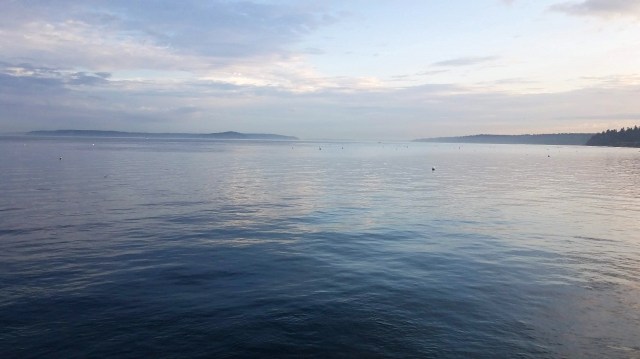
We set out early and caught the 7:10 a.m. ferry to Kingston, deciding to forgo breakfast and instead head straight for our first destination, Mount Walker. We did make one quick stop along the way at an interesting roadside artistic display of painted hot water and propane tanks, where Brian insisted he be photographed. I’m not sure how these gems were overlooked by Roadside America—perhaps Brian can submit them for consideration!


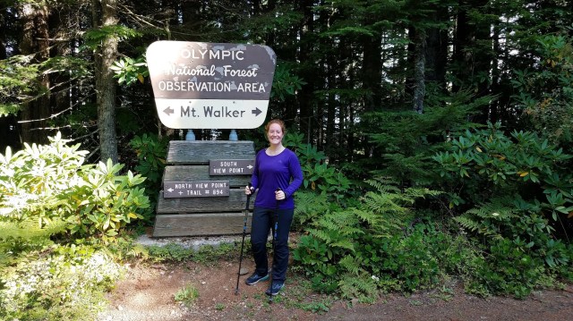
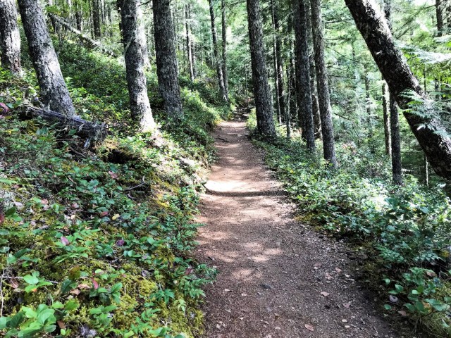
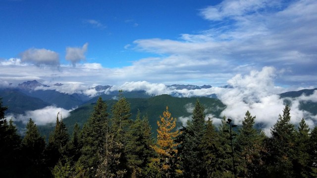
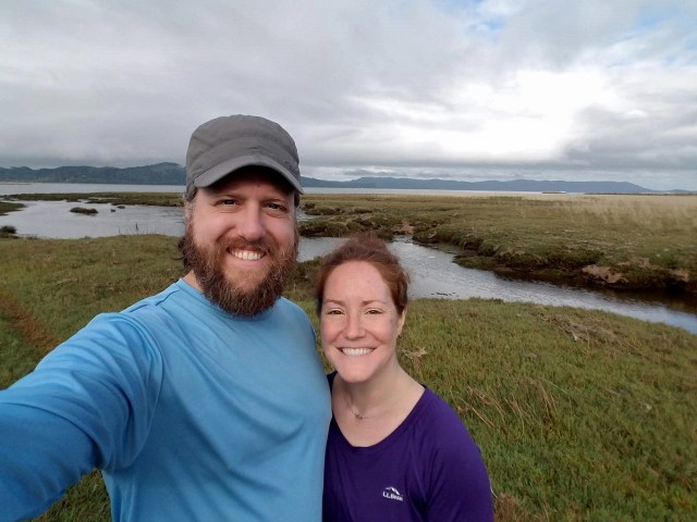
After winding our way through the woods, we turned onto a gravel road and parked across from the Mount Walker trailhead. There were only a handful of cars, and we ended up having the trail almost entirely to ourselves.
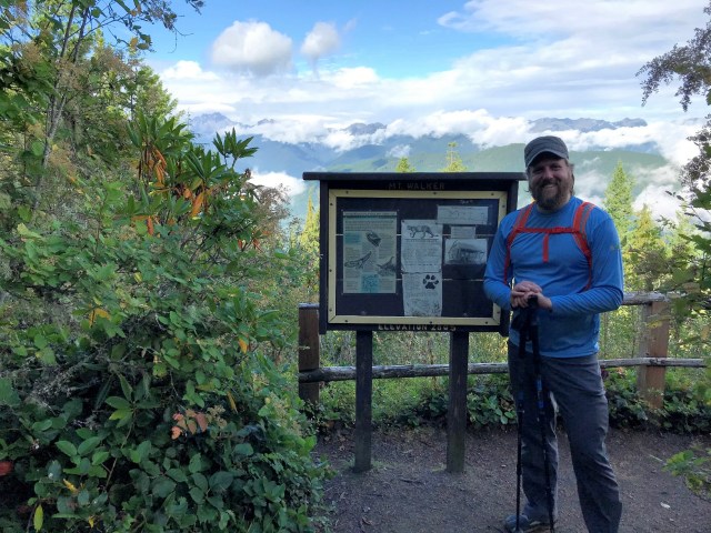
This hike ended up being 5.5 miles roundtrip thanks to some wandering around we did at the top in order to see both the northern and southern viewpoints. The hike itself was 2 miles straight uphill at 2,500 feet of elevation gain. This was no joke—WTA reports that the trail has sections that are 10% and 20% grade, and I can attest that this is true! We had to stop several times for water and to stretch out our calves—we were both sweaty and happy when we finally reached the top! What a workout!
There were a few people at the viewpoints who had driven to the top of the mountain to park and look around. There was some cloud cover so we didn’t have the full 180 views of the surrounding mountains, but what we could see was beautiful.
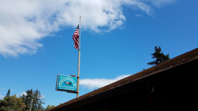
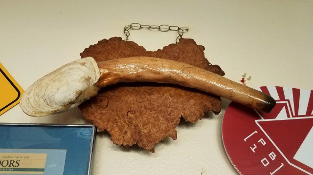
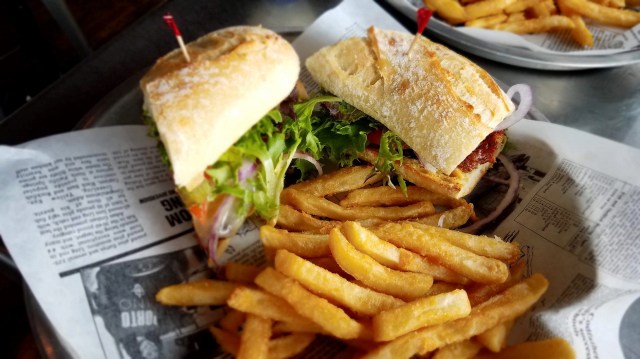
We were starving after the morning’s adventure and after a quick detour to see the world’s largest clam pile, we pulled into a roadside eatery called the Geoduck for lunch (the final picture in the series below is of a geoduck, in case you aren’t familiar. And yes, that is an actual animal that you can eat!).
There was outdoor seating on a patio overlooking the Hood Canal, the weather was beautiful, and we thoroughly enjoyed our lunch before continuing south on route 101 toward the Pacific Ocean. This whole stretch of 101 along the canal was a wonderful drive, especially on the bikes.

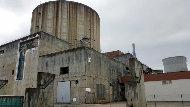
Somehow Brian and I both stumbled upon our next stop, the Satsop Business Park, which is home to an abandoned nuclear power plant that was built in the 1970s. The project ran out of funding in the early 1980s and was left incomplete. The place was surreal—it was as though we were driving around a deserted concrete world post-apocalypse. Towering overhead were two enormous concrete structures with smaller half-completed and abandoned buildings nearby.
Some of the areas have been given new life and serve as distribution centers for company’s like Overstock.com. But much of the park is deserted and open for public tours several times a year. It was fascinating and we were able to wander around for a while, but we may well be back for a guided tour!


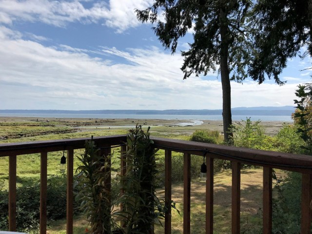
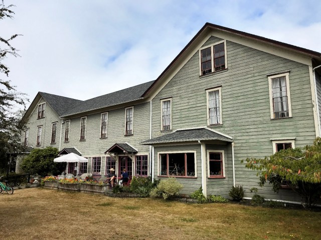
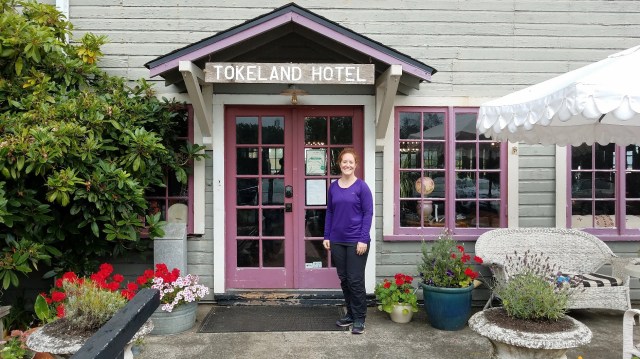
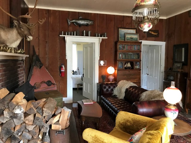
Our final stretch was the longest, but we eventually made our way to the Pacific Ocean and our destination, the small town of Tokeland. The Tokeland Hotel is certainly the town’s crowning jewel—the area is residential and aside from a small casino, there is nothing else to really see or do.
However, the inn was a delight and a perfect spot to relax. The staff were friendly, and we were quickly led through a series of large rooms with eclectic décor as we headed toward our room on the second floor. The inn was established in 1885 and much remains the same, including a lack of plumbing, resulting in guests sharing Loo 1 and Loo 2 in the hall versus having en suite amenities. We are preparing for a similar experience when we stay at Paradise in the Mt. Rainier lodge later this year, so this was good practice!


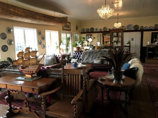


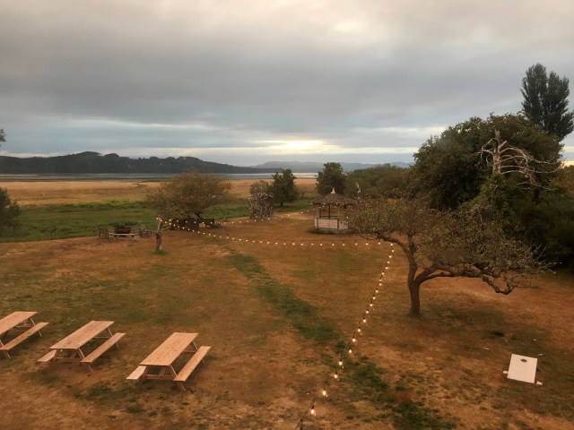
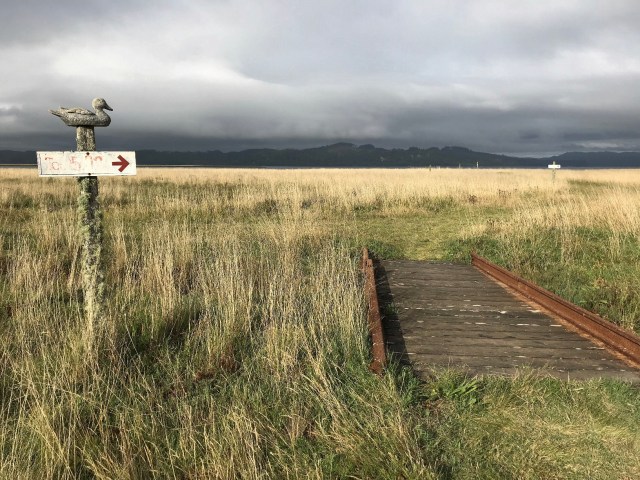
After dropping off our things and changing out of our motorcycle gear, we headed outside for a walk around the grounds, which used to be a golf course and home to a shooting club in the early 1900s. Today you can wander around the mowed trails through a maze of wetlands, restoring your inner peace.
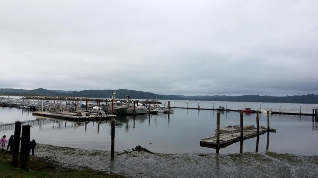
We also ventured to the southern tip of the peninsula to check out the marina before I realized the time and we hoofed it back for dinner.

The inn is owned by a husband-wife duo–the wife is the chef at the inn as well as at the Capitol Hill-based Wandering Goose where we enjoyed my birthday brunch last year. We spent several hours at dinner, enjoying shrimp cocktail and a trio of southern appetizers, splitting the scallop pasta entrée, and lingering over plum gallette and chocolate bread pudding.
The place was full of patrons, our waitress was lovely, the sun sank slowly into the ocean, and I couldn’t have asked for a better way to conclude our first day!
Day 2: Tokeland > Elma (163 miles)
We were up and packed before our alarm sounded Sunday morning. After I grabbed some coffee from the self-serve station in the dining area downstairs, we took a final stroll through the wetlands and then rode north toward Westport.
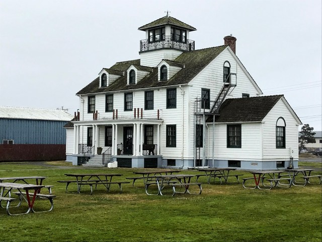
During his research, Brian discovered the Grays Harbor Lighthouse, which is the tallest lighthouse in Washington! Other interesting facts from their website:
Construction of the lighthouse began in 1897. On June 30, 1898, a dedication ceremony was held at the base of the lighthouse and that night marked the first official service of the Grays Harbor Light. Originally located approximately 300 feet from the water’s edge, the lighthouse now sits about 3,000 feet from the high tide mark. This change occurred from land accretion in the area, due in part, by construction of the jetty system in the early 1900s.
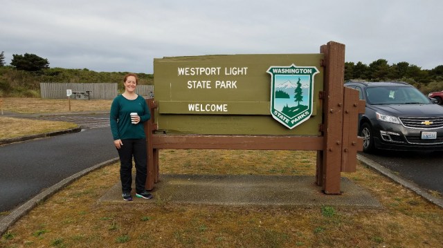
We arrived at our destination about 30 minutes after leaving the inn, only to discover the lighthouse didn’t open until 11 a.m. No matter—I popped across the street for a coffee from the Lighthouse Bistro, and we set off on the 2.5-mile hike I found along the coast.
After a quick walk down the sidewalk to Westport Light State Park, we were on a clear, paved trail through the grassland and dunes leading out to the beach and ocean. The trail was lined with benches and had several wooden boardwalk/overlooks where we could pause and admire the waves crashing to shore.

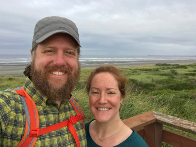
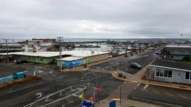
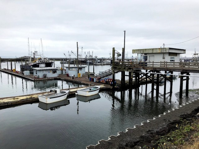
Rather than returning the way we came, when we reached the parking area at the other end of the trail we continued into the town of Westport, dodging the rain and exploring the Westport Viewing Tower, marina, and Westport Maritime Museum.
While the rain eventually stopped, the sky continued to look ominous. We picked up the pace, walking along a busy road and cutting through a small neighborhood and back to our bikes just as the clock was striking 11 a.m.

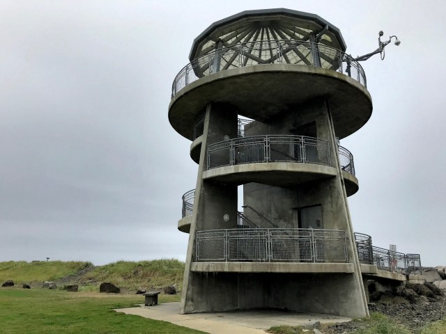


The lighthouse had just opened so we purchased tickets and joined a small group climbing the 135 steps to the top. In addition to its unique placement so far from shore, this lighthouse had a few other distinct features:
- The light house’s signature is alternating white and red light. Because of the amount of light absorbed via the red screen, that half of the lens had to be many times bigger than the lens producing white light so you could see both from an equal distance. There’s a picture of the large, red side of the lens below.
- The floor surrounding the lens has small portals all around, allowing light from the lens to shine down to the floor below so the keeper could see without having to use multiple other light sources.
- The walls below the lens have vents that the keeper could open or shut as needed to control the flame and keep it consistent.
I also enjoyed learning about the mercury bath on which the lens floated for decades—this frictionless environment made it possible to move the lens with only the push of a finger!


It was lunchtime when we concluded our Westport adventure. From there, our journey took us north through Aberdeen, the birthplace of Nirvana’s Kurt Cobain, and Hoquium. I thought we would cut over to the ocean and drive north along the coast, but I was hungry so instead we headed directly to Seabrook to check out Mill 109, a restaurant I read about somewhere online.
The town was established in 2003 and everything looked and felt as though it were still new. Despite the late hour, the place was busy. We grabbed seats just inside along the floor-length window and shared fish and chips and an oyster sandwich before crossing the street to a small market where we grabbed supplies for the evening.


Satiated, we continued north to the Olympic National Forest and Lake Quinault. This turned into an adventure for me as my tank only holds enough gas for me to travel about 100 miles. There were no towns or gas stations along our drive, and I was right on the brink—we ended up pulling over so I could switch to reserves for the final few miles heading into the park where I was able to refuel.
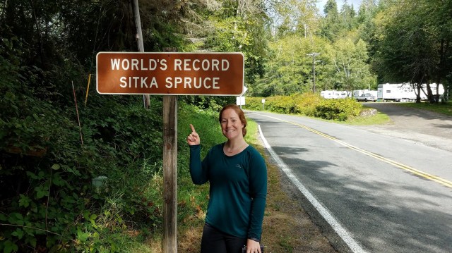
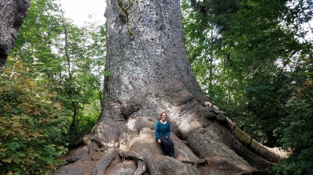
We made two stops in the park to see the world’s largest spruce (a 191-foot Sitka with a 58-foot circumference, estimated to be more than 900 years old!) and to enjoy a modest, 2-mile interpretive hike through the temperate rainforest.
The Sitka spruce was incredible—pictures don’t do it justice. The hike was short and sweet but filled with gigantic Douglas firs—the most I have ever seen in one place.


We wanted to reach our yurt before sundown. After winding our way southeast through the peninsula, which is replete with farmland and the remains of countless clear-cut forests, and navigating a sketchy bit of gravel road, we finally pulled up to our overnight abode.
Keith, the owner, was very kind and gave us a quick tour of the place. The yurt was so much bigger than I imagined and had all kinds of amenities inside—a small bedroom, a bathroom complete with a composting toilet, and a living space filled with musical instruments and vinyl records, view masters and slide shows, crystals and salt laps, and a small kitchen area.

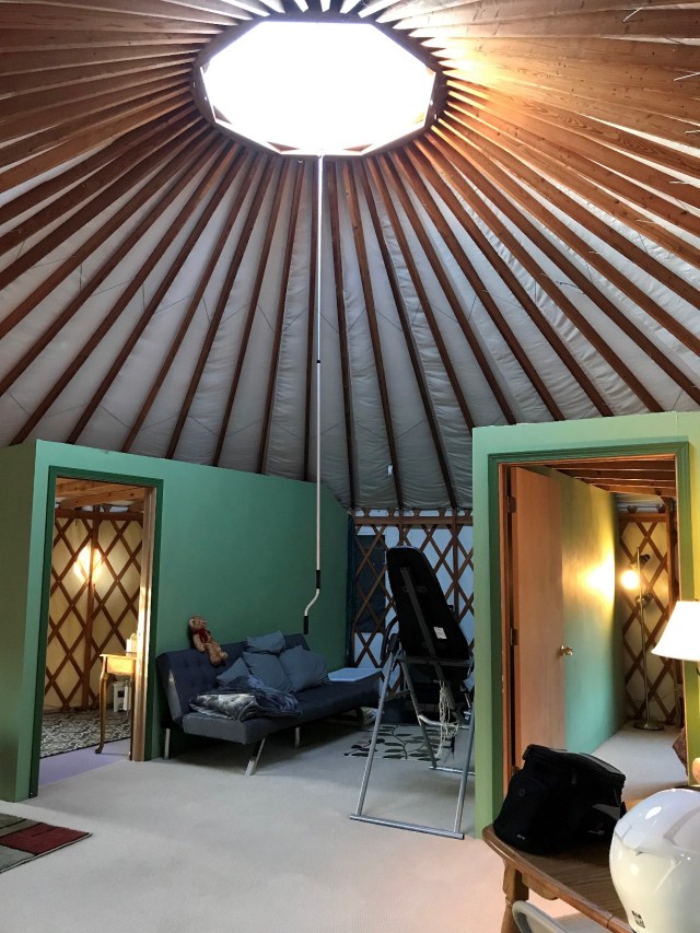

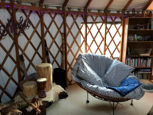


Our overnight manual detailed several areas of the property we were also welcome to explore, including a crystal fire pit, a regular firepit, and a manifestation well. We were tired and ready to relax so I folded myself into a cozy bowl chair while Brian played guitar, and we jointly enjoyed the snacks we had purchased for dinner.
Before bed we popped out on the patio and stood in awe under a pitch-black night sky filled with stars. We haven’t been that far from light pollution since our trek to Mauna Kea on Hawaii’s Big Island. It was another incredible day.
Day 3: Elma > Lynnwood (98 miles)
Once again up before our alarms, we set out early for Shelton to refuel and catch route 3 north toward Bremerton. Originally, we hoped to grab brunch at the Hi Low Café, one of our favorite spots, but it was closed for the holiday so we rerouted to Poulsbo instead.
This fun Scandinavian village was not terribly busy when we arrived, and we had no trouble grabbing brunch at the Brass Kraken along the water. Our experience and food were just ok–I would try it again for a meal other than breakfast and sit outside on their patio overlooking the water.
We walked off our breakfast, enjoying the marina and a resident seal diving along the shore, exploring a wooden boardwalk to a nearby park, grabbing some treats from Sluys Bakery for later, and then heading for home.


Our three-day weekend was just the right amount of time to keep a steady pace of motorcycling around the southern part of the Peninsula without getting too saddle sore. I was ready to rest each evening, but I was recovered and ready to head out each morning. I loved both places we stayed, and our hikes at Mount Walker and in the Olympic National Forest were highlights for me—I know Brian put the abandoned nuclear power plant at the top of his post-trip, must-see list.
I can see why the northern loop of the peninsula gets all the attention and if you only have time to do one route, I would stick with the northern loop where you get the full experience of the mountains, Strait of Juan de Fuca, and national park.
However, if you have more time, there is a lot of beautiful country to explore on the southern route as well, from driving along the coast to accessing the lower rainforests to a variety of Roadside America stops, many of which we had to forgo this trip.
Until next time, Olympic Peninsula!

Pingback: Things to Do: Seattle, Washington – Heather's Compass
Pingback: Washington Hikes: Tubal Cain Mine – Heather's Compass
Pingback: Opt Outside: Exploring the National Parks – Heather's Compass