
 We talked all week about hitting the trail on Saturday morning but it wasn’t until Friday night that we realized we hadn’t actually decided where we wanted to hike!
Planning out our hikes in advance is not a reflection of my need to be constantly organized, although it certainly eases my mind to have a plan. There are some logistical reasons we have to plan ahead that hadn’t occurred to me early on in our journey to becoming intermediate hikers:
- We are a minimum hour-long drive from the Cascade Mountains and most of the major hikes. The time we get up and hit the road can vary quite a bit, depending on where we decide to hike.
- Many of the parks require permits and passes that you have to secure before you get to the park and trail.
- This time of year the mountains have tons of snow and you have to double-check the trails and trailheads are actually accessible. The weather in the mountains can be quite different from the weather where we live and can also vary from trail to trail, depending which area of the Cascades we are considering.
- The weather, type of trail, etc. impacts what we pack for our hike.
Before we headed upstairs to bed, we huddled in the living room over our phones to construct our plan. While I was scanning the hikes I had saved in my Washington Trails Association account to assess length/height and which permits we needed, Brian looked them up on Google Maps to find out where they were. I love that we’re starting to know the names of the more popular hikes and where they are in the Cascades, but there are still quite a few that are unfamiliar and that we have to spend a little time researching before we commit.
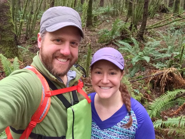
We decided to tackle a more reasonable hike that was a little closer—over in the Snoqualmie region—given I needed to come back from the hike and get my homework done. At 5.6 miles and 1,486 foot ascent, the winner was an out-and-back hike to Teneriffe Falls.
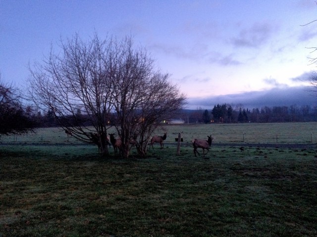
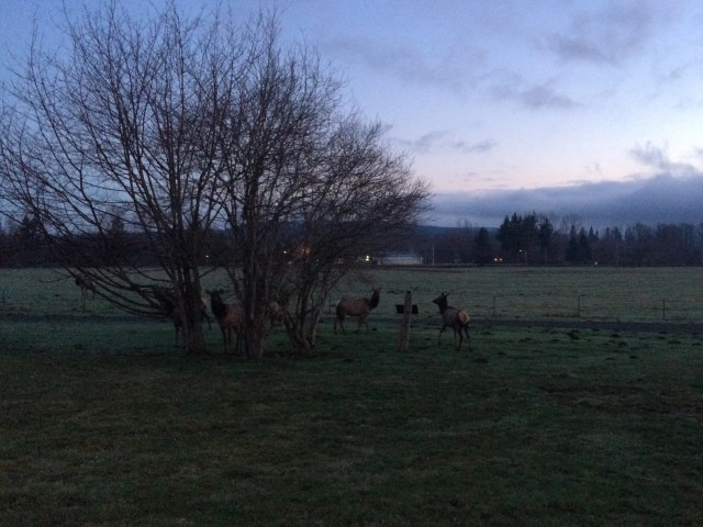
Around 6 a.m. we were on the road and on track to arrive at the trailhead just as the parking area opened at 7 a.m. The sky was beginning to grow light as we neared Snoqualmie, and all of a sudden I made out some figures along the road. I started hollering and gesturing at Brian although I wasn’t sure what I was seeing or how to articulate it in the moment, and he was able to safely slow us down and turn us around in time to pull up alongside an elk herd!
I don’t think I’ve come across an elk herd in the wild before, although we did see a magnificent male elk along the road while we were motorcycling around Vancouver Island last summer that literally took my breath away. This herd was primarily composed of females, though there was one spike in their midst, and they all stood silently watching us under a few small trees. My cell phone pictures don’t do them justice, but I tried to quickly snap a few before other cars came along to scare them away.
The rest of our journey to the trailhead was uneventful, and the lot was basically empty when we pulled in. I couldn’t believe how big it was—the website said it held 70 cars, and I believed it. Usually the trails have extremely limited parking, but I think because this hike is near so many other popular ones and in a residential area they likely had to put in extensive and permanent parking options to keep people off of the road.
We were quickly on the trails, which wound up through the woods before leveling off. One thing that stood out to me about this hike was how much the trail varied throughout—from packed dirt to pine needles to rocks and boulders! There were very few people on the trail and it was rather wide in places so we were able to hike beside each other most of the time.


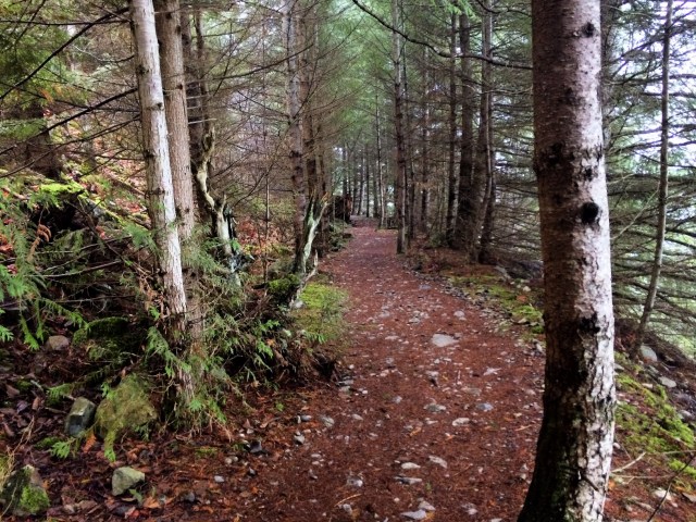
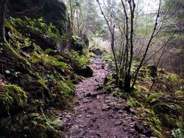
After a somewhat leisurely stroll through the woods with occasional views through the trees and over the surrounding area, we came to the beginning of the switchbacks.
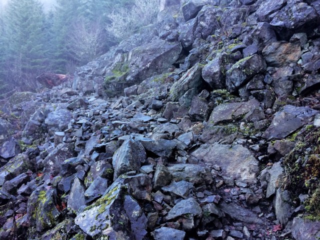
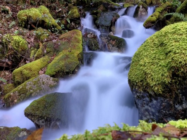
The website was not exaggerating when it referred to them as ‘relentless’—there were 22 of them! We made our way back and forth over the rocks and boulders, sometimes reentering the woods and catching glimpses of the river flowing from the waterfall.
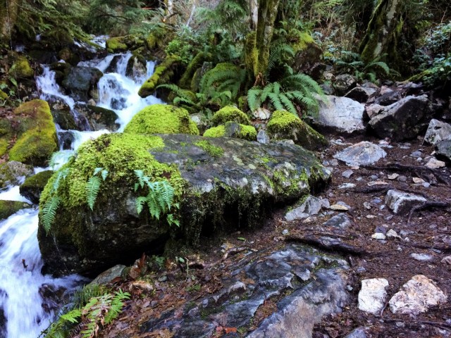
About half-way up the water seemed to be flowing more aggressively and getting louder, and soon we were actually hiking right along a small section of falls leading up to the bigger drop. I can see why other hikers talked about water on the trail—had there been recent rain or snow we would have been climbing up the falls versus alongside them!


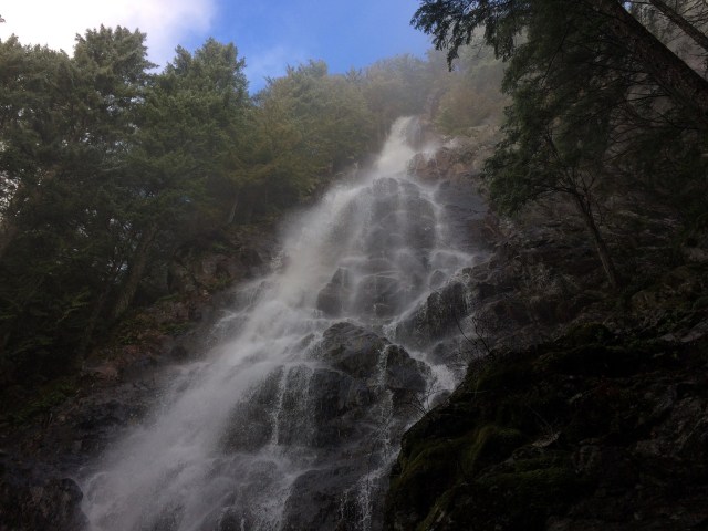
We finally rounded the last switchback, headed back into the woods, and climbed up a small hill to the foot of the falls. It was absolutely incredible. We were staring straight up at the huge drop, watching the water crash down into the pools nearby. I don’t think I’ve ever been that close to a major waterfall from that angle—the perspective was mesmerizing. I couldn’t stop staring up, taking in how the water was shooting out over some ledges and trickling down along the rock in other places. It was truly breathtaking.
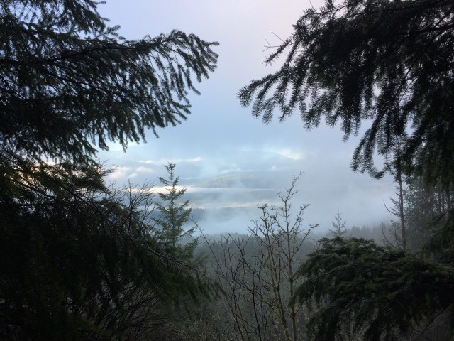
Clouds had settled in all around the mountain and our trek through the switchbacks had been foggy with extremely limited views. But the clouds hadn’t quite made their way directly above us so as we stared up at the falls, it was lit by a sunny, blue sky.
We were beginning to get wet from the mist and some of the random sprinkles of water so we finally had to pull ourselves away and head back toward the trail for our descent. Another hiker had just made it to us as we left—she seemed very nice, but I was so glad we had that incredible view and moment to ourselves.


On our way back to the trailhead I was once again grateful we had dragged ourselves out of bed early. Our round trip took us just under three hours and as we were heading down we passed between 80-100 people. I can’t imagine all of those people trying to take turns cramming into the small viewing spot to see the falls—it would have been an entirely different viewing experience.
I would highly recommend this hike to both beginner and intermediate hikers. It didn’t take that long, offered a decent workout, and was definitely worth the final view. It’s no wonder it’s so popular!
We will definitely be back soon, if not to see the falls, then to take the full trail to the Mount Teneriffe Summit.

Pingback: Celebrating Earth Day, Your Way – Heather's Compass
Pingback: Washington Hikes: Talus Loop Trail – Heather's Compass