
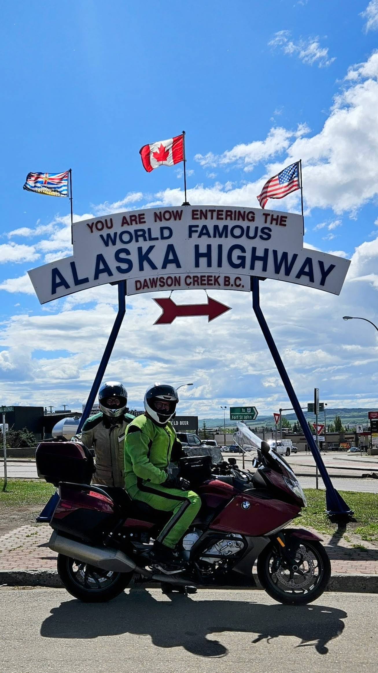
The Alaska Highway was one of the most anticipated routes of our motorcycle trip from Wyoming to Alaska.
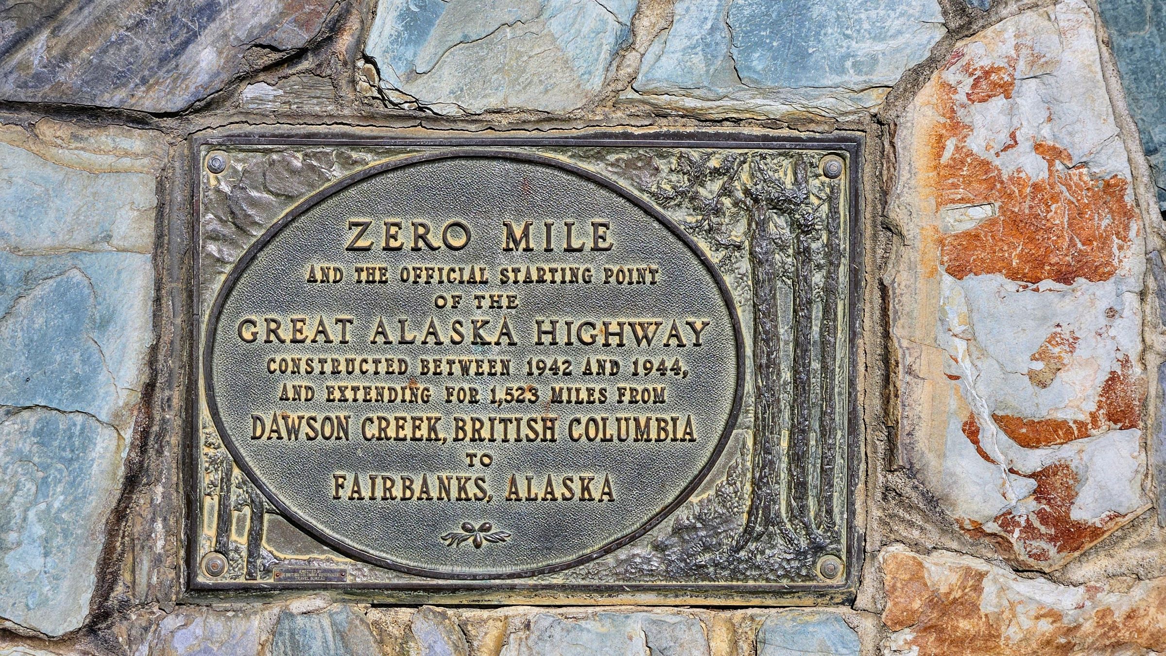
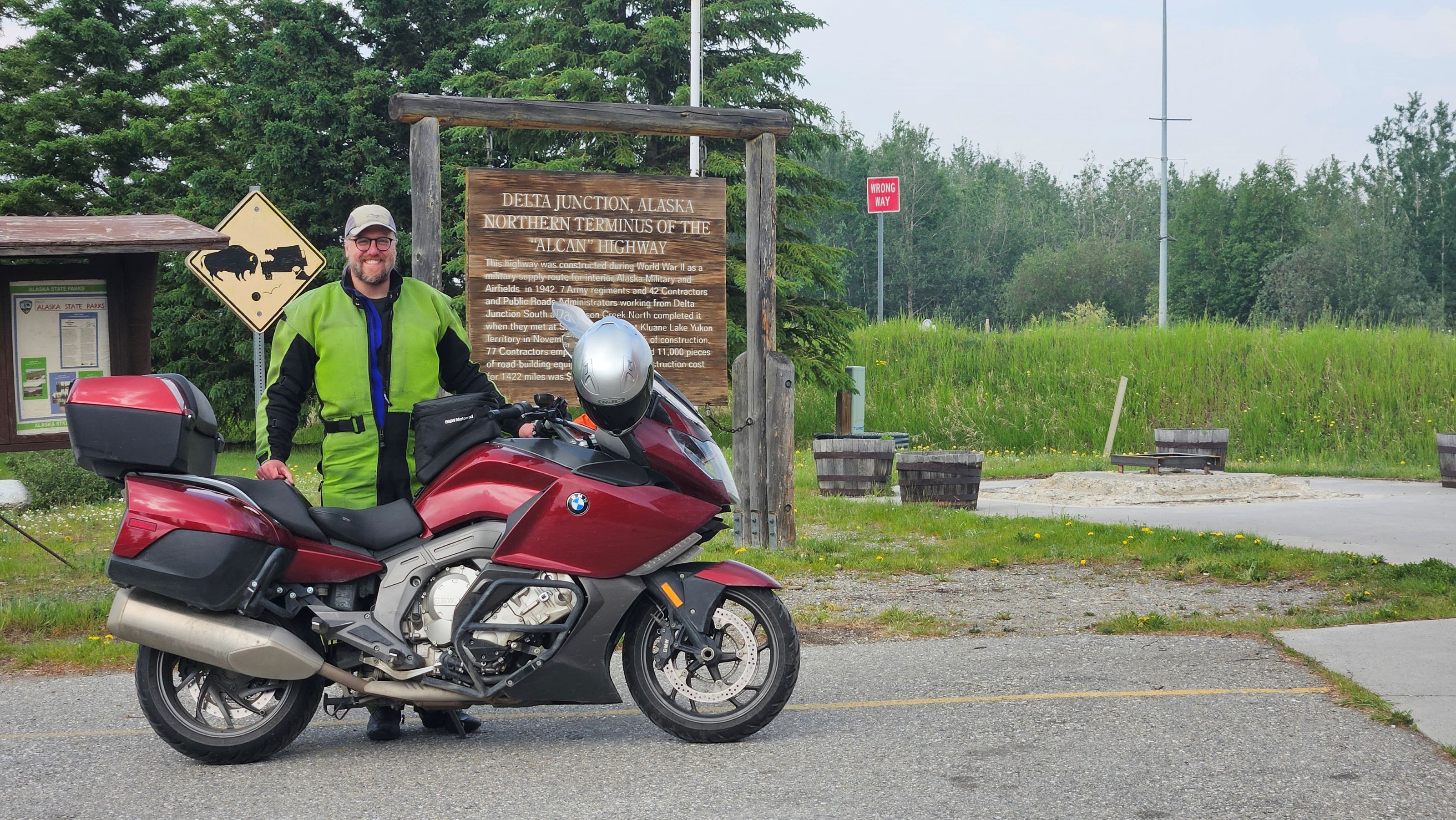
Built in 1942 and opened for public use in 1948, the Alaska Highway connects the vast wilderness of Northern British Columbia, Yukon, and Alaska with mainland USA and Canada. The route stretches nearly 1,400 miles / 2,250 km from Dawson Creek, BC, to Delta Junction, AK.
We arrived at Dawson Creek, BC, at the end of May after weeks of checking the wildfire status near Fort Nelson, BC, which had closed the Alaska Highway. Crews had just reopened the road so we were able to take the Alaska Highway north as we had planned.
Leading up to our trip, I had spent hours on the internet reading blogs, articles, and forums about the road conditions and services along the Alaska Highway.
While traversing this route is a bucket list journey for people on all sorts of vehicles, I wanted to understand what we would be likely to encounter on a motorcycle. Opinions ranged from those saying you need a full-on adventure motorcycle with extra gas strapped to the sides to those who had completed the trip on a street bike without issue.
Here is a recap of what we experienced and what I recommend.
Motorcycling the Alaska Highway: What to Expect
Gas Stations, Restaurants & Currency
Since the BMW K1600GT has a 7 gallon / 26.5 L tank, I opted against carrying extra fuel. We had no issues finding fuel along the route. Each evening I would map the distance between fuel stations for the following day and didn’t push the limits in case one was unexpectedly closed. The gas station services beyond fuel were highly variable so I recommend carrying a toolkit, as described in my previous post. All stations accepted credit cards.
Tips:
- We thought it prudent to carry some cash, but it wasn’t needed for fuel. We did use cash for an occasional meal so I do recommend carrying some amount of US and Canadian money.
- It is a good idea to carry some nonperishable food and water. Although many gas stations have attached restaurants, not all were open at the time we passed through.
Road Conditions
Road conditions were better than expected for the majority of the route. We were warned about RV-swallowing pot holes, but in reality the worse stretches of road were between Haines Junction, Yukon, and the Alaska border, and from about 7 miles after crossing the Alaska border to Tok, AK. The US section directly after crossing the border was freshly paved, but a considerable amount of construction followed, which makes sense given the short road work season.
An advantage of being on the bike was that we were able to successfully dodge most pot holes. However, the mud/dust we experienced in the construction areas was worse for motorcycles and riders. Several construction areas had a pilot car, which meant long waits swatting mosquitoes or sitting in the inevitable rain. The flaggers were excellent at directing the motorcycles to the front of the line, which did help reduce the mud and dust from other vehicles.
Tips:
- In my opinion, a street motorcycle is all that is needed, but it does help to be comfortable riding on gravel/dirt to navigate the sections under construction.
- I recommend stopping at car washes along the way to spray dirt and debris out of the radiator. I did not do this and ended up with the motorcycle dash flashing an overheating warning. Pressure washing the radiator remedied the situation, but in hindsight, I should have done that more often and before the mud dried and hardened.
- Reduce speed in areas with lots of potholes. This was especially helpful in the rain as the potholes fill with water and become considerably harder to see.
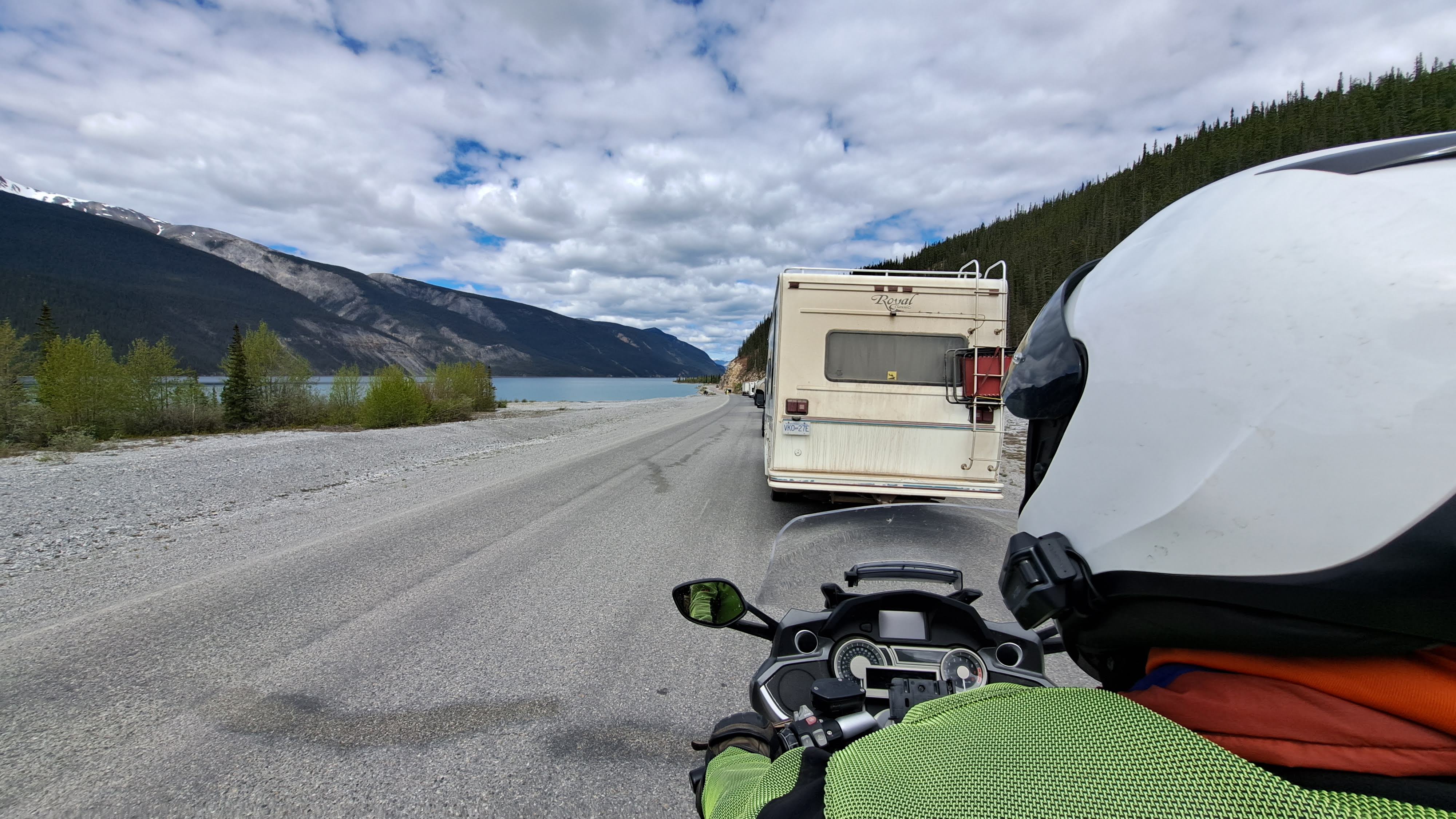
Traffic
Because the Alaska Highway is the main overland route, we did experience a fair amount of traffic – mostly semi trucks and RVs. This did not pose too many issues as the road has well designated passing areas.
Tip: Be careful of rocks and road debris kicked up by other vehicles.
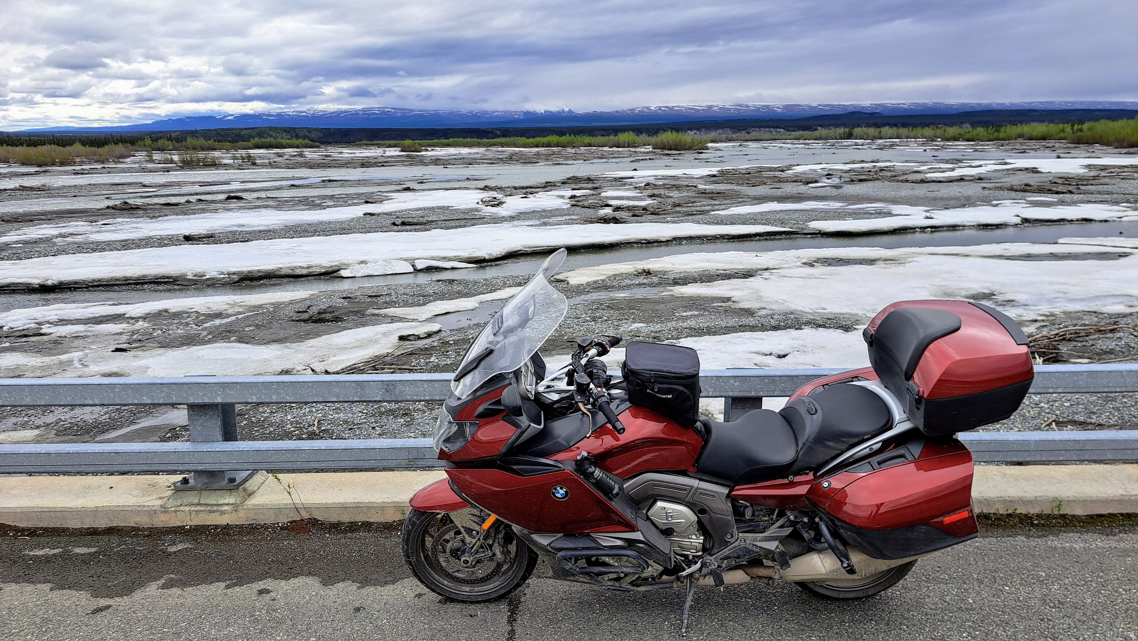
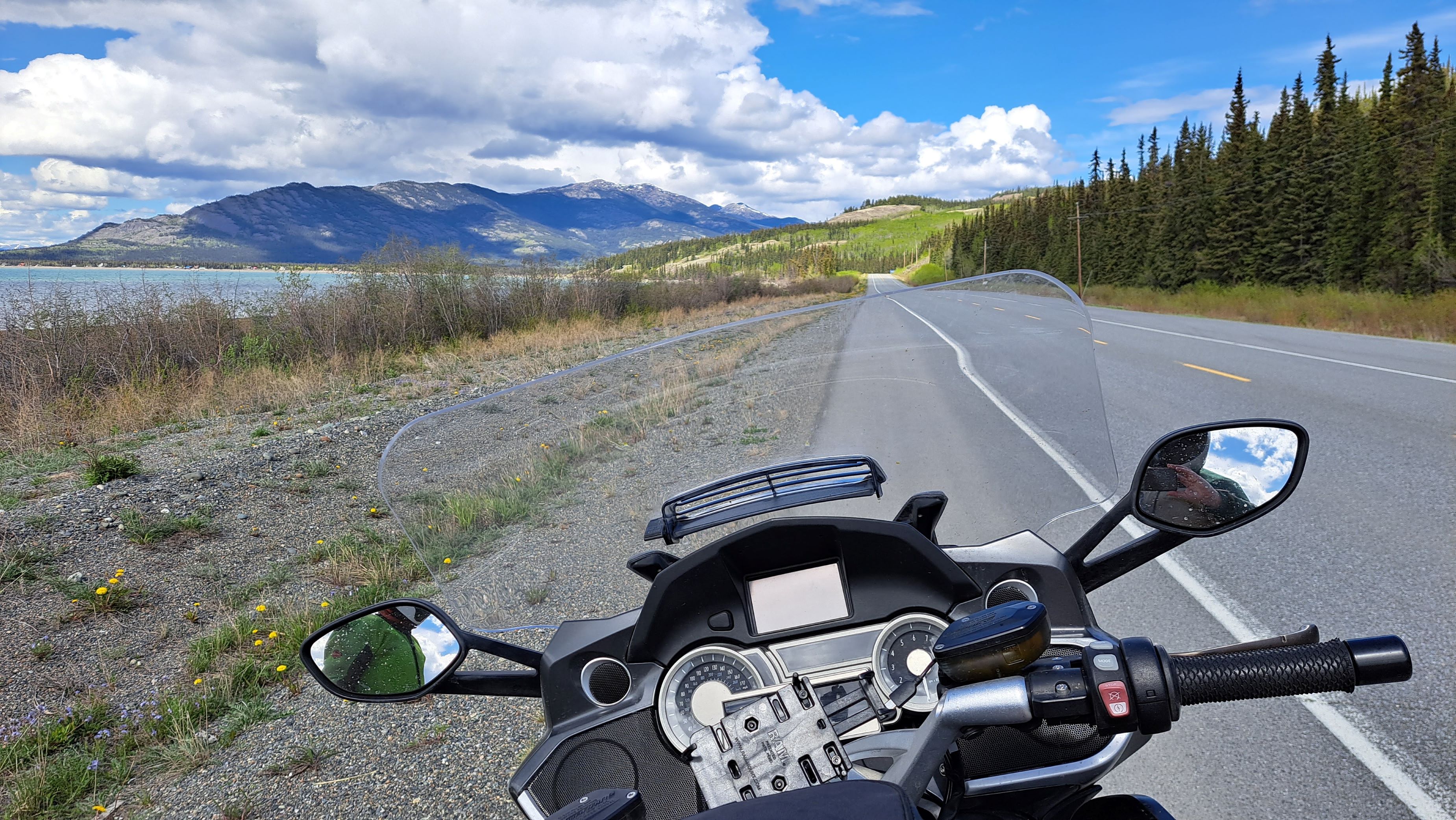
Scenery and Wildlife
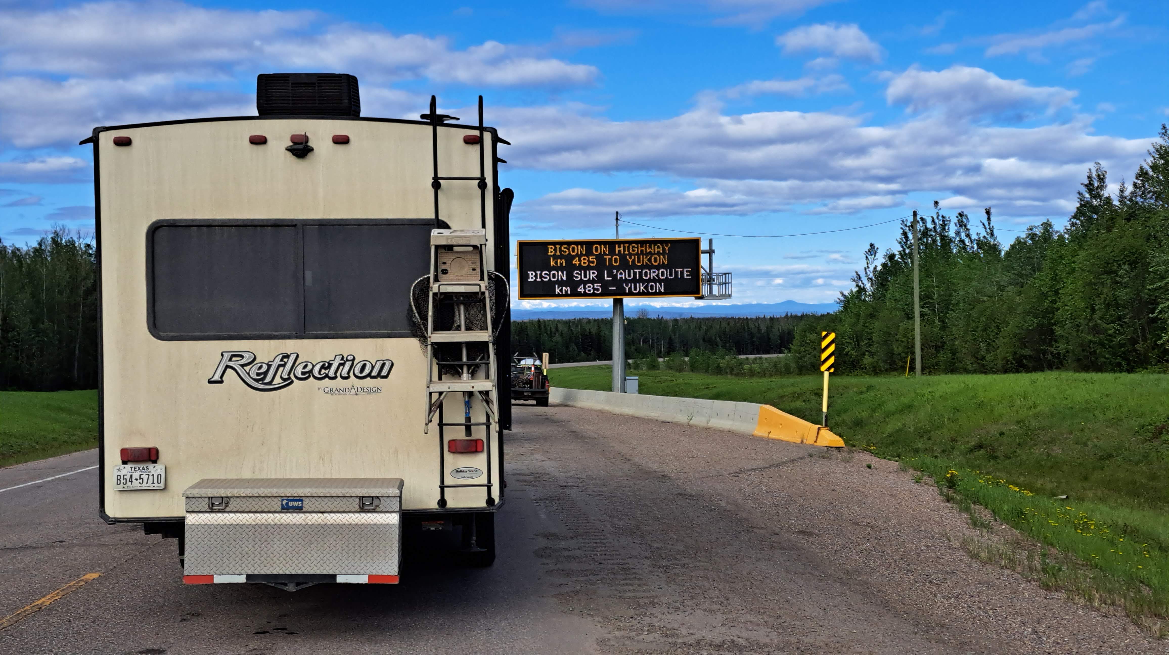
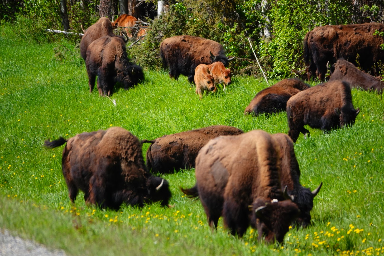
The majority of the road has a nice wide shoulder and the land on either side is mowed back to the treeline, which allowed for excellent wildlife spotting. We saw numerous black bears and bison as well as a few grizzly bears and moose.


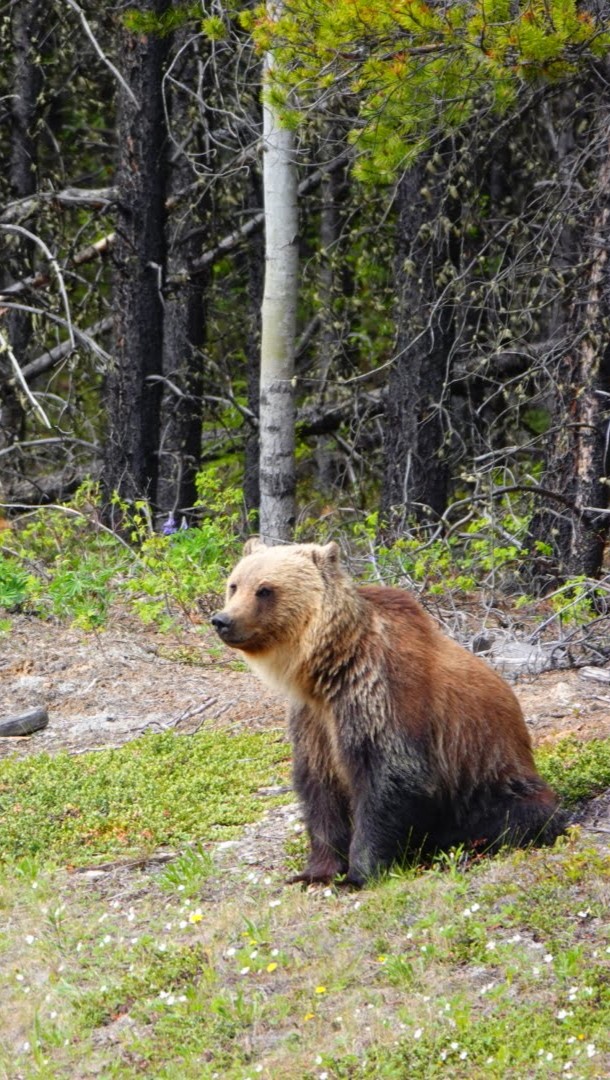
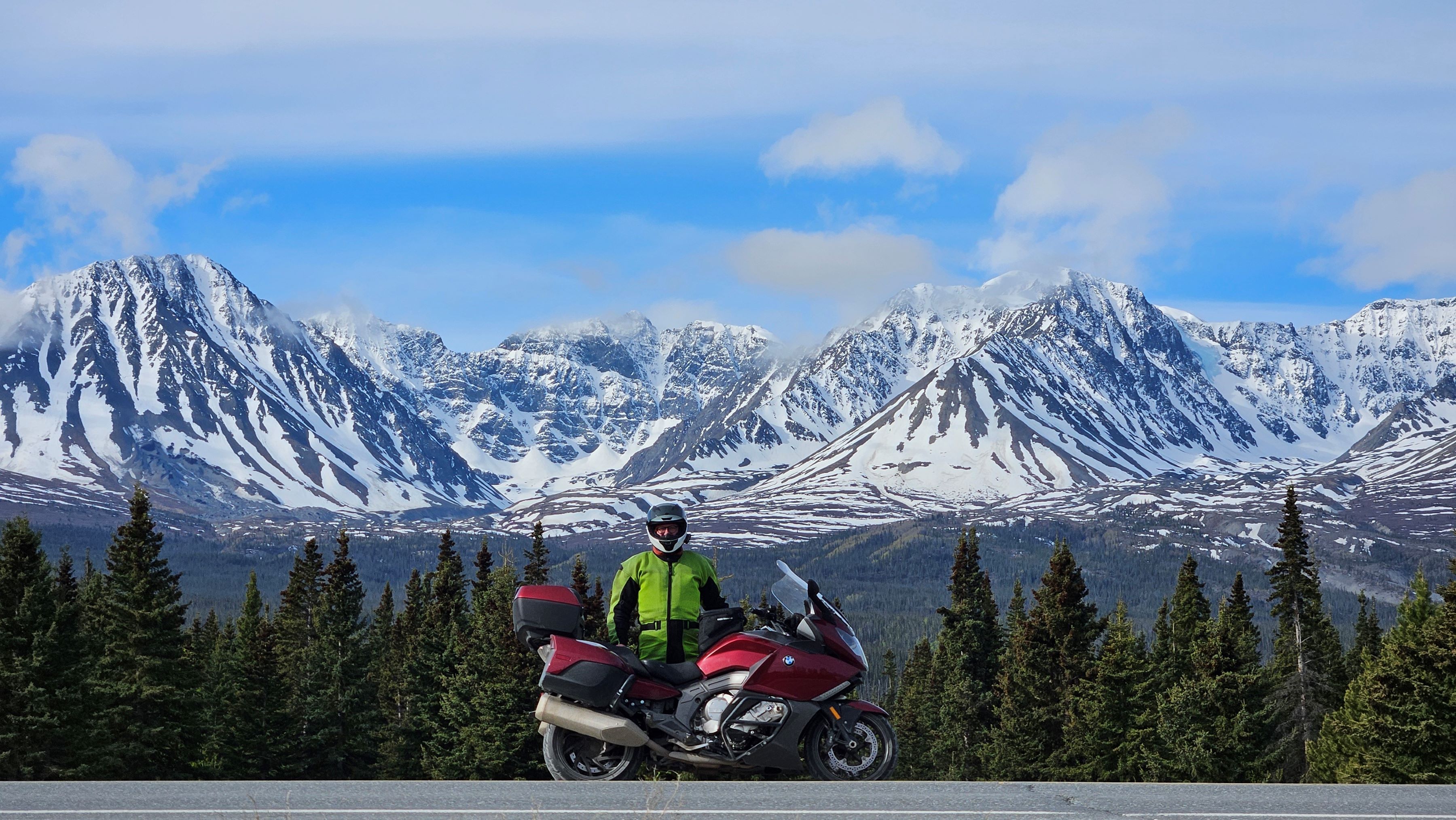
The scenery was quite variable along the route, ranging from wide-open plains and trees to large snow-covered mountains. The Kluane National Park area around Haines Junction, Yukon, was some of our favorite scenery along the Alaska Highway.
Tips:
- One time I needed to brake hard on the gravel-covered shoulder so we could snap a picture of a a nearby bear. The ABS activated and brought us safely to a stop. I was glad to have a motorcycle equipped with ABS and may have been picking up a dropped bike or worse without it.
Motorcycling the Alaska Highway: Favorite Stops and Sites
Notable stops along the route include:
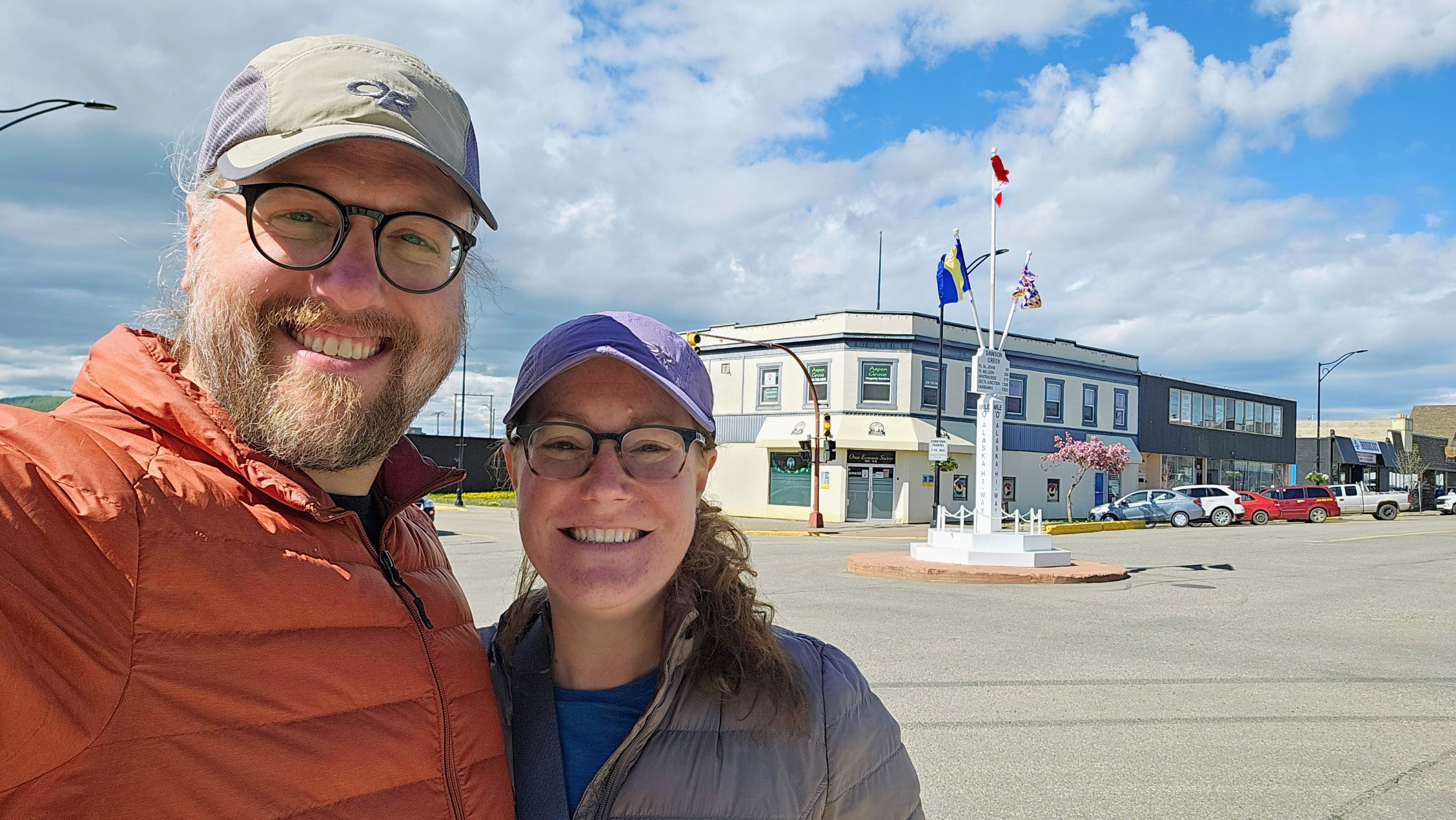
- Dawson Creek, BC, Alaska Highway Sign. There is also a marker in town, just a couple blocks west.
- Toad River Lodge Restaurant. Good roadside food with excellent views.
- Watson Lake Sign Post Forest. Started as a joke by the Alaska Highway builders but has grown to an impressive size and includes some of the original equipment used to build the road.
- SS Klondike. Although the steam ship was closed for restoration, we liked the museum and especially the film.
- Kluane National Park and Reserve Visitor Center. Great place for information about the area.
- Delta Junction Visitors’ Center. Unfortunately the Alaska Highway end point marker was removed for restoration while we were there, but inside had a lot of information on the construction of the Alaska Highway, including films of the equipment operating and worker interviews.

I’m glad we were able to experience the Alaska Highway by motorcycle and thoroughly recommend it.

Perhaps I missed it, however want to know what month you rode in. Planning a trip up for early September 2025 from Kelowna in BC to Keno City Yukon.
We rode in late May and most of June.
Pingback: Motorcycling the Stewart-Cassiar Highway – Heather's Compass
Incredible bear photos! Even if it meant making use of the ABS..!
Thanks Seb! I’m glad to have had ABS and the opportunity to see so many bears.