While Mount Rainier is the volcano most people associate with Washington, Mount St. Helens is the one Washington residents most like to discuss, especially on the anniversary of its May 1980 eruption. My work colleagues in particular each have a vivid recollection of where they were during that time and in the days and weeks afterward as the smoke and ash left their lasting marks on much of the state.
Given its significance, I knew we had to make time for a visit while we were still Washington residents. Brian had visited many moons ago when he rode his motorcycle around the U.S., but I had yet to visit and we were running out of time. We finally decided that weather be damned, we were heading down for a day and would make the best of whatever we encountered!
We left early on Saturday morning and drove to the western entrance via Route 504. Our plan was to park at Johnston Ridge Observatory, get our bearings, go for a hike, and then peruse the visitor center.
Planning note: the observatory doesn’t open until 10 a.m., and the two port-a-pots in the Johnston Ridge parking lot have been completely compromised/are unusable. The closest amenities are at Coldwater Lake, and unfortunately the ones in the picnic area were also vandalized and are closed.
I highly recommend stopping at the ones at the Coldwater Lake boat launch before you head to the observatory if you’re arriving early in the morning like we did. As an added bonus, you can walk down by the lake for incredible views from the dock!

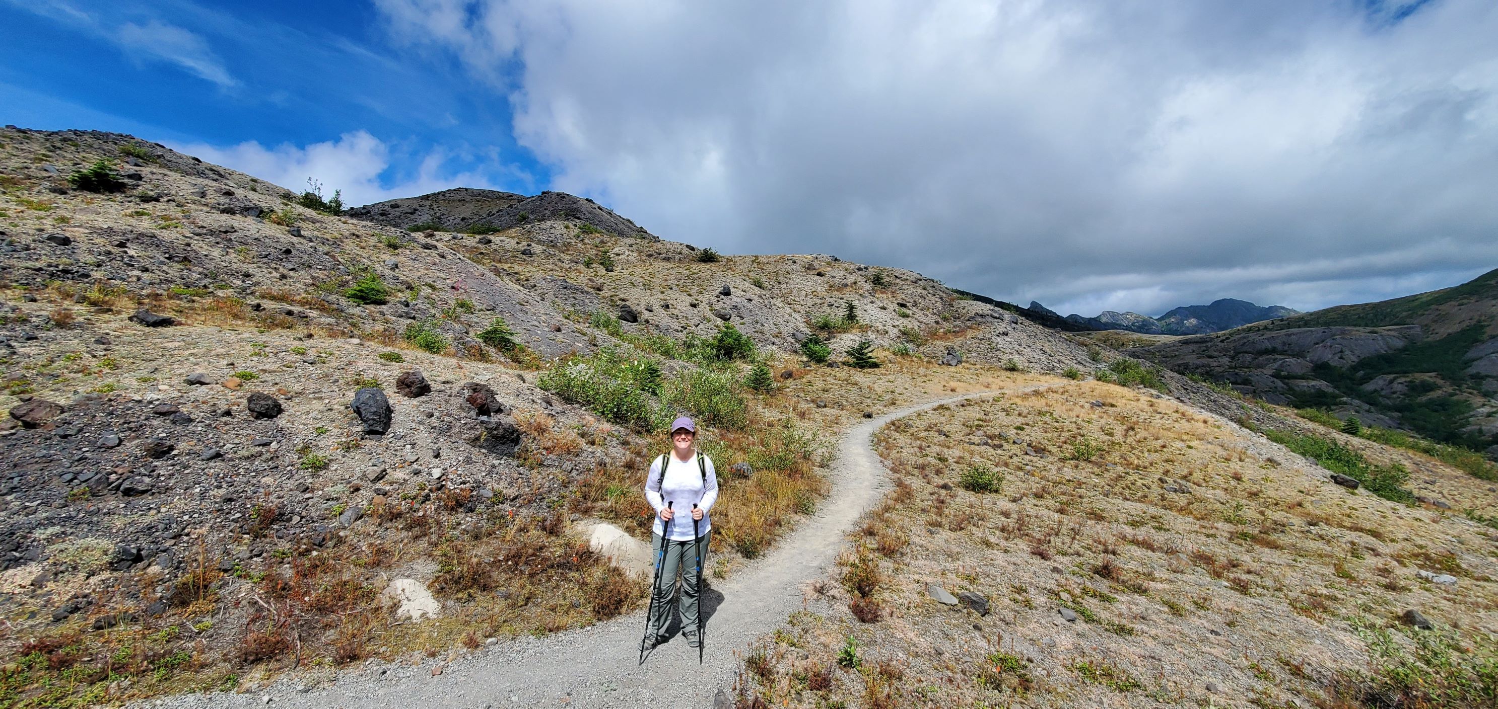
From the Johnston Ridge Observatory parking lot we set out on the Boundary Trail for Devil’s Point.
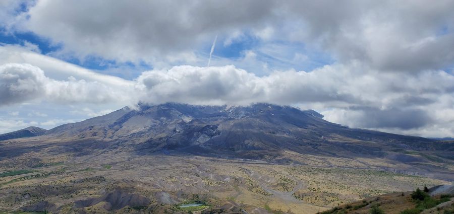
It was extremely foggy at first but conditions continued to improve throughout our hike such that we could occasionally see most of the volcano through the clouds.


The trail is in great condition, although there are several sections where the brush has overgrown the trail quite a bit. Nothing impassable, but we were surprised given how many people travel this trail each day.
You can see it winding along the ridge in the photo below – much of the trail is exposed and dry, and the unsheltered areas can get very windy!


We were also surprised to discover that Brian’s Gaia app didn’t have the Devil’s Point trail extension listed. The on-site signage was sufficient to guide us to our final turn, but it wasn’t clear exactly where the point was located – based on other hikers’ footsteps and our own visibility of the trail, we are 99% sure we achieved it!
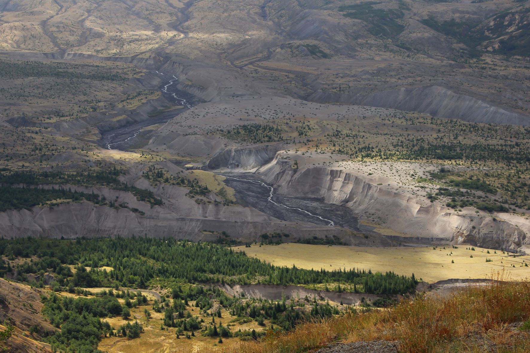
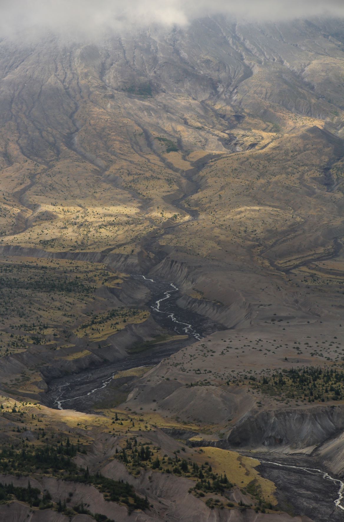
Along the hike, we had amazing views of the lower three-quarters of the volcano and the barren and gouged landscape along its northern side. Occasionally we caught a glimpse of the Crater Glacier near the peak, but more often we could make out the melt carving paths along the mountain side.

It was a little overcast and cool, which made for a beautiful hike – there were lots of posted warnings about water and heat for those who visit in the middle of summer.
There were a few people hiking on the main trail, but we only passed two couples on the Devil’s Point breakoff. I thought it would be a more popular stop, but if you weren’t following the signage, it would have been easy to miss the turnoff. That might have worked to our advantage!

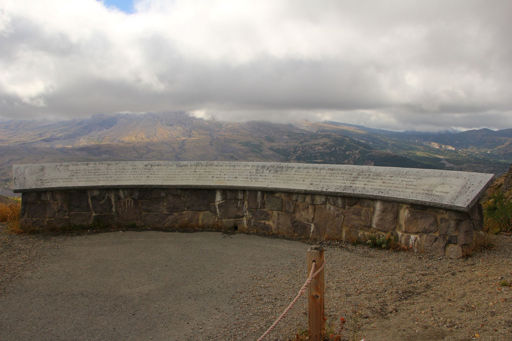
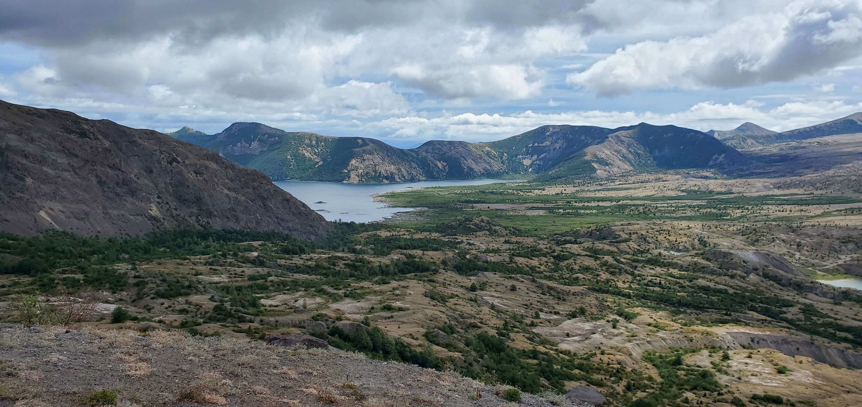
It was clear enough to have great views of Spirit Lake from the trail. It’s amazing the number of felled trees still lining its banks all these years later. We spent some time learning about the events leading up to and following the eruption in the observatory after our hike, and it was crazy to learn how the eruption impacted Spirit Lake and other nearby waterways:
Volcanic activity and mudflows from Mount St. Helens created Spirit Lake roughly 3,000 years ago. But the 1980 eruption nearly blasted it to extinction. A debris avalanche, triggered by the eruption, slammed into the lake like an enormous tidal wave, sweeping water out of the lake basin northward and up the steep slopes of nearby Mount Margaret. Some water may have spilled over Margaret’s summit—about 800 meters above the lake’s surface. Most of the lake water rushed back down, stripping slopes of trees, rock and soil—down to bedrock—and washing all that was dislodged into the lake. Debris pushed the lake’s surface elevation 60 meters higher than its pre-eruption level of 975 meters, greatly altering its morphometry and blocking its natural outlet, the North Fork Toutle River.
https://www.americanscientist.org/article/science-after-the-volcano-blew
Overall our out-and-back hike clocked in at 5.2 miles with 685 feet of gain, and it took us just under 2.5 hours with stops for photos. It was the right amount of time given the day’s visibility, and we spent another hour in the observatory soaking up the stories, hearing about the history, and enjoying the movie screening of additional photos and video footage.


No adventure would be complete without Brian throwing in a few unusual Atlas Obscura and Roadside America stops. For this trip, he discovered an A-frame house that was buried by a mudslide that was triggered by the eruption. The house, which had been newly built, was quickly filled with 200 pounds of mud and silt and remains that way today!
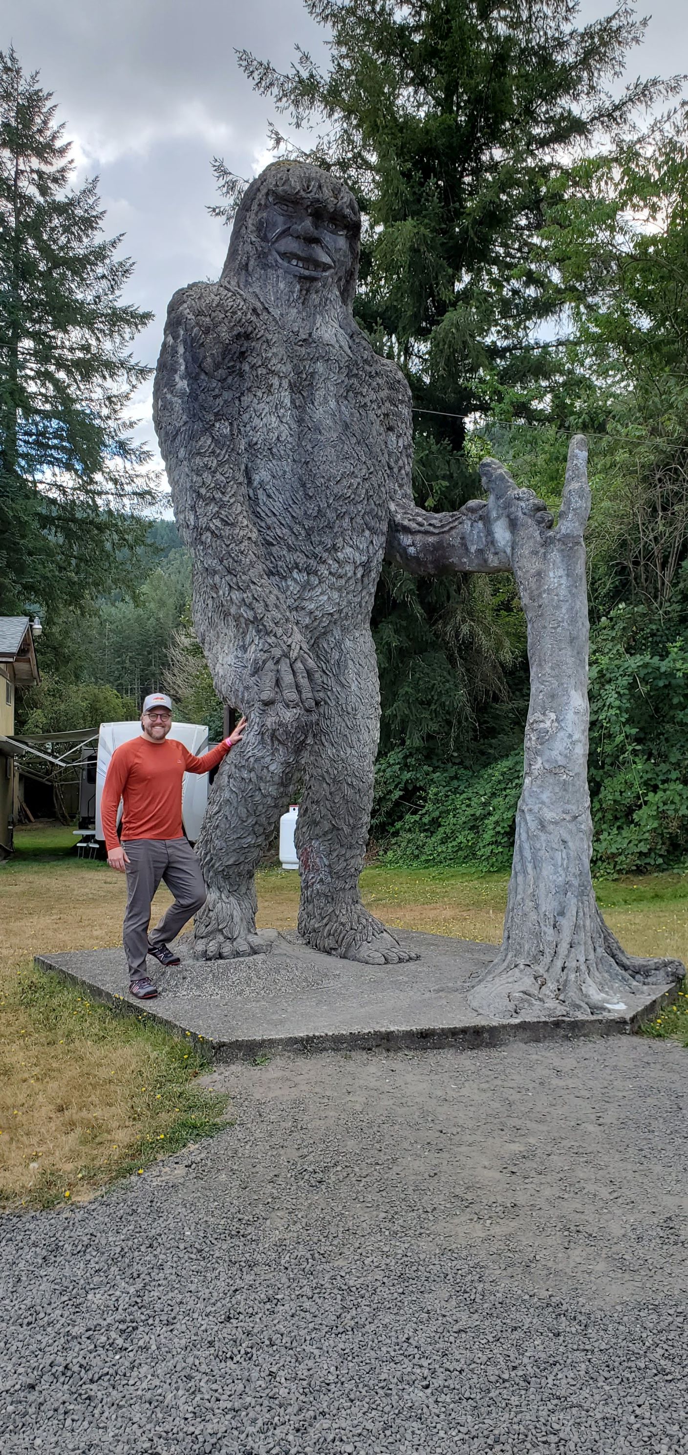
Bonus: a 28-feet-high concrete statue of Big Foot is a short walk across the parking lot.

It’s incredible how powerful and transformative the eruption was to the surrounding area – and how drastically the landscape changes each time there’s an eruption.
Although the weather didn’t completely cooperate for our visit, that’s the nature of mountains and volcanos! I’m thrilled we finally squeezed in a hike at Mount St. Helens.

Pingback: Things to Do: Seattle, Washington – Heather's Compass