The last month has been a little crazy. We finally ripped the band-aid off and listed our house, which went into contract two weeks later, and in the midst of prepping it to sell we found a new place to rent in the South Sound and moved most of our things and ourselves in.
After five years of learning the neighborhoods, cities, and area north of Seattle, we’re excited to get to know the area south of Seattle. High on our list is spending more time hiking around Mt. Rainier, Mount St. Helens, and the Olympic Peninsula, visiting cities like Tacoma, Olympia, and Vancouver (when COVID-19 is less of a threat), and exploring more of Oregon.
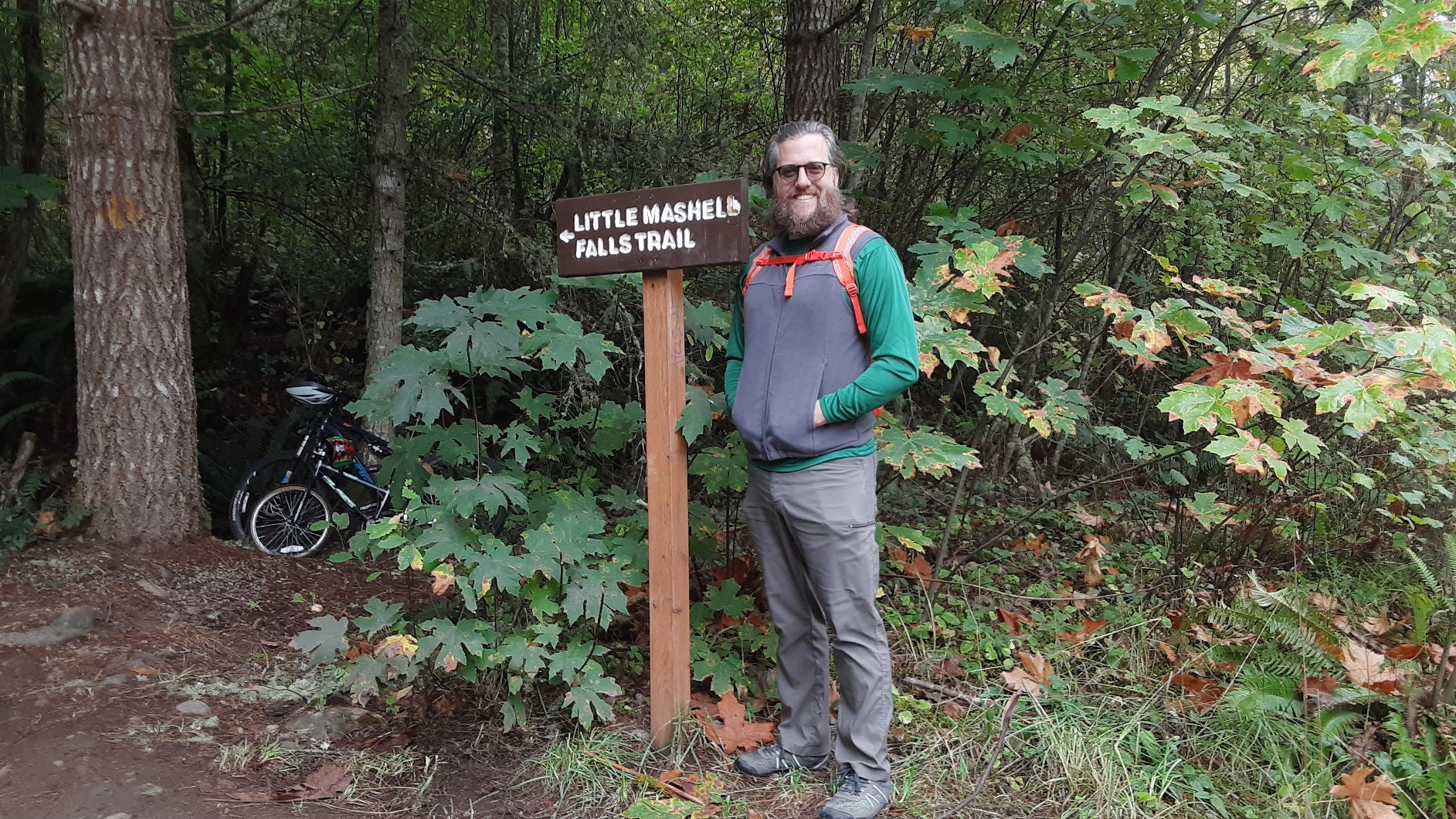
There’s no time like the present, so we’ve been meeting our neighbors from a safe distance, going for lunchtime walks through our immediate neighborhood, and riding our motorcycles around the local area. This past weekend we also did our first local hike – the Little Mashel Falls – Bud Blancher Trail.
This hike was a brief, 30-minute drive from our new home, and although we got a bit of a late start, we had no trouble finding parking outside the gate at the trailhead. The trail is flat and very well maintained, and the signage indicating where to turn off the Bud Blancher Trail onto the Little Mashel Falls trail was very clear, despite some of the comments I perused in advance on the Washington Trails Association website.

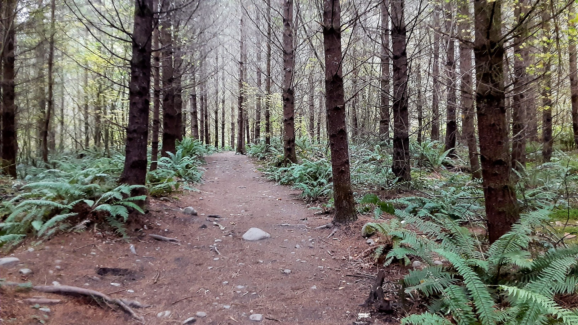
After a couple miles of flat trail winding into the woods, we encountered some elevation gain and rocky terrain as we made our way to the paths that split off the main trail to view the lower, middle, and upper sections of Little Mashel Falls. There were a few other people on the trails but everyone was respectful and either keeping their distance or wearing a mask.
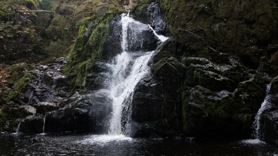
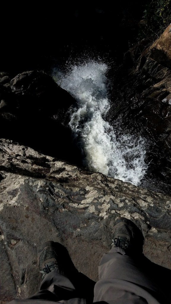
The trail to the lower falls was steep — I would have wanted my hiking poles if it had been muddy/rainy — and washed out at the base, but we had no trouble making it to the falls. This section was cascading and relatively unoccupied.
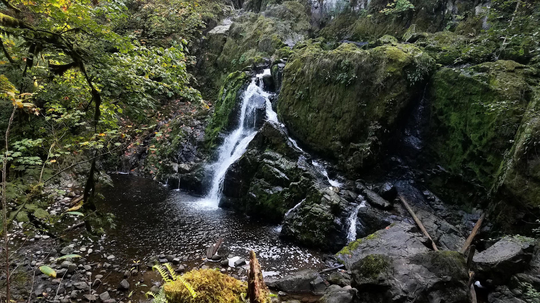
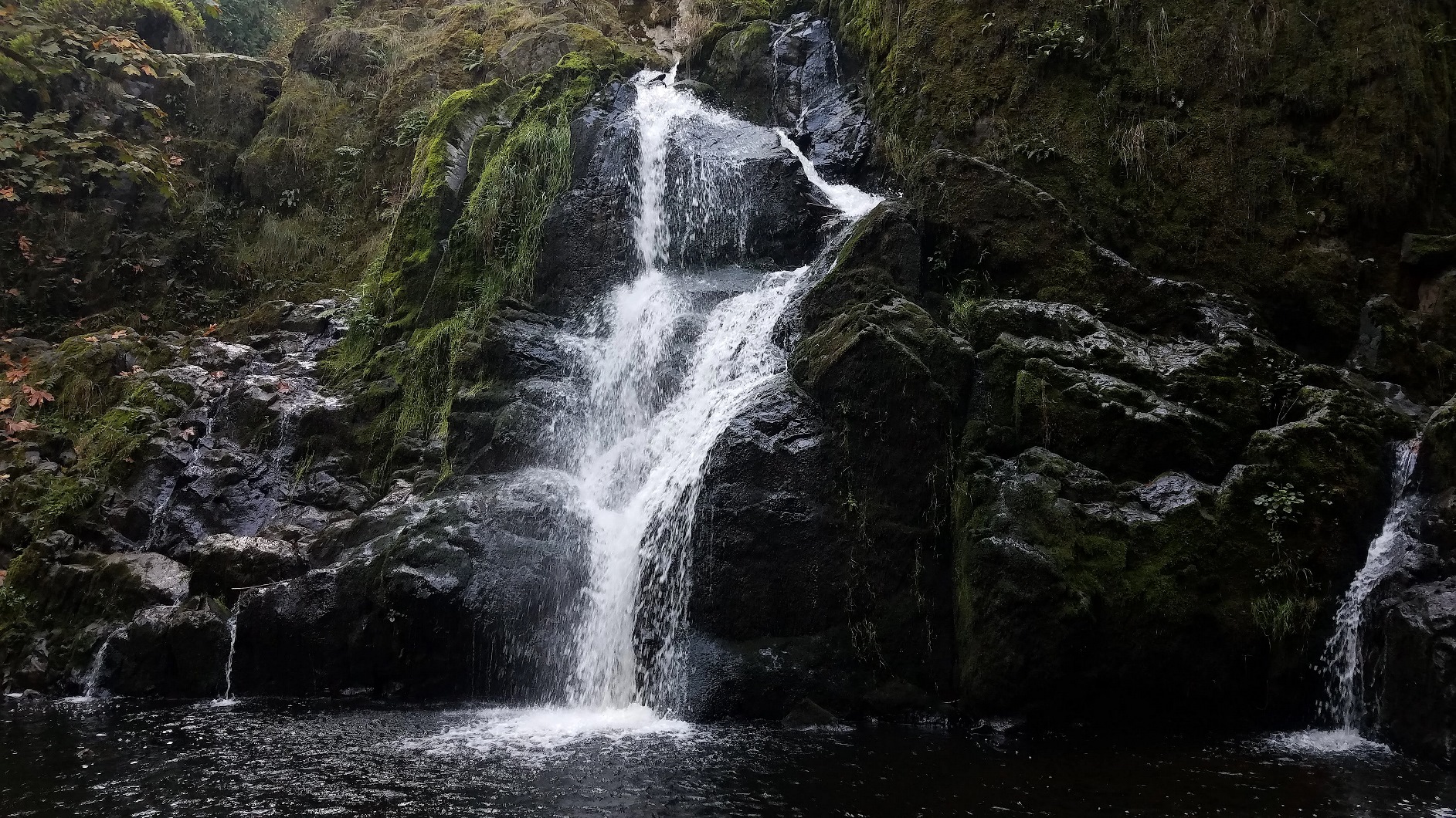
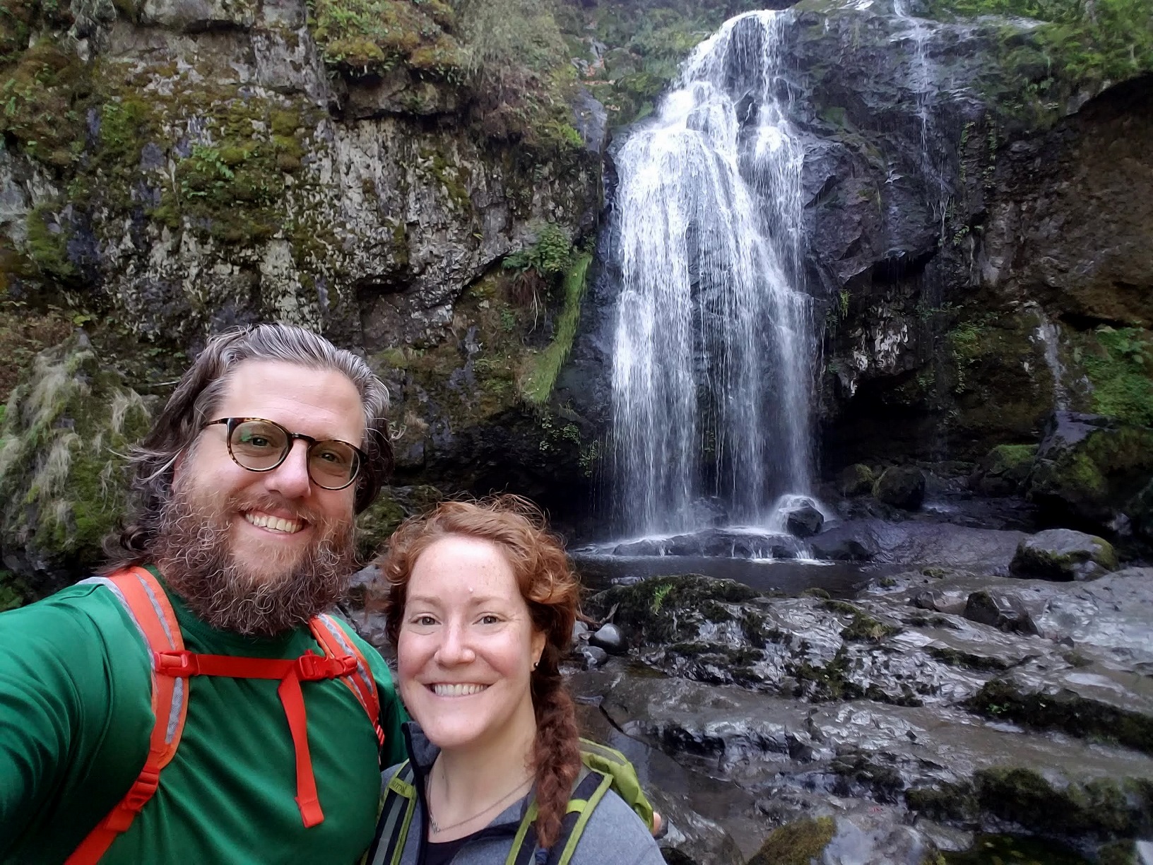
The most popular section is the middle falls where you can climb around and behind the main 90-foot drop. There were more people here scrambling over the boulders to the pools of water. One woman even went for a swim!
The trail was very easy to navigate and relatively short – I can see why this section is so popular.

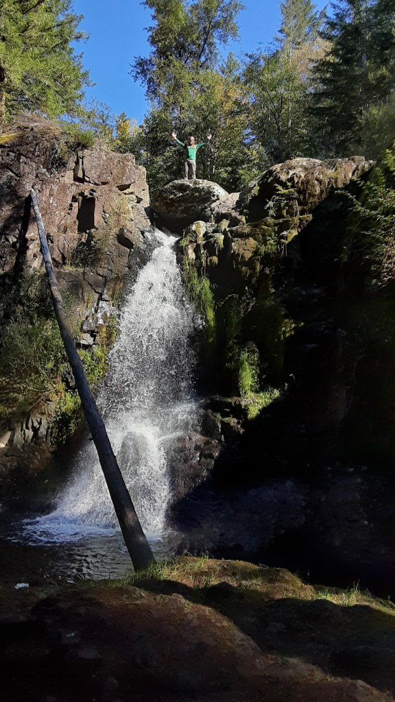
The upper falls trail was a different story — several areas were washed out, several trees were down across the trail, and there was a somewhat dry river bed full of stones we had to navigate before getting to the falls. Certainly not as well traveled or maintained as the other viewing areas!
Brian thought he needed to climb to the top of this upper falls section — he arrived just as the sky cleared. I snapped a few photos, took a break in the shade, and then we set off for the trailhead.
Our hike ended up being 5.4 miles round trip with 710 feet of gain. It was the perfect fall morning hike and a great way to continue learning more about this new area of Washington state!

