
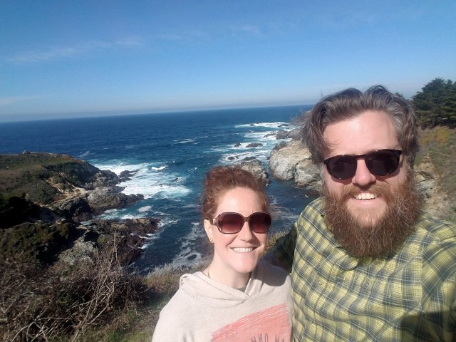
 Brian and I had Presidents’ Day off and United miles burning a hole in our pocket so we booked a getaway to a new area of California for both of us—Big Sur.
Brian had met a customer in Monterey once, but I’d never spent time south of San Francisco and was looking forward to exploring more of the coast and a new national park.
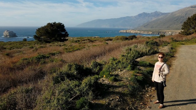
We kept our itinerary loose until the last minute so we could flex our days around the best weather in each place. When we caught our 6 a.m. flight south on Saturday morning, this meant kicking off our weekend with a road trip along Route 1 to experience the Big Sur coast.
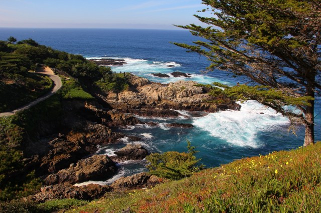
Everything was smooth sailing out of San Francisco and through Carmel-by-the-Sea, but as we pulled back onto the highway after our second coastal viewpoint just after the Bixby Creek Bridge, the car started beeping about low pressure in the rear passenger tire. Thankfully there was a gorgeous overlook immediately ahead, so we pulled off, only to discover the tire was going completely flat—the air loudly whistling away.


Brian quickly put on the spare while I called Budget to find out what we should do. They said it was no problem, we simply needed to take it to the nearest Budget to exchange it.
Unfortunately, this meant driving in the wrong direction back to Monterey, but fortunately we were only about 30 minutes away rather than in the middle of the Big Sur coastline. The small rental facility at Monterey Airport only had one rental available—a Nissan Frontier, which was NOT my ideal road trip vehicle!—but we didn’t really have a choice. Into the truck we went!
With traffic, travel, getting gas, etc. the delay cost us a couple of hours, so we had to knock several things off our itinerary. It also meant we had to contend with more traffic than we had originally faced when we set out early, including being turned away at one of the main beaches I wanted to visit because it was at capacity.
I was disappointed—I couldn’t help it—but we made the most of the time we had, hitting a few key stops and simply enjoying the overall drive.


Here are a few of the stops we were able to enjoy along the way:
McWay Falls at Julia Pfeiffer Burns State Park
It was easy to tell we were approaching a popular pull off due to the number of vehicles lining either side of the road. This was definitely the case as we approached the access area for McWay Falls, and we ended up pulling in and paying for parking at this stop to avoid the crowds and to recover from the earlier disappointments of missing a few other spots on the list.
We found some shaded parking and then walked the trail down to the overlook—the viewpoint is actually above the waterfall, which you can watch tumble down onto the sandy beach below. There were a few people wandering around and taking pictures, but we had no trouble getting to the railing and admiring the area.
There was a short path beyond the parking lot that led to a wooded picnic area by a stream—if you’re looking for a break from all the people and traffic, it would be a lovely spot for lunch.
This was a lovely stop along the coast, but I would probably opt—as others had—to park along the road and walk in versus paying to park at the trailhead next time. The pricing was steep and the trail is very short, flat, and accessible.


Ragged Point
Our turnaround point was at Ragged Point Inn & Resort, a fun little complex with restaurants, shops, public restrooms, and wonderful views of the coastline. There was also a trail that wound down the side of the cliff, but we weren’t appropriately attired and didn’t have time to explore it.
Instead, we walked the simple trails on the property to an overlook and back through the accommodation areas. The landscaping and scenery were lovely—if you’re looking for a place to stay, this is worth checking out! It was also a perfect turnaround point for us given we were trying to get to Hollister that evening.


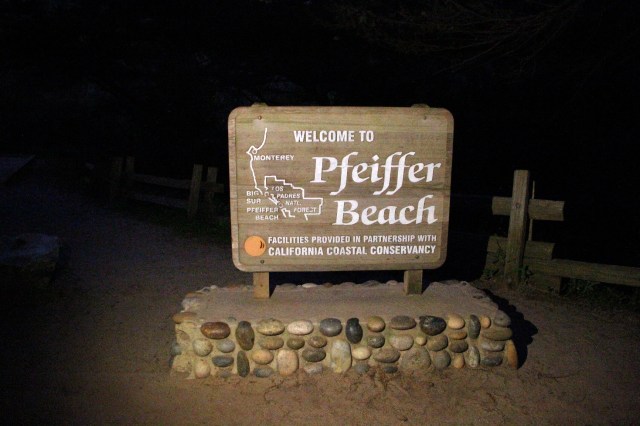
Pfeiffer Beach
Although we were turned away during our first attempt at accessing Pfeiffer Beach, the barricade and rangers were gone when we pulled in around sunset, so we decided to try once more. It was getting dark and the road out to the beach was very narrow, winding, and replete with potholes—we were constantly pulling over to allow cars that were heading away from the beach to pass us.
We finally reached the parking lot only to be approached by a ranger who said the beach closed at sunset—noooo! We must have looked really disappointed because he told us since we had driven all the way there, he would let us run out to the beach for a final glimpse so long as we made it quick. Yeeeesssss!
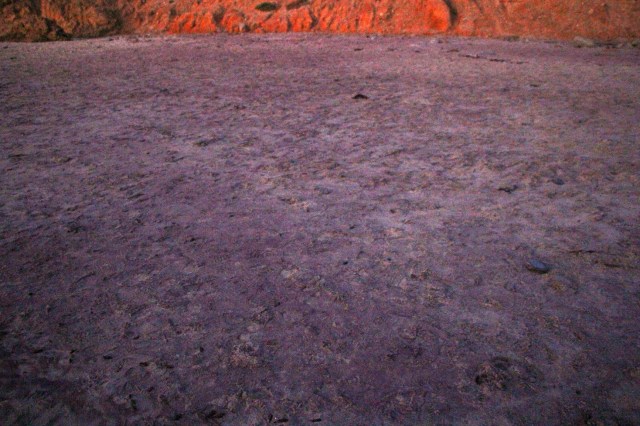
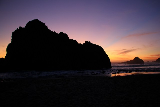
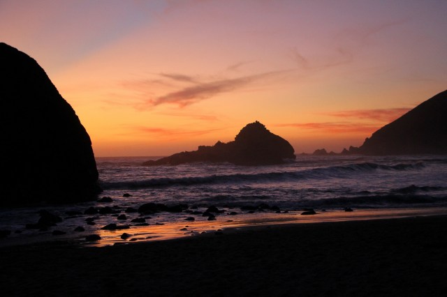
We parked and took off for the beach, Brian running to the left and me running to the right so we could see as much as possible and talk about it later. The reason I really wanted to see this beach is that it’s known for having purple sand—and it really did! We caught some incredibly colorful and beautiful views of the final moments of sunlight over the water, and we got to see the deep purple sand where it was wet. Our pictures don’t do any of it justice.
I am so thankful to the ranger for letting us have those precious moments on the beach—after the earlier disappointments, this was such a wonderful ending to our day! All in all I loved our time driving the Big Sur coast and look forward to doing the southern leg, and the things we missed, on another trip!
Things we Missed/Things for Next Time:
- Hurricane Point View
- Point Sur Lighthouse
- Henry Miller Memorial Museum
- Limekiln State Park
- Hearst Castle
- Nepenthe

Pingback: Celebrating Earth Day, Your Way – Heather's Compass
Pingback: Ultimate Travel Bucket List – Heather's Compass
Pingback: California’s 17-Mile Drive – Heather's Compass
Pingback: Hiking in Pinnacles National Park – Heather's Compass