 Last Friday after dinner, I spent some time looking through my ‘backpack’ on the Washington Trails Association website to see what local hikes I had saved.
There were a couple within an hour or so drive from our house that we were considering, but while I was opting for those with some mileage, Brian was looking for something with a little elevation gain.
We compromised on two Fidalgo Island hikes–Sugarloaf mountain and Mount Erie. The site recommended you park and tackle Sugarloaf first because you could slightly backtrack along those trails and cut over to hike Mount Erie, rather than returning to your car and relocating to the other trailhead. It would mean more time in the woods so we were happy to follow the suggestion!
The weather had been beautiful all week and we were hopeful Saturday would present the same clear skies so we would be able to take in the amazing views from both summits.
We decided not to set our alarms and simply head out whenever we got up Saturday morning. We were both awake before 7 a.m. and it didn’t take long to pack our things and hit the road.
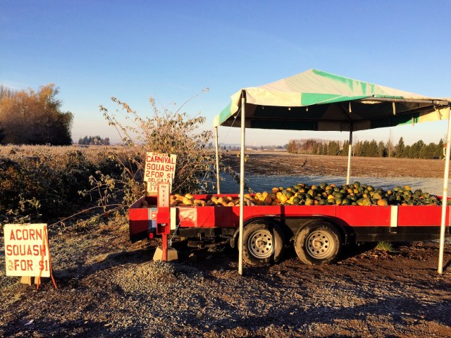
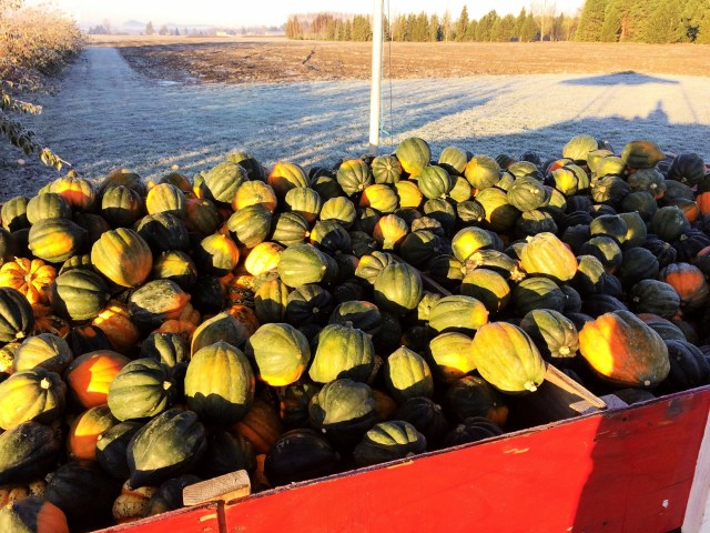
I needed a pit stop along the way so we turned off the highway around Arlington. Something went wrong with our GPS and we took a few wrong turns before heading back in the direction of I-5. Along one of the side roads, we passed a squash stand. Brian was sure the sign said two for a dollar so we turned around and headed back.
Sure enough, there was a giant cart full of acorn, carnival, butternut and spaghetti squash–most for 50 cents each and some for 33 cents each! They were huge and in perfect condition–we had hit the jackpot!
Thankfully I had thrown several reusable shopping bags in the trunk before we left. We filled one to overflowing with six squash and three dollars later we were back on the road. I don’t know if we could find the stand again, but if you find yourself on the back roads of Arlington, keep your eyes peeled for the end of harvest deals!

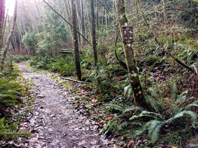
The GPS coordinates for the Sugarloaf trailhead on the Washington Trails Association site took us right on route 20 into Anacortes when we really wanted to go left, but once we were on the right road we had no trouble finding the trailhead. There were plenty of parking spots despite our relatively late start and around 9:30 a.m. we hit the trail.
Brian got his wish for some elevation gain on Sugarloaf–the first 520-foot climb is over only three-quarters of a mile! We were sweating and I was having trouble carrying on a conversation when we finally hit the first plateau.
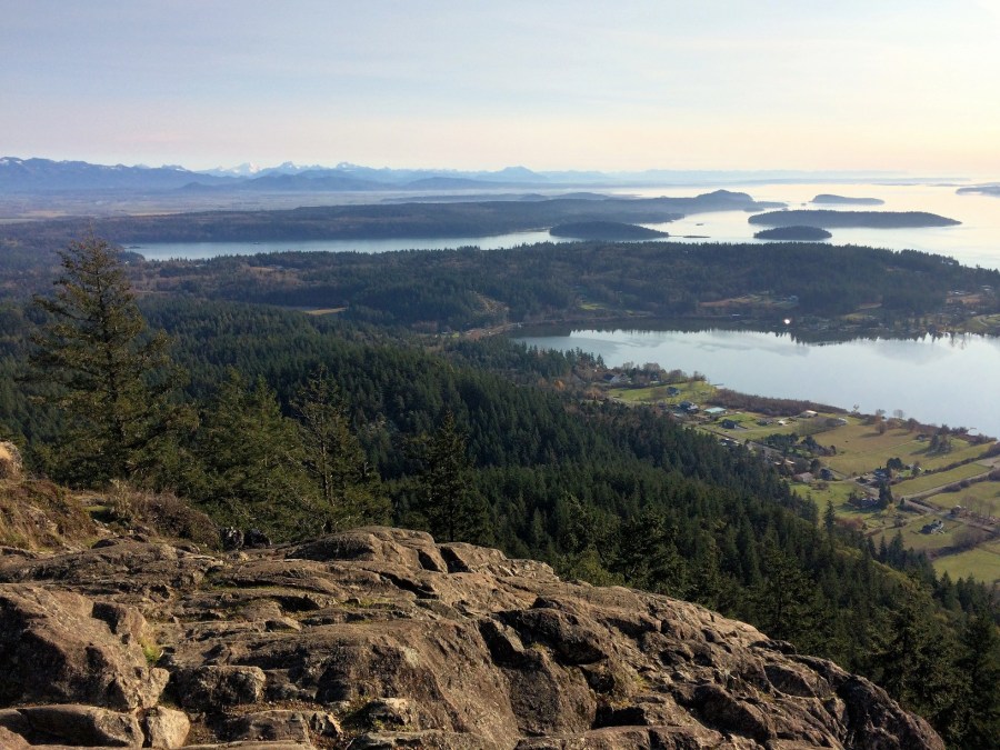
As we were catching our breath, we caught a glimpse out over the San Juan Islands through the trees, and it was all the inspiration I needed to continue our climb to the summit.


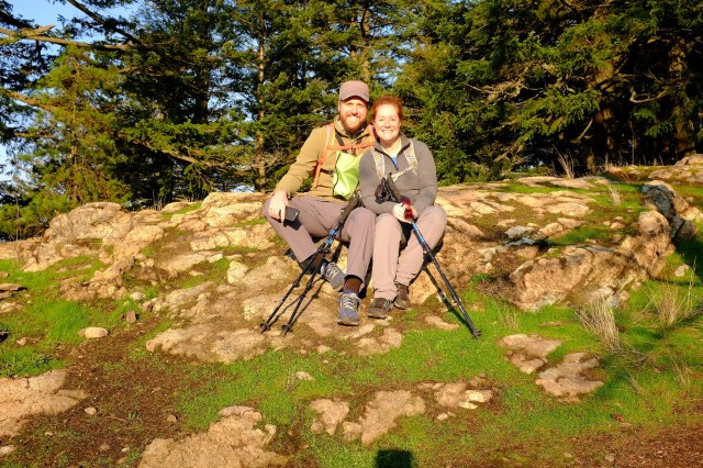
We took a few photos on the summit, which at 1,275 feet was still grassy and tree-lined.
The sun was in our favor and we had great views over the bay looking west toward the San Juan Islands. As I had hoped, it was relatively clear with blue skies overhead!
We also had a nice view across to Mount Erie’s summit, where we were headed next.


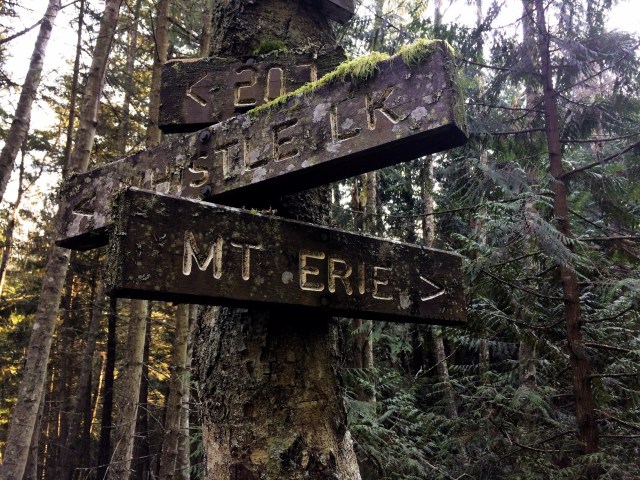
 After our rest we headed back the way we came and cut over toward Mount Erie via trail 226.
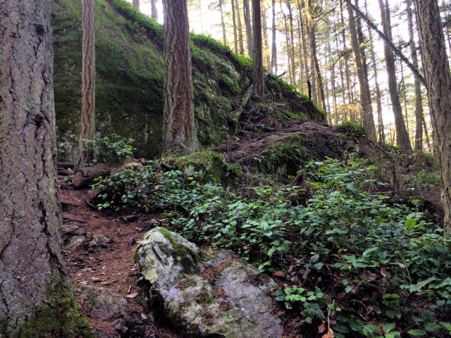
It was a really nice hike from Sugarloaf to Mount Erie–wooded and peaceful. There were a few trees down that we had to scramble over but otherwise the trail was clear and well-marked. The biggest obstacles we encountered were the trail markings from a group that had clearly made their way through the forest on horse back!
Despite those signs of life, we didn’t see anyone on the trail to Mount Erie. We passed a handful of people on the Sugarloaf trail, but I was surprised how quickly we were on our own with the trail to ourselves.
While the Mount Erie trail has an elevation gain of 1,000 feet, you achieve it over 2.5 miles so it was a fairly easy hike to the top. Before I knew it, we were seeing signs for the summit!

Unlike Sugarloaf, Mount Erie’s summit is accessible by car. The parking areas were nearly full when we arrived and there were quite a few people walking out to the different viewpoints and reading the informational plaques.
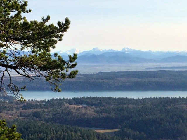
Once again, the views were incredible–we could see both the Cascades and Olympics, the base of Mt. Rainier, and amazing views of a very snowy Mt. Baker. We didn’t see anyone else who looked like they had hiked up, but there were a few people who were climbing up the rocky face of the mountain and just reaching the top!
We decided to walk down the road rather than retracing our steps back via the trails. This allowed us to check out a few other viewpoints along the way that we would have missed otherwise.
Overall our hike was about five miles and took us about four hours, which included taking a couple of wrong turns and spending time walking around and taking pictures on each summit. I really enjoyed our quiet time in the woods, but I would recommend going on a day when it’s clear and you can also enjoy the views of the surrounding area!


Pingback: 2017 Travel Recap – Heather's Compass
Nice article and lovely photos! Thanks for sharing 😊
Thank you! The sunshine and clear skies made for beautiful views and photos!
looks beautiful. You captured the landscape I feel I was there.
Thanks! It was such a beautiful day!