We recently enjoyed two days in Arches National Park, opting to visit in March ahead of the summer heat and timed entry reservations that are require from April 1 to October 31.
Despite visiting during the off-season, the park was relatively busy the second day of our trip because spring break had kicked off. Note to self: Pay attention to those travelers and dates if we continue to visit popular spots in the spring!

This was my first time visiting Arches National Park. Having spent the prior day at nearby Canyonlands National Park, I thought I had a good idea of what to expect of this park’s terrain. Not so – its geological features were unique and fully held my attention as we wound our way into the park.
The park lies atop an underground salt bed that is responsible for the arches, spires, balanced rocks, sandstone fins, and eroded monoliths of this mecca for sightseers.
Two days was just enough time for an introduction to the park, including hiking in several key areas.
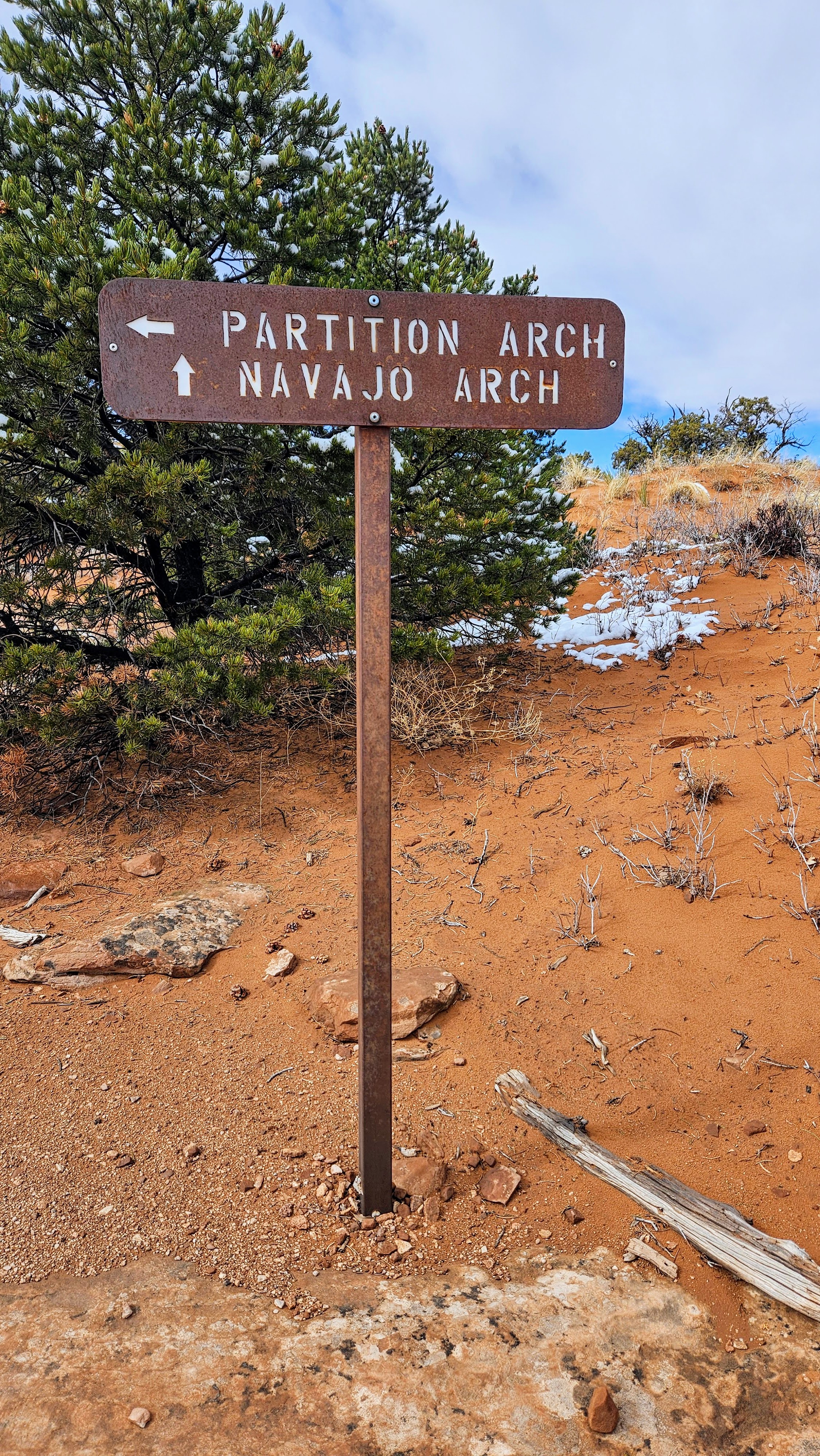
Devil’s Garden: Double O Arch, Navajo Arch, Partition Arch, Landscape Arch, Pine Tree Arch, and Tunnel Arch
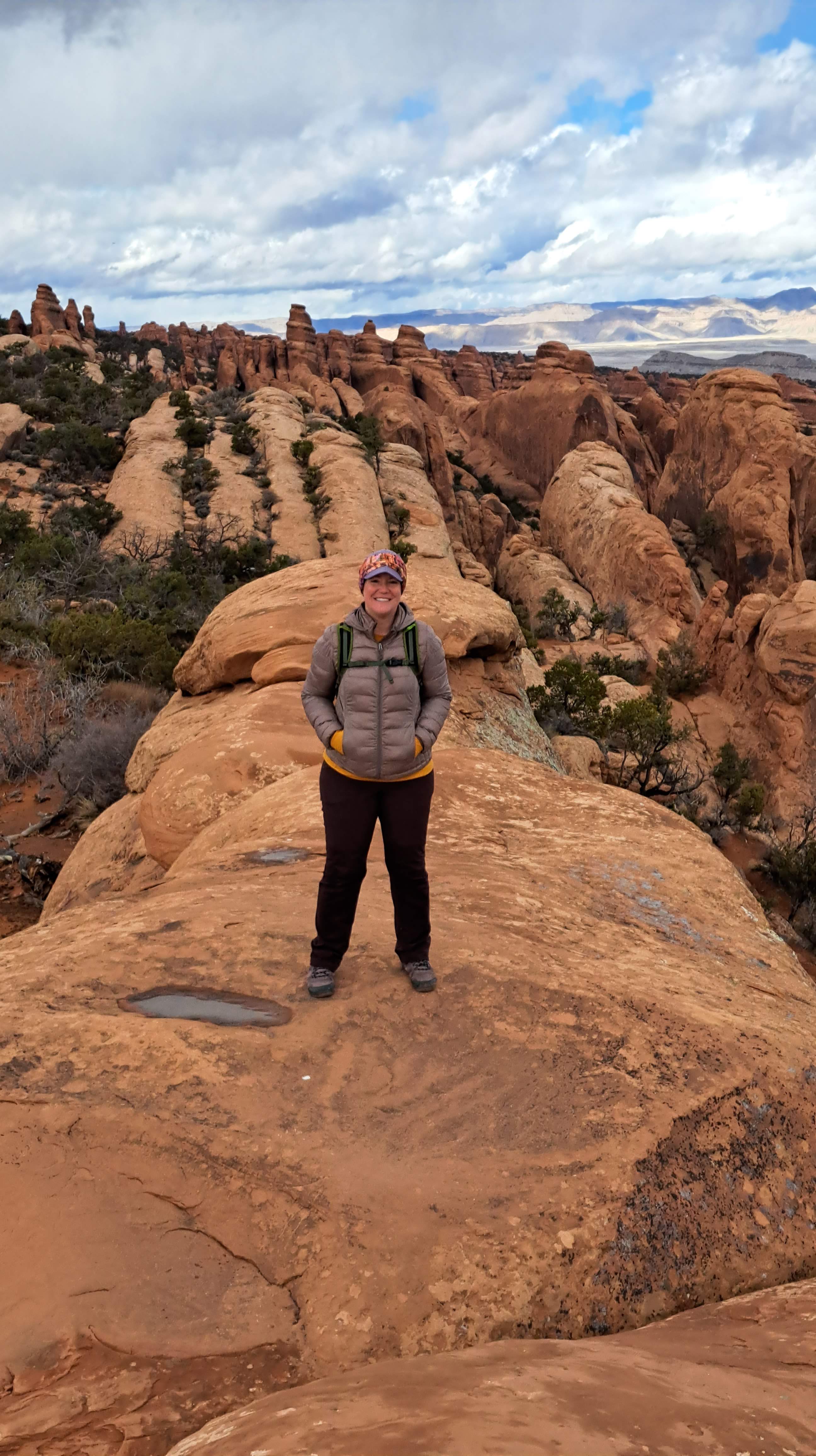
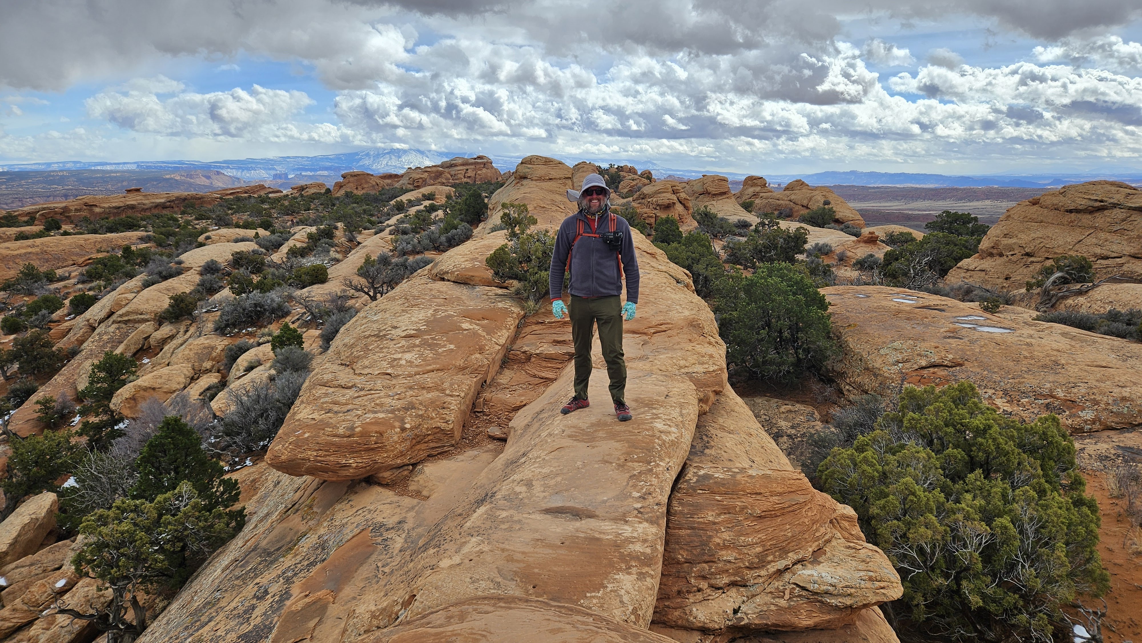
Our first morning we parked at Devil’s Garden Trailhead so we could hike out and back to Double O Arch, hitting a number of popular arches along the way. We woke up to snow and enjoyed the light dusting along the trail as we set off on our hike.


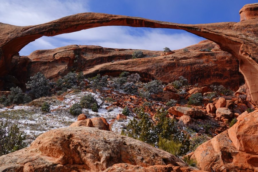
Our first stop was Landscape Arch. Many people come to Devil’s Garden simply to hike the 1.8 mile / 2.9 km roundtrip trail to this impressively long and fragile arch. The hard-packed trail is easy and fairly accessible – we saw people of all ages, including families with young kids, enjoy this short hike.

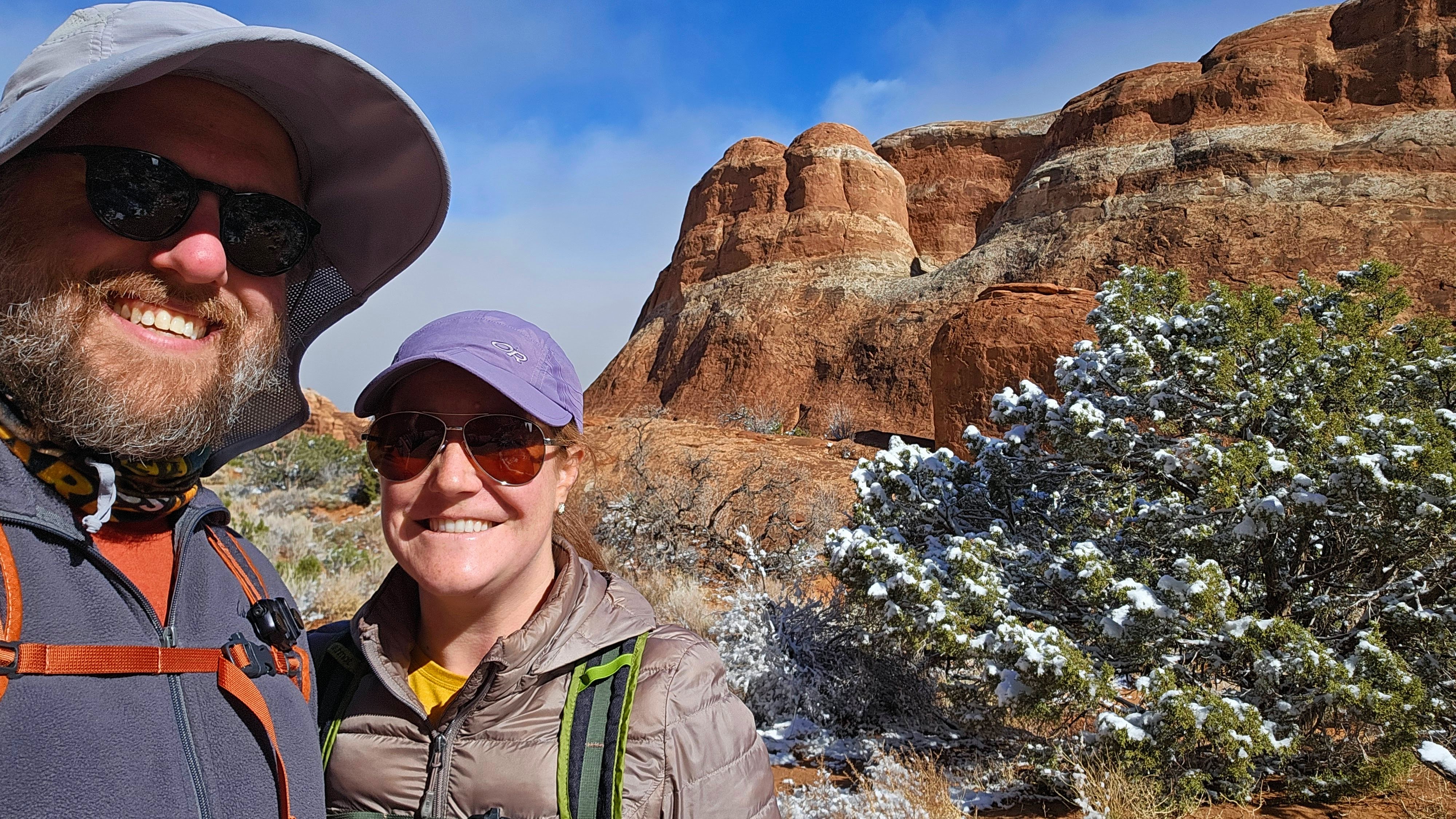
The trail beyond Landscape Arch requires you to scramble up a sandstone rock face (you can see it behind us in the photo below!) before catching the spur trail to Partition Arch and Navajo Arch.
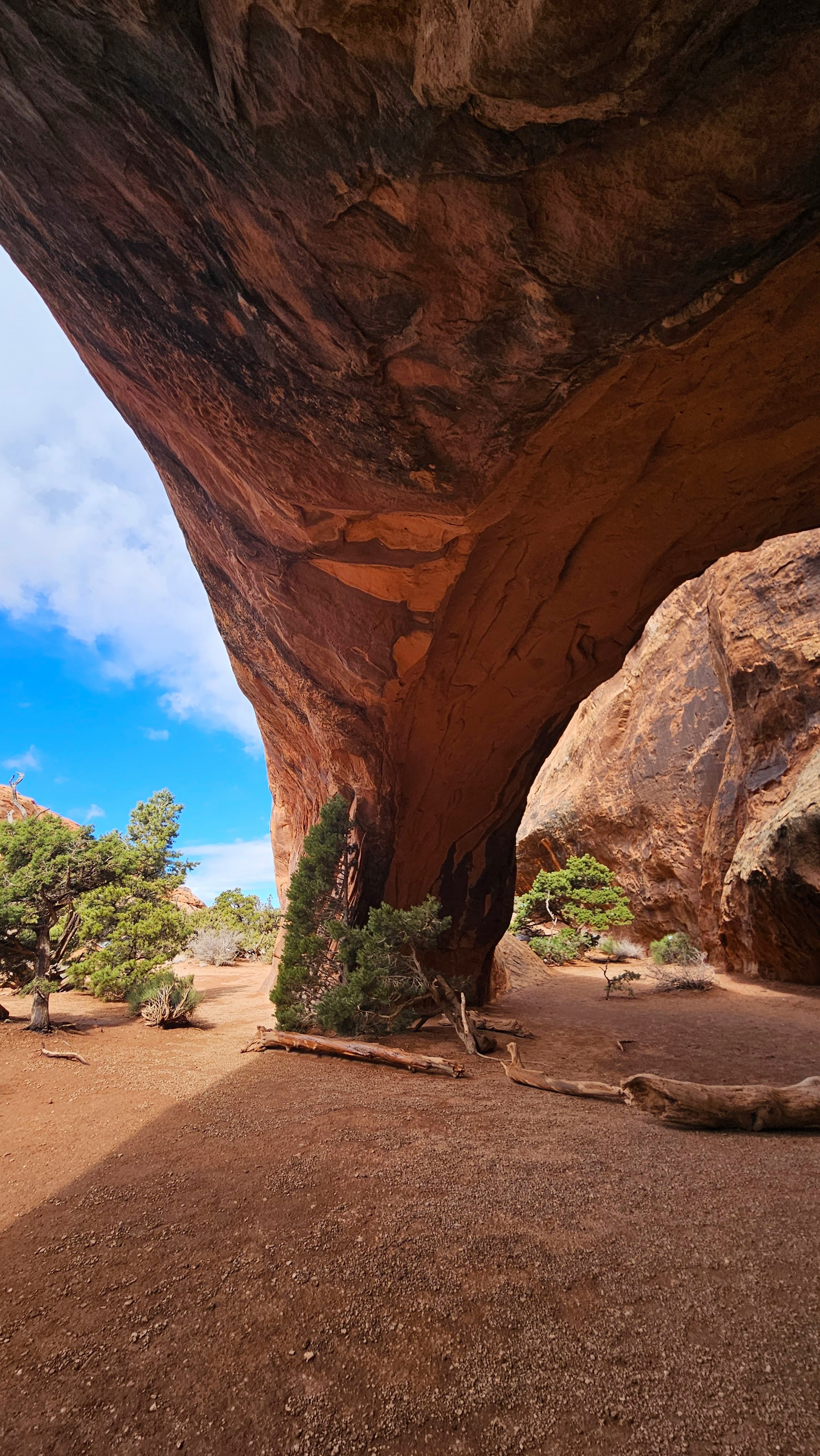
I was pleasantly surprised by both of these spots. Partition Arch has an incredible view of the surrounding area through its window, and Navajo Arch has created an airy cave you can partially walk into. I was surprised so few people were exploring these arches – we only saw a couple people at each site.


After a short stint on the normal trail we came to a narrow, rocky ridge we had to navigate in order to arrive at our turnaround point, Double O Arch.
As we approached, the wind picked up and it started to rain, making the rock slick and our journey back a bit more precarious. Brian took a quick photo of the double arch configuration and then we carefully made our way back out to the trailhead, taking the short spurs to Pine Tree Arch and Tunnel Arch before heading to our car.
Overall this hike was 4 miles / 6.4 km roundtrip with about 275 feet / 84 m of gain. If the weather had been better, we would have hiked all the way to Dark Angel and caught the primitive loop trail back out. As things stand, I feel good that we stuck with a safer route this visit.

The Windows Section: North and South Windows, Turret Arch, Double Arch, Garden of Eden, Balanced Rock
I really enjoyed the Windows Section of the park, which has a number of accessible arch formations you can see via simple, short walks from the different parking areas. On the way back to the Windows, we drove by the Garden of Eden, which is a really interesting area of formations that create what does look like a large rock garden.
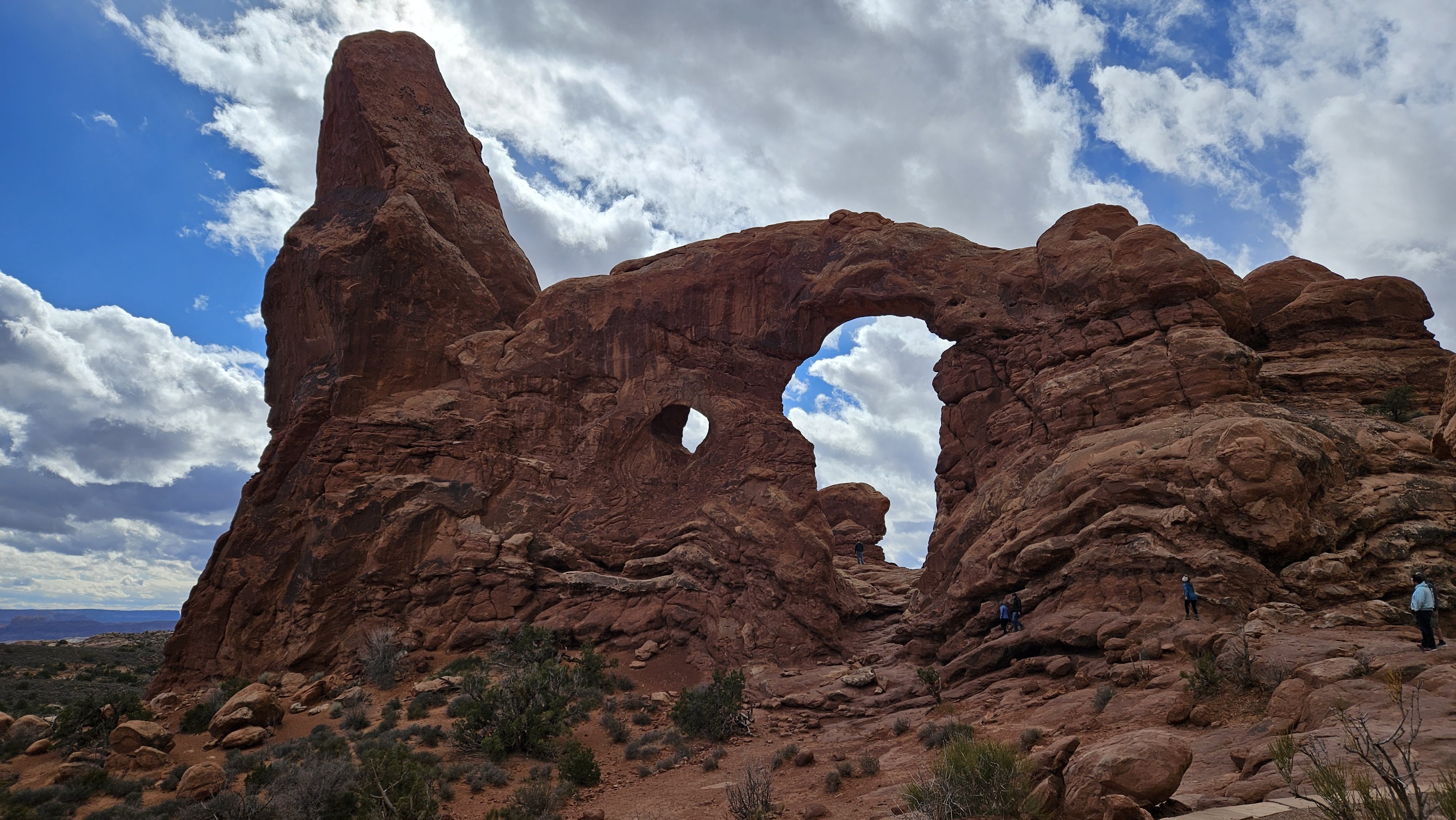
The North and South Window formations are as described – two open holes in a mass of rock that you can look through in either direction. Across from them is Turret Arch, which is a unique formation with a spire to one side of a small window. We opted to hike the primitive loop trail that leads around to the backside of the Windows, but it wasn’t that interesting and we couldn’t see through the windows from that angle as I had hoped. I’d recommend skipping the loop and simply taking the short path from the parking lot to the Windows and Turret Arch.
The clouds were looking ominous as we made the short trek (.6 miles / 1 km roundtrip) out to the nearby Double Arch formation. I really liked this feature – the two arches create an open ceiling above the red rock walls that reminded me of some of the old abbey remains we’ve visited elsewhere. Sadly, our stop was slightly spoiled by a number of people who were disregarding the signs asking visitors not to climb on the formations. It was upsetting to see people not only put themselves at risk but potentially damage the geological features we’re all trying to enjoy. We didn’t stay long.
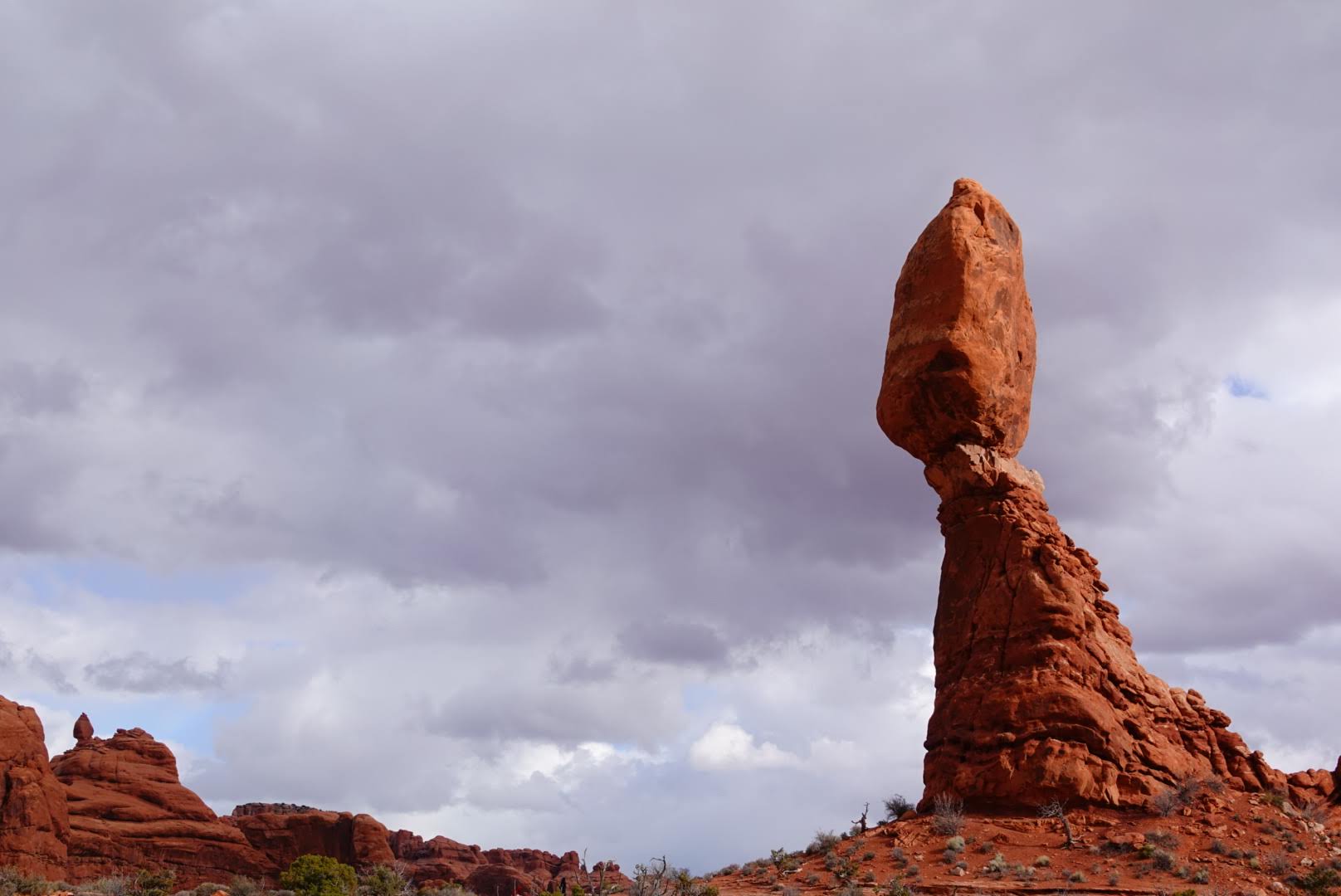
On the way out of the Windows Section we stopped at one of the most well-known rock formations in the park – Balanced Rock. We hiked the .3 mile / .4 km loop trail around this feature and were amazed at how different the rock appears to be balancing from the different perspectives. From certain angles it looks quite precarious and from others it looks like it could stay solidly in place forever.


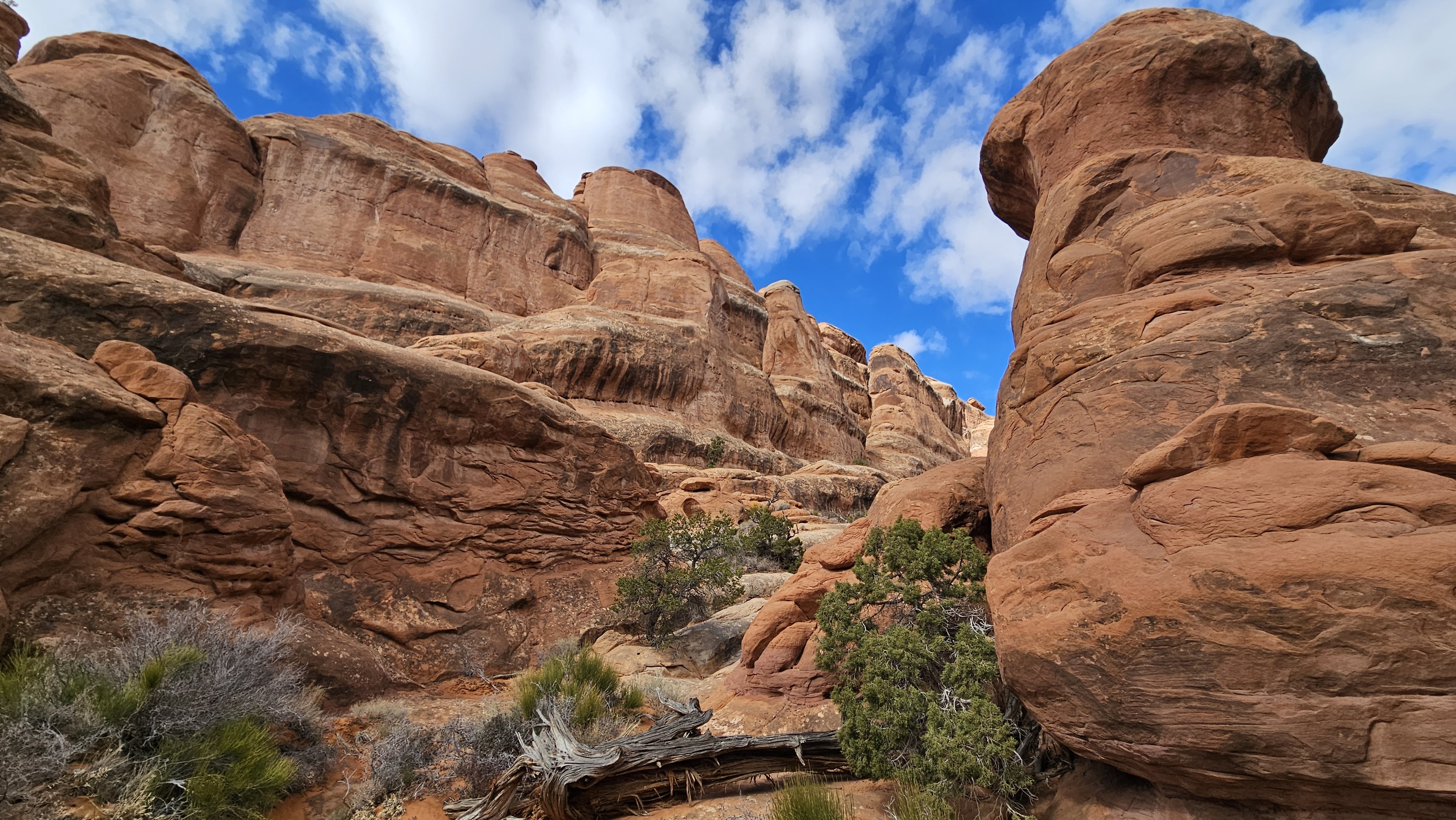
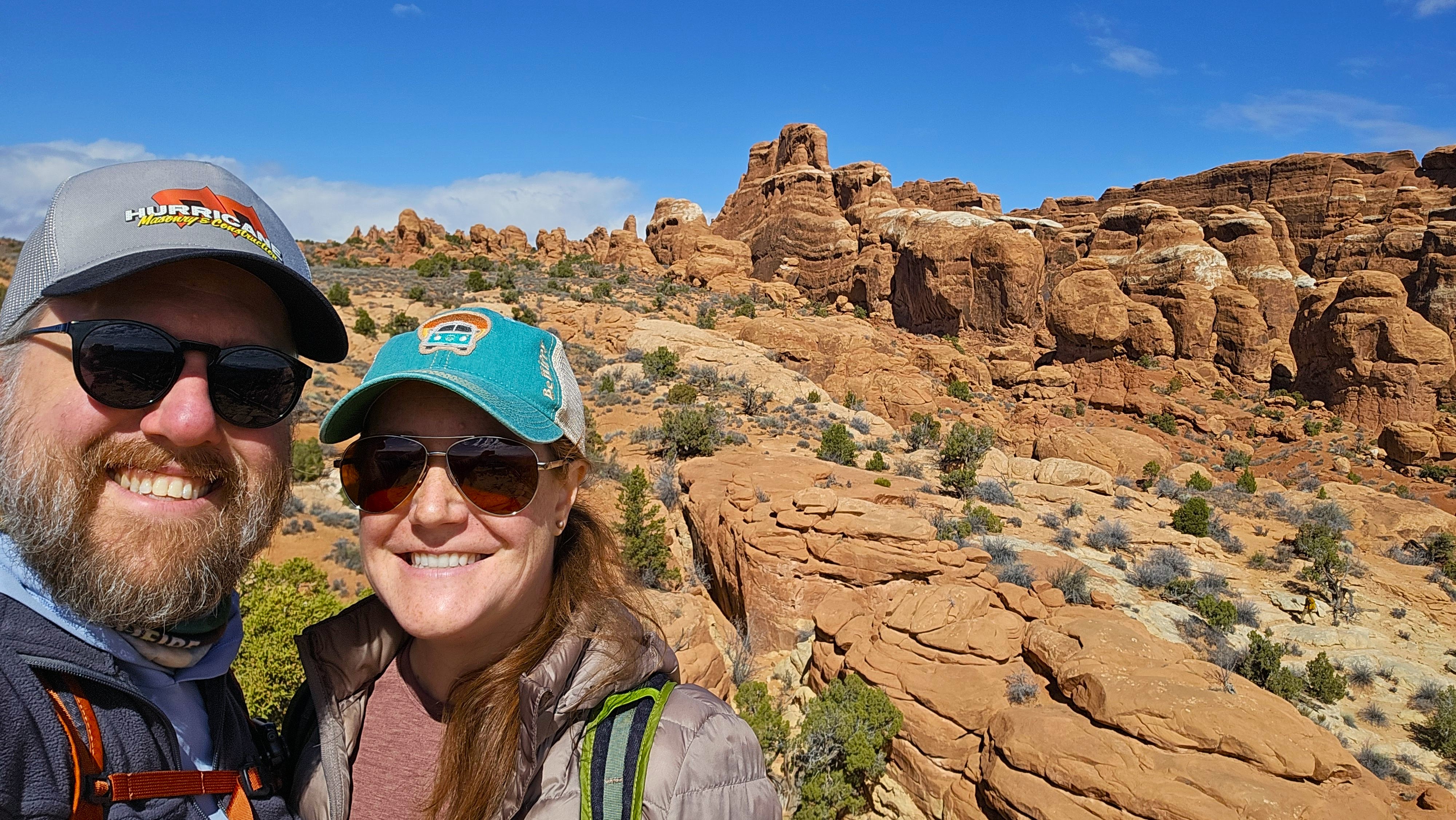
Fiery Furnace: Permit-only Labyrinth
When we were planning our trip, I asked some friends about their favorite hikes in Arches National Park. One of my friends from Kent State who now lives in Utah recommended we reserve a permit to hike the Fiery Furnace, which I quickly learned is a labyrinth of narrow sandstone canyons that you can explore on your own or as a part of a guided tour. We were too early in the season for a guided tour so I reserved us timed entry permits to explore on our own the second morning of our visit.
On our first day in the park, we had to stop in the visitor center to retrieve our permit. We were required to watch a video about how to safely navigate the Furnace, including information about staying on hard rock or washes in order to avoid stepping on the vulnerable soil crust. After the video, a ranger gave us a brief talk, administered a short quiz, and then gave us our permit for the following day.
Desert soils may appear barren, but they teem with living organisms that bind loose, fragile soils together so they can support plant and animal life. These organism-rich soils are a critical part of the ecosystem in canyon country. Called biological soil crusts, they prevent erosion, absorb water, and provide vital nutrients to plants. This community of cyanobacteria, lichen, algae, and fungi grow slowly. A single footstep can destroy hundreds of years of growth.
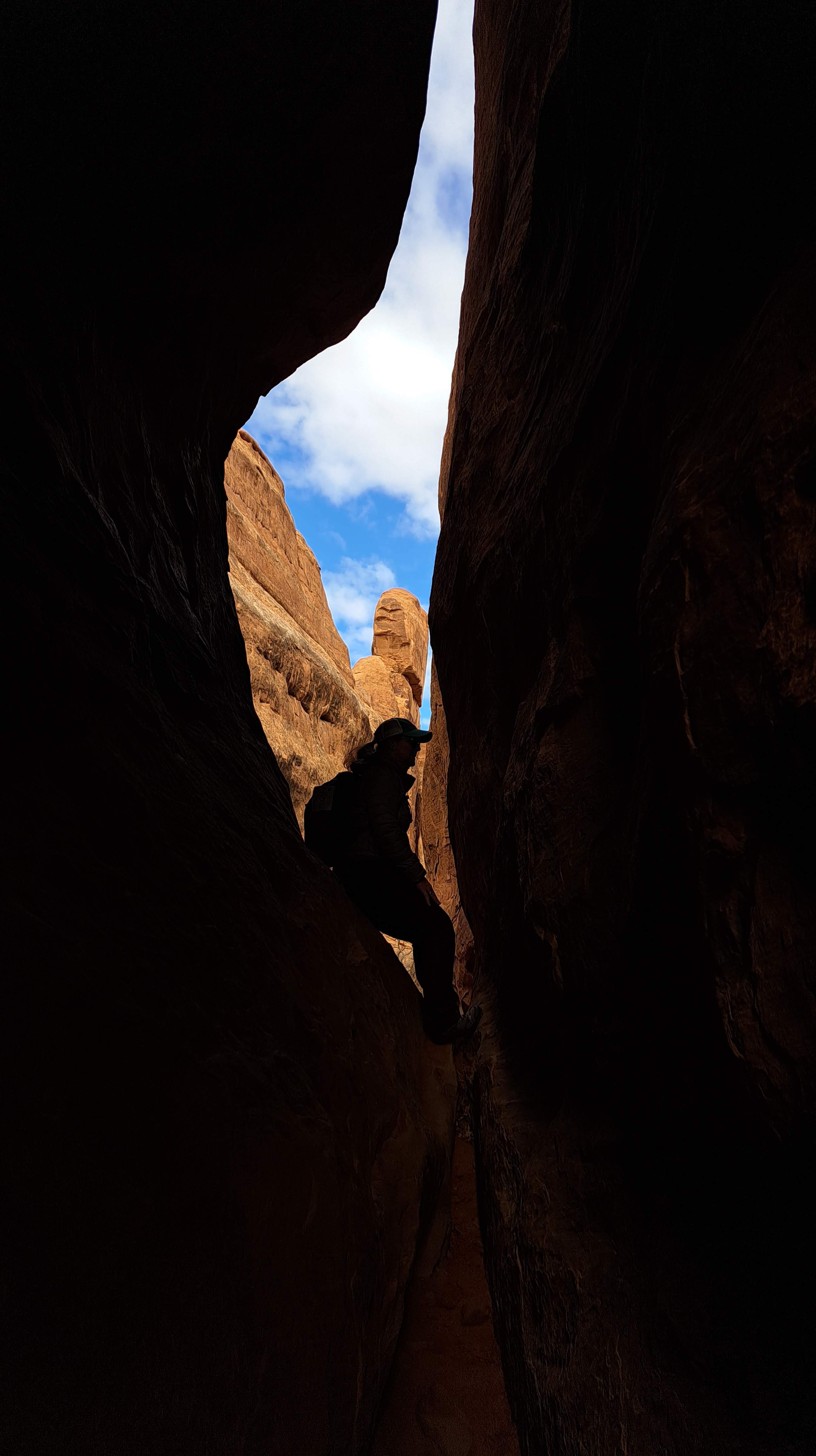
We spent several hours in the Furnace, and it was unlike any hike I’ve ever done. At times it was very frustrating trying to find a route that wouldn’t result in us damaging the soil crust. We had to backtrack several times in order to eventually find an appropriate path. There were narrow sections we had to squeeze through, areas where we had to scramble over or climb the rock in order to access the next area, and amazing formations towering overhead.
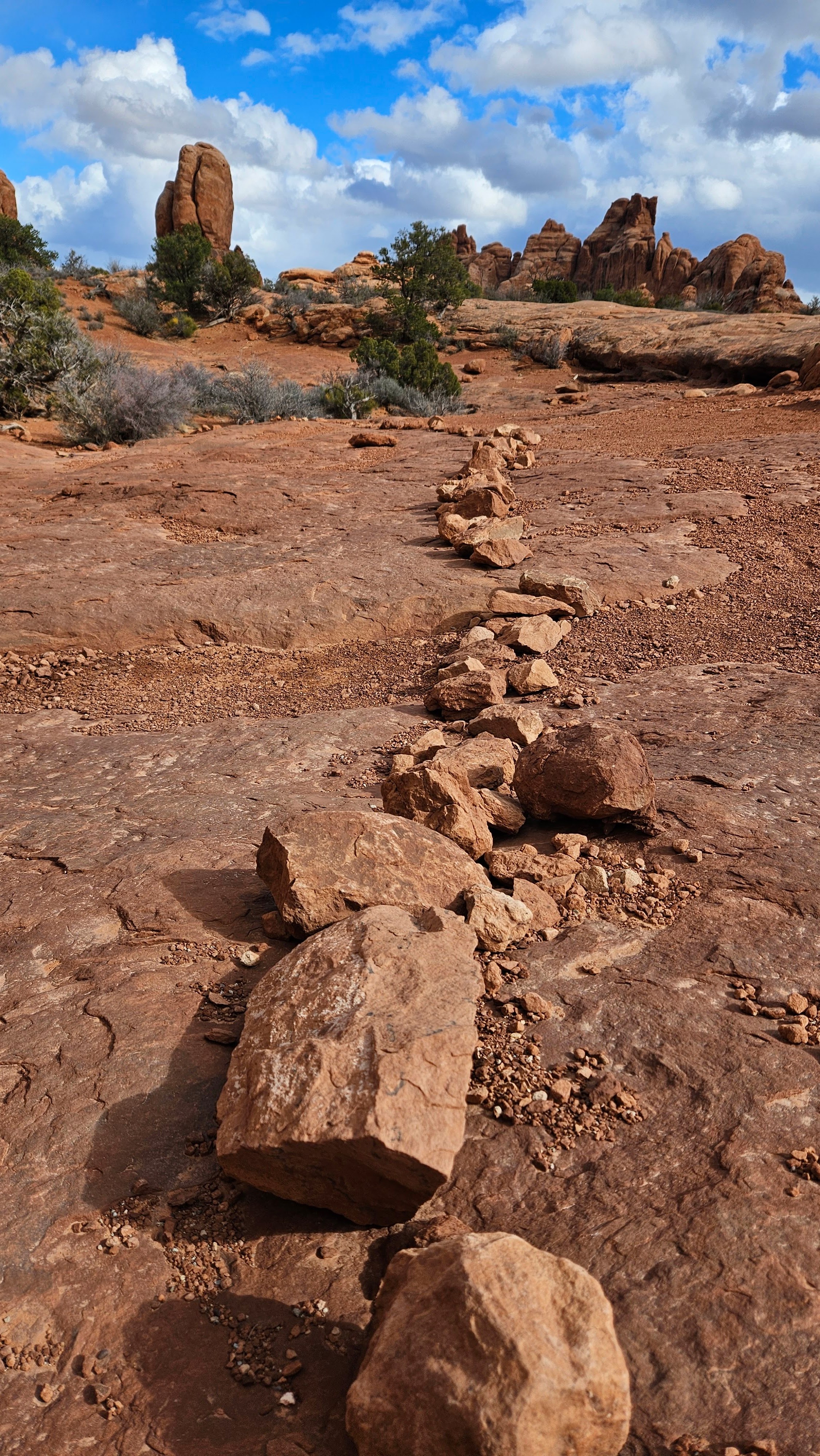
We’d read there were small white arrows affixed to the rock in certain places to help the guides navigate groups through the maze, and once I found one, I was on the hunt to find more so we could complete the loop. That made the hike much more enjoyable for me – I liked the challenge of spotting the tiny arrows (which were NOT always easy to find!) and the reassurance that we were on an approved route and not damaging the terrain underfoot.


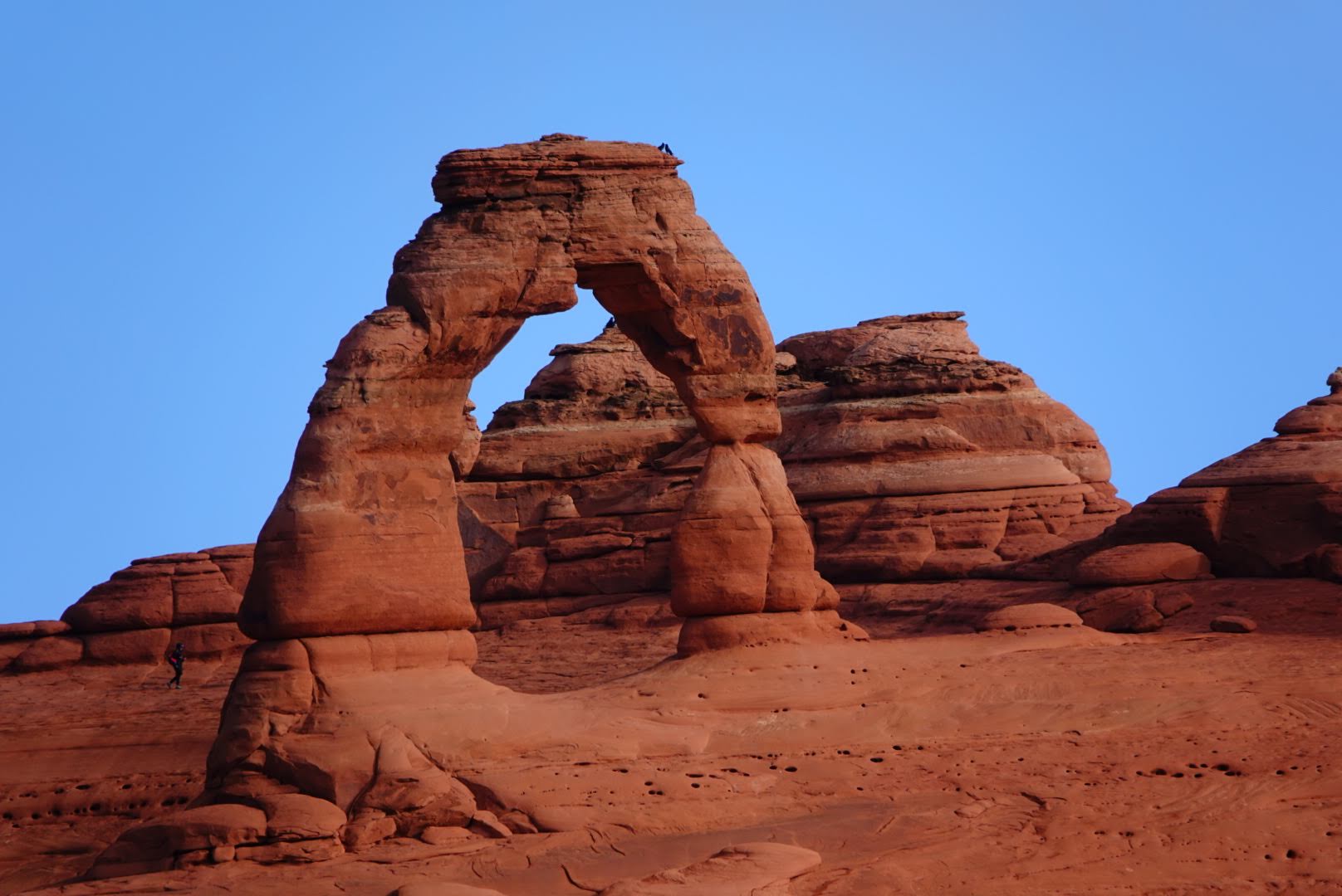
Delicate Arch
Our final hike was to the iconic Delicate Arch, which has to be the most photographed arch in the park. We drove by the parking lot a few times during our two days in the park and it was always busy.
The hike out to the arch is no joke – 3.2 miles / 5.1 km roundtrip with 538 feet / 164 meters of gain, but the majority is straight up a steep, unshaded slickrock slope. I can’t imagine doing this hike in the summer – it was a lovely, partially sunny and relatively cool afternoon for our trek and I was still sweating profusely by the time we made it to the arch.
There’s a fun section just before the viewpoint where the sandy trail wraps around a large rock formation with a steep drop off to the outside of the trail. We saw several people who were pretty uncomfortable on this leg of the hike, hugging the inner rock as they made their way around.
We stayed at the arch for a little while, enjoying the views of the surrounding area and La Sal Mountains in the distance. There were quite a few people relaxing at the viewpoint and waiting their turn to take a photo underneath the arch.


If the hike is not for you but you’d like to see Delicate Arch, I’d recommend checking out the nearby Delicate Arch viewpoint hikes. You can drive beyond the Delicate Arch parking area to a larger parking area and picnic spot and hike two trails out to the lower Delicate Arch and upper Delicate Arch viewpoints.
Brian took the photo below from the upper Delicate Arch viewpoint – it was a great view!
It was a great first trip to Moab, and I enjoyed hiking in both Canyonlands and Arches National Parks. Although we hit several major areas in Arches National Park, we didn’t have time to explore the Courthouse Towers, Petrified Dunes, or Rock Pinnacles sections of the park. There were many more hikes and a number of viewpoints to see, and I hope we can go back at some point to explore more.

Pingback: Things to Do: Cheyenne, Wyoming – Heather's Compass
Pingback: Hiking in Capitol Reef National Park – Heather's Compass