We spent several days in Moab, Utah, so we’d have easy access to two new-to-us national parks – Canyonlands National Park and Arches National Park.
Despite being across the street from one another, significantly fewer people visit Canyonlands than Arches each year. I’m guessing it’s because Canyonlands requires you to get out of your vehicle to really experience the park while you can see a number of amazing rock formations from your car as you drive through Arches. Instagram probably also has an impact on visitation – everyone wants their photo with the iconic Delicate Arch over in Arches National Park.
We loved our very windy day in Canyonlands and could easily have spent more time there. We visited the northern Island in the Sky region, which is the one most easily accessed from Moab, but I’d love to go back and spend time in the eastern Needles region and over in the backcountry region to the west called the Maze.

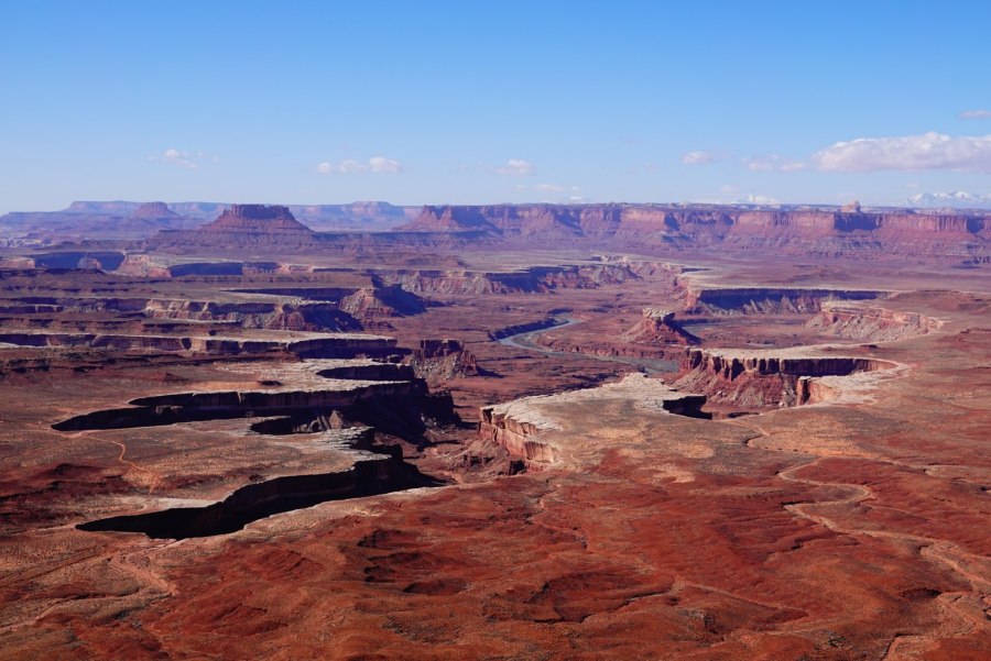
After a brief stop at the Island in the Sky visitor center to scan our park pass, watch the park movie, and grab a couple maps we headed to Green River Overlook. The Green and Colorado rivers flow through Canyonlands, forming the two canyons that create the park’s three distinct regions.
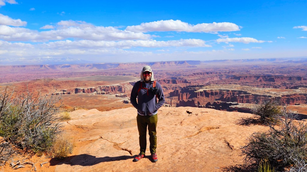
Island in the Sky – a broad mesa wedged between the rivers – is Canyonlands observation tower. From it you see vistas of dimensions hard to comprehend.
NPS brochure


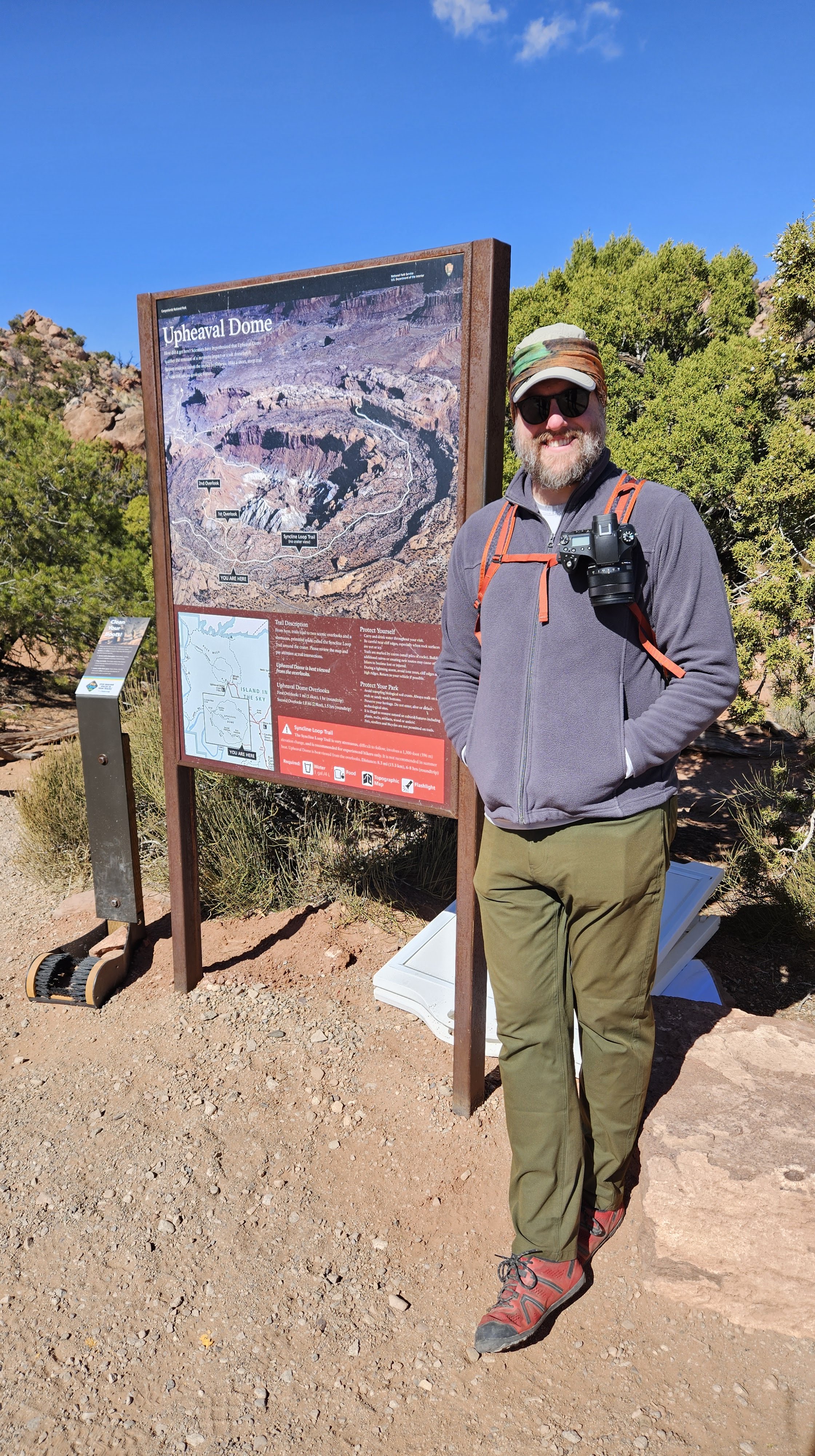
Our second stop was the mysterious Upheaval Dome, where we hiked out to two viewpoints along the rim of the 1,500 foot / 457 m deep hole that looks much more like a crater than a dome. Geologists still don’t know what caused this odd phenomenon, although current theory focuses on a meteor strike.
We did our best to follow the cairns and primitive arrows directing us across the giant red rock slabs to the two viewpoints. The first one is a little better marked and only .6 miles / 1 km and 100 feet / 30 m of elevation gain roundtrip. Carrying on to the second viewpoint adds 1 mile / 1.5 km and 50 feet / 15 m elevation change.
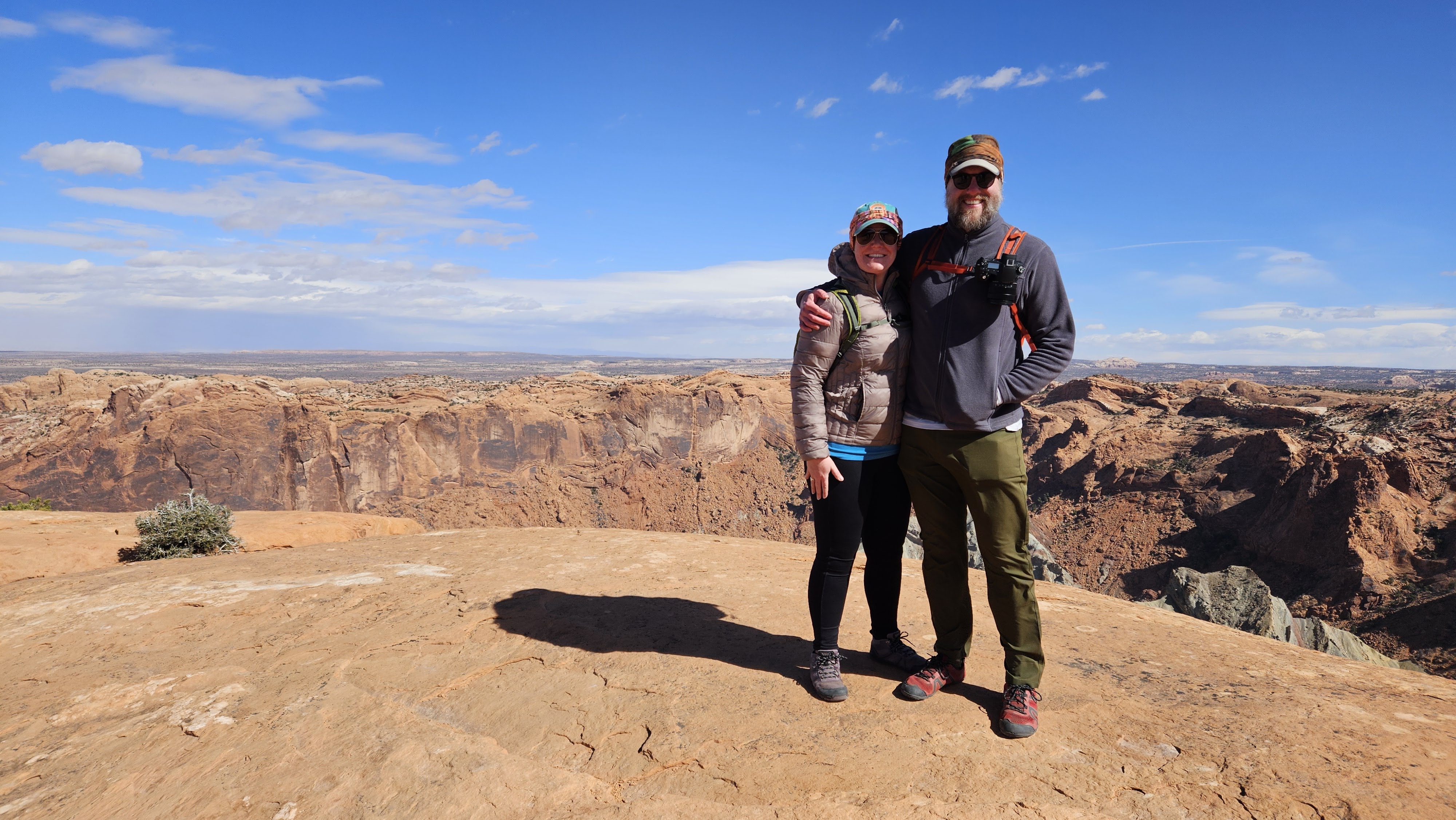

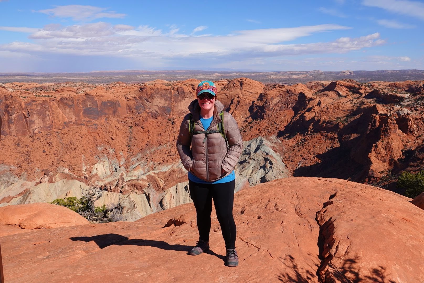
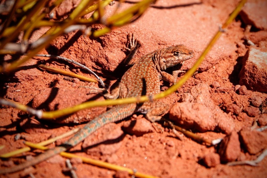
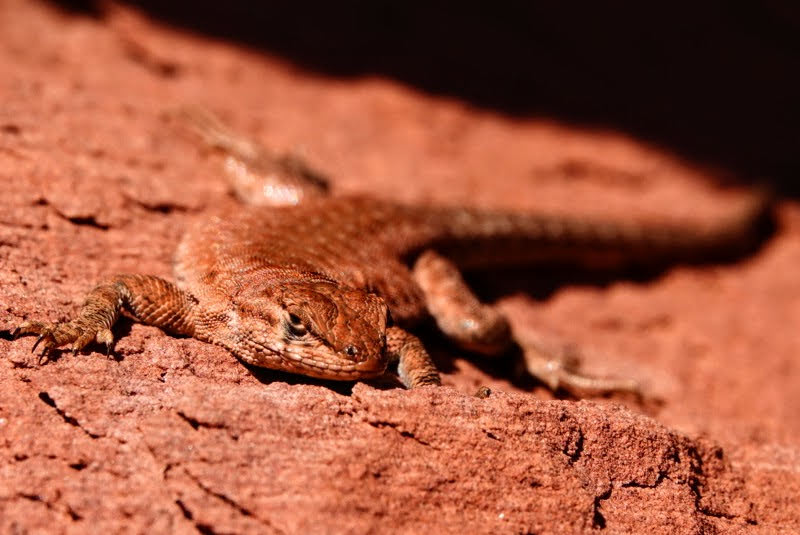
We also spent time hiking at the southernmost point of Island in the Sky via the Grand View Point Overlook. While you can simply park and enjoy the view from the overlook, there is a 1.8 mile / 2.9 km out-and-back trail that winds out to the actual Grand View Point.
The wind was still gusting so we stayed clear of the exposed rim as we made our way to the trail’s turnaround point. Along the way we saw several lizards sunning themselves on the warm rocks.

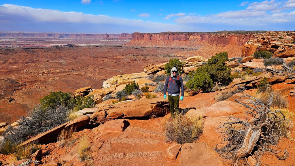
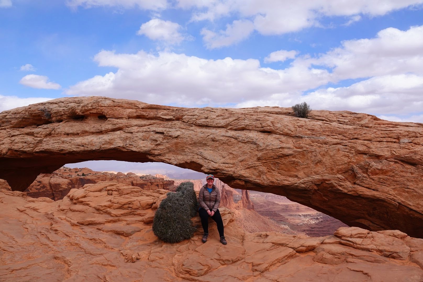
While Arches National Park is certainly more well-known for its namesake rock formations, it turns out Canyonlands has its own standout arch, known as Mesa Arch.
The wind and clouds were picking up as we made our way along the easy .6 mile / 1 km loop trail to the arch, which had great views of nearby rock spires with the La Sal Mountains as a backdrop.

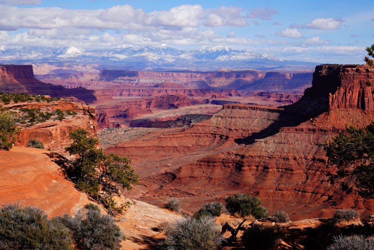
At the beginning or ending of your time in the park, you can walk across the street from the visitor center parking lot to the Shafer Canyon Overlook.
Despite the clouds, we had colorful views of the canyon and the snowy tops of the La Sal Mountains. Nearby is the access point for Shafer Trail Road, an unpaved 4WD road that winds down into the canyon and throughout the park.
It was a full-day visit to the Island in the Sky region of Canyonlands National Park and definitely left us wanting more. Hopefully someday we can come back and visit the other sections of this impressive national park!

Pingback: Things to Do: Cheyenne, Wyoming – Heather's Compass
Pingback: Hiking in Capitol Reef National Park – Heather's Compass
Pingback: Hiking in Arches National Park – Heather's Compass