
After a full day at Petrified Forest National Park, we planned to conclude our time in northeast Arizona by visiting two well-known sites in the Navajo Nation – Canyon de Chelly and Monument Valley – before heading on to eastern Utah.
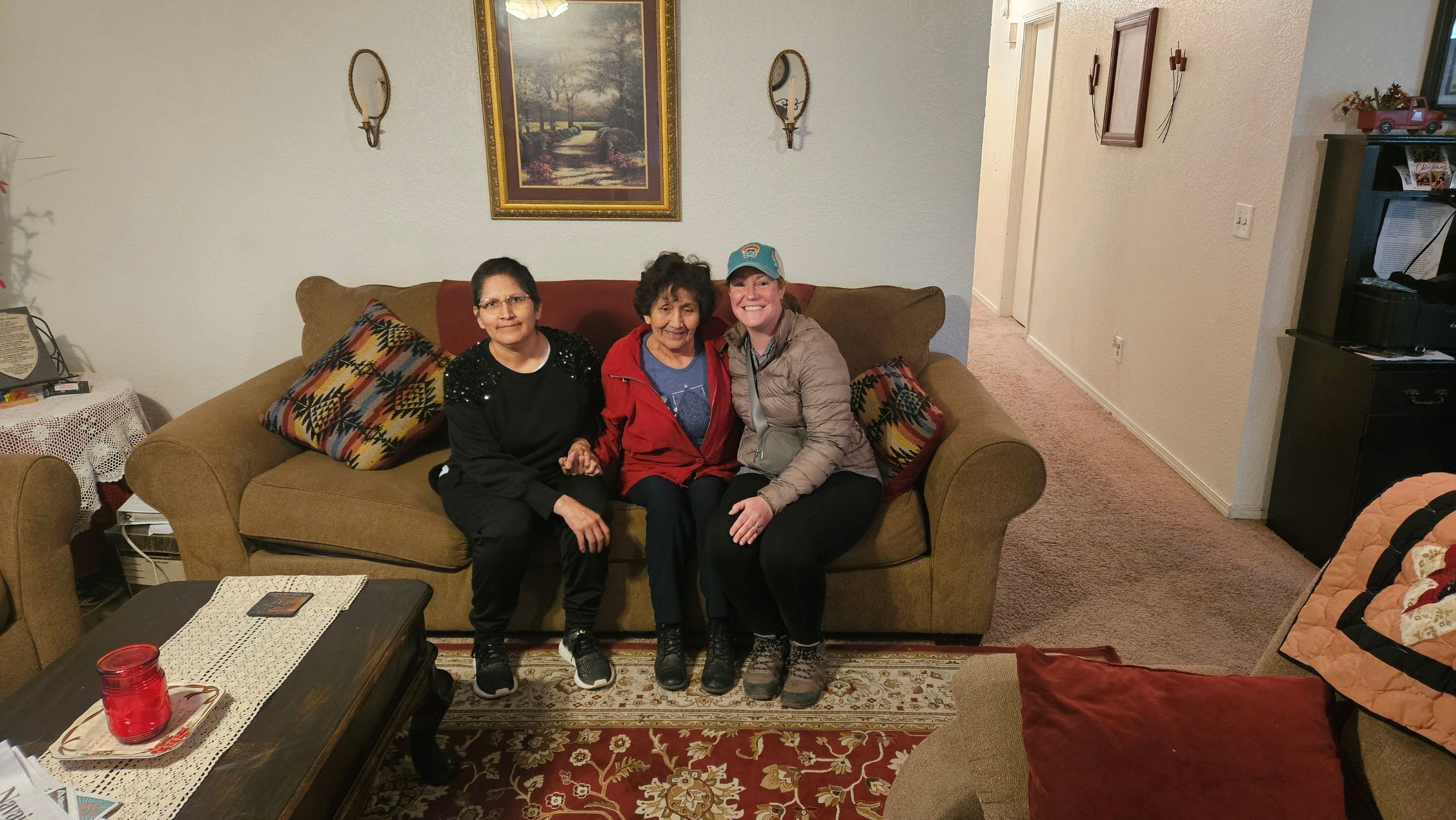
Although this remained our plan, we added in a last-minute stop along the way at Window Rock to deliver quilting supplies my mom and her quilting group had pulled together for an organization that helps distribute these items to various quilters throughout the Navajo Nation.
Window Rock
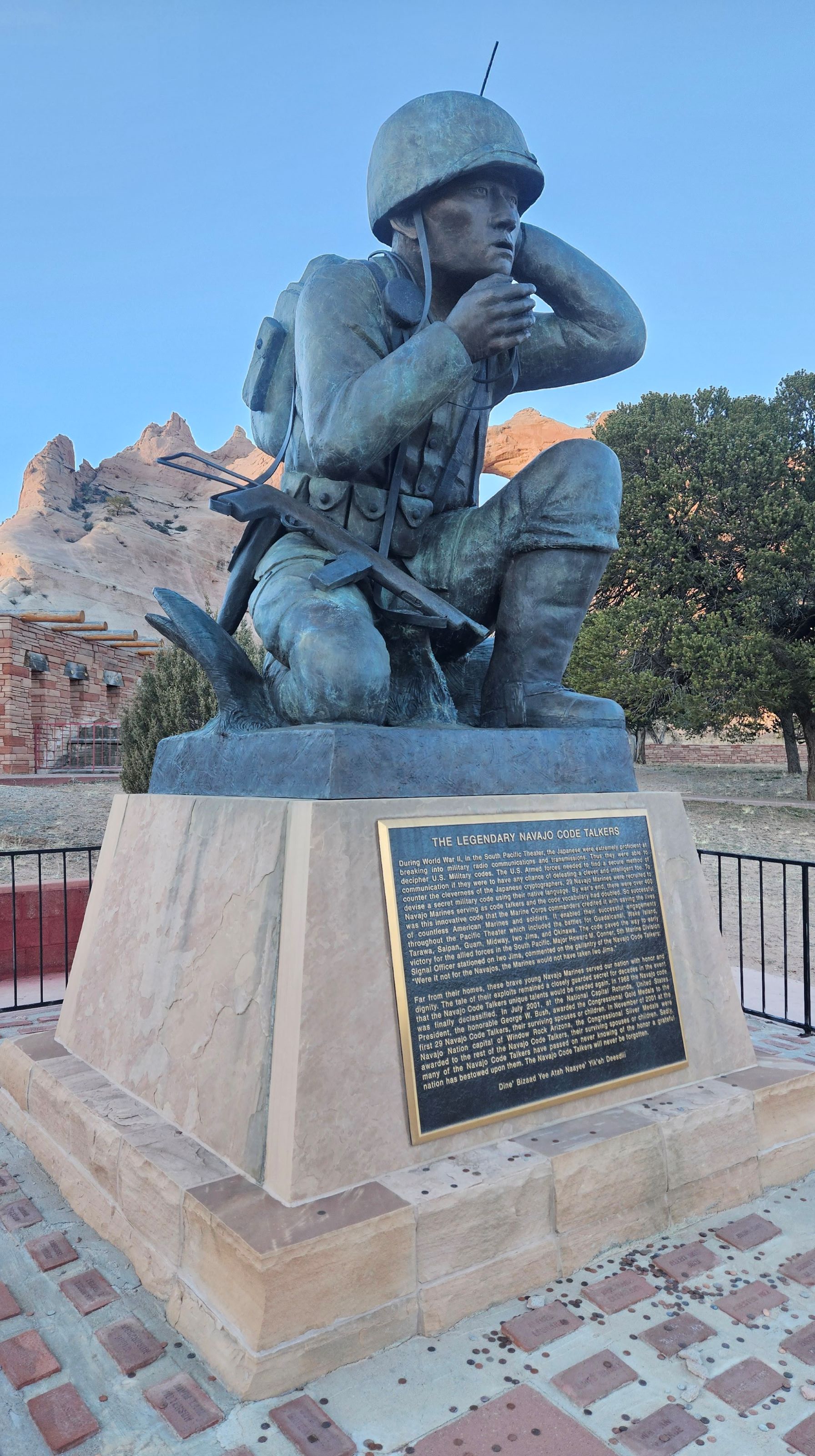
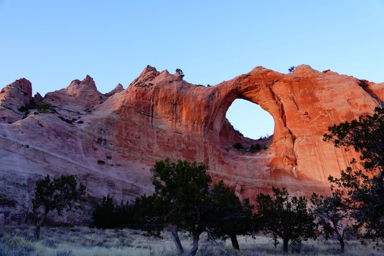
Our first stop upon entering the Navajo Nation – the largest territory of a sovereign Native American nation – was Window Rock, the nation’s capital. Our hosts, Lola and Tonya Woods, took us to Window Rock Tribal Park and Veteran’s Memorial, which is home to the rock formation that gives the capital its name. Next to the park are the tribal governmental offices, including the Office of the President and Vice President, Attorney General’s Office, Navajo Nation Council Chambers, and more.
In addition to the Window Rock feature, the park is home to a memorial Lola brought to our attention honoring the WWII Navajo Code Talkers, who took part in every assault the U.S. Marines conducted in the Pacific from 1942 to 1945. Nearly 400 Navajo people served as code talkers in the war, successfully transmitting messages by telephone and radio in their native language, which the Japanese were never able to break.
We briefly stopped at Lola’s home to unload all of the quilting supplies. She and Tonya were kind and gracious hosts, and they gave us a few gifts and made us frybread tacos to take on the road that evening. It was an incredible way to begin our time in the Navajo Nation.
Canyon de Chelly National Monument
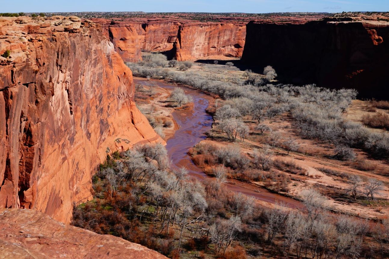
We stayed in Chinle that night and spent the following morning exploring the Canyon de Chelly (pronounced canyon d’SHAY) National Monument. People have lived in these canyons for 5,000 years – from initial residents to Ancestral Puebloan people, to Hopi and Navajo people. The Navajo people continue to live, farm, and raise sheep in the canyon today.
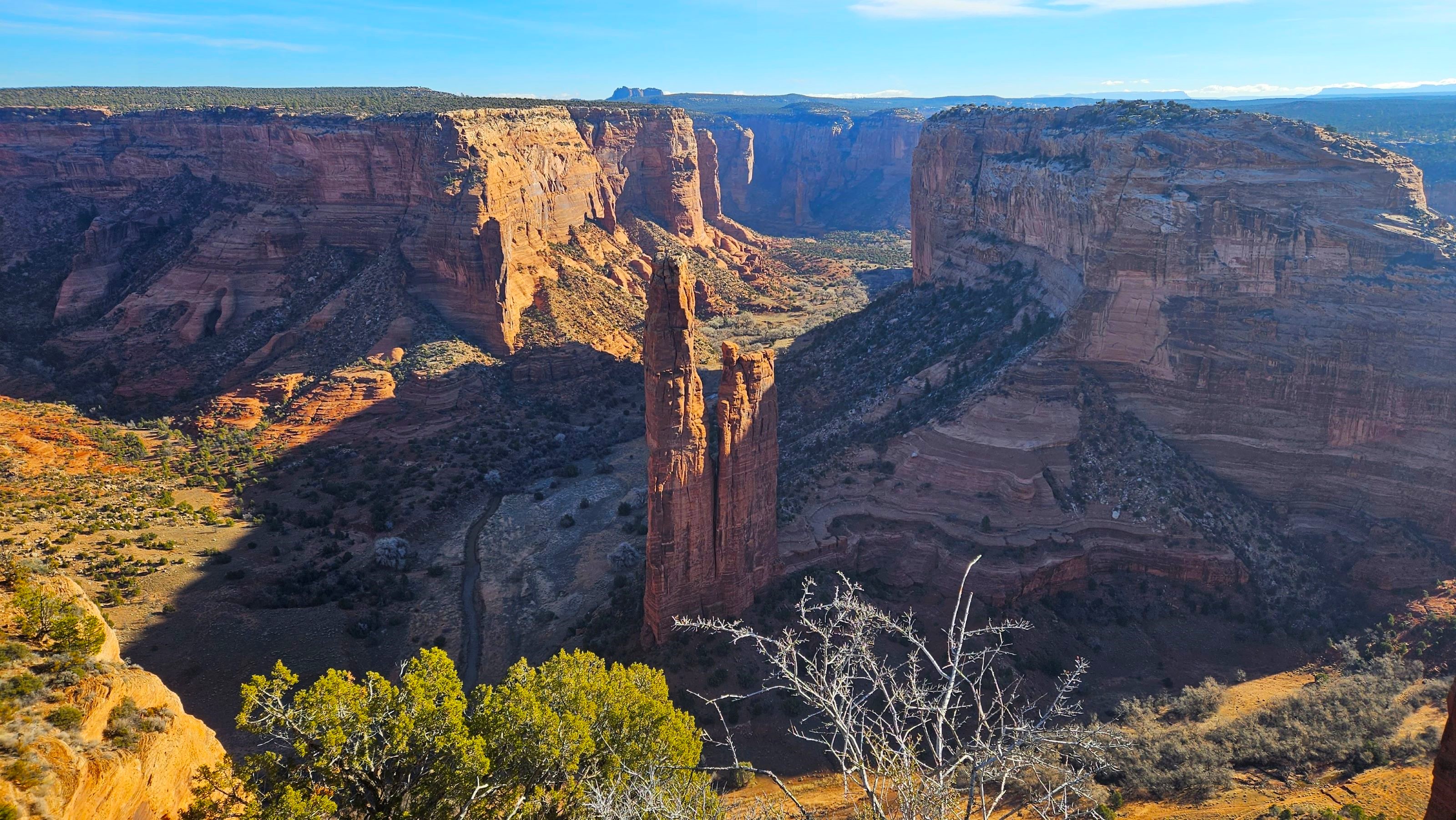
After a brief stop in the visitor center to get a map, we took the South Rim Drive (37 miles / 60 kilometers roundtrip) to the turnaround point at Spider Rock Overlook. Some of the stops on both rims are currently closed and the hikes into the canyon require booking a guide so it was helpful getting direction on how to spend our time before we set out.
The Spider Rock Overlook was a standout – you can see the 800-foot / 244-meter sandstone spire sitting out in the middle of the canyon in the photo below. We were fighting the morning side light so it was hard to capture the scale of the canyon in our pictures. On the drive back toward the visitor center we stopped at Face Rock Overlook, Sliding House Overlook, and the Tsegi Overlook for different views of the north rim, Chuska Mountains, and the farmlands below.
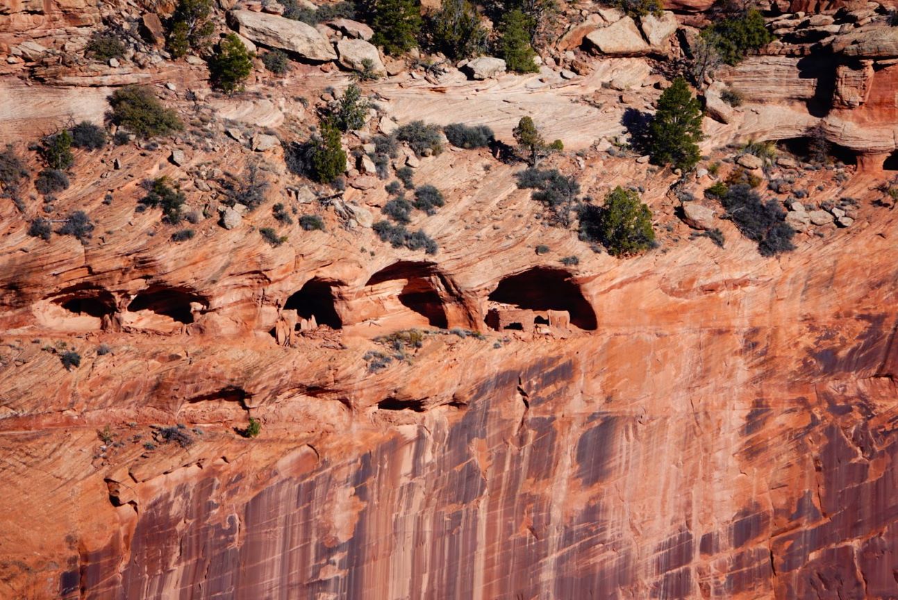
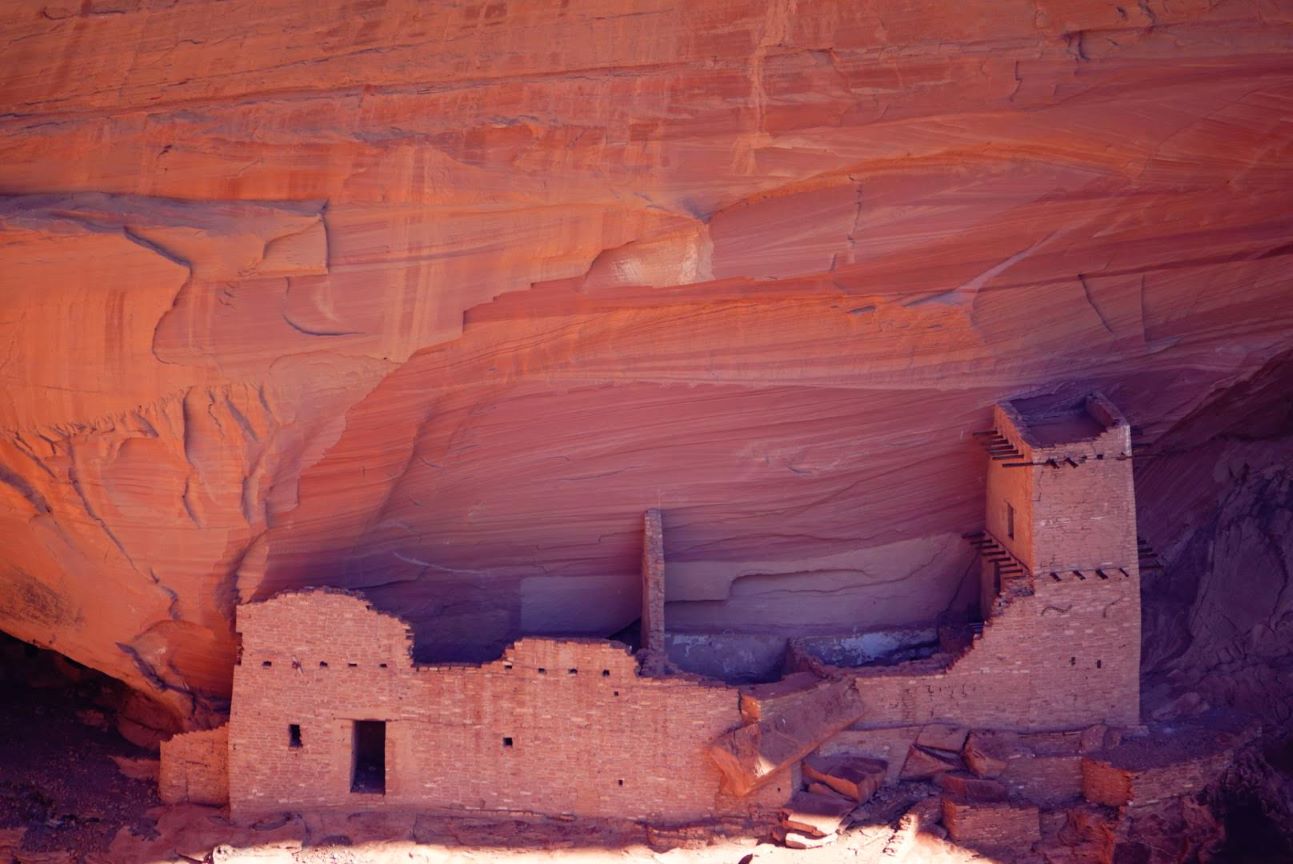
We then set out on the North Rim Drive, which is 34 miles / 55 kilometers roundtrip. We again started at the turnaround point and worked our way back to the visitor center, starting at Mummy Cave Overlook where we had views of the structures in Canyon del Muerto. The Mummy Cave structure is one of the largest Ancestral Puebloan villages in the canyon and was occupied until around 1300 AD. Another highlight on this rim was the Antelope House Overlook where we could see the Navajo Fortress, which was used as a refuge by early Navajo people.
We’ve visited a few sites that were home to the Ancestral Puebloan people, but this one stood out given its current occupation by the Navajo people and the self-guided walks out on the rim rock where you have only the most basic guidance on how to stay clear of the open cliffs. I endorse the posted warnings about keeping an eye on children and pets (and errant spouses!) during your visit.


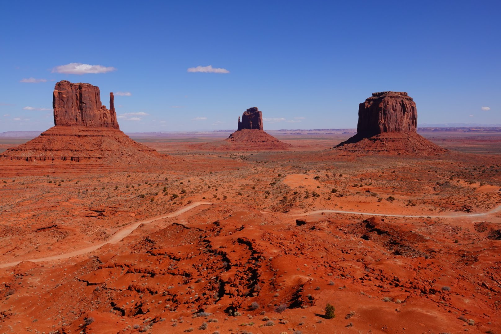
Monument Valley Navajo Tribal Park
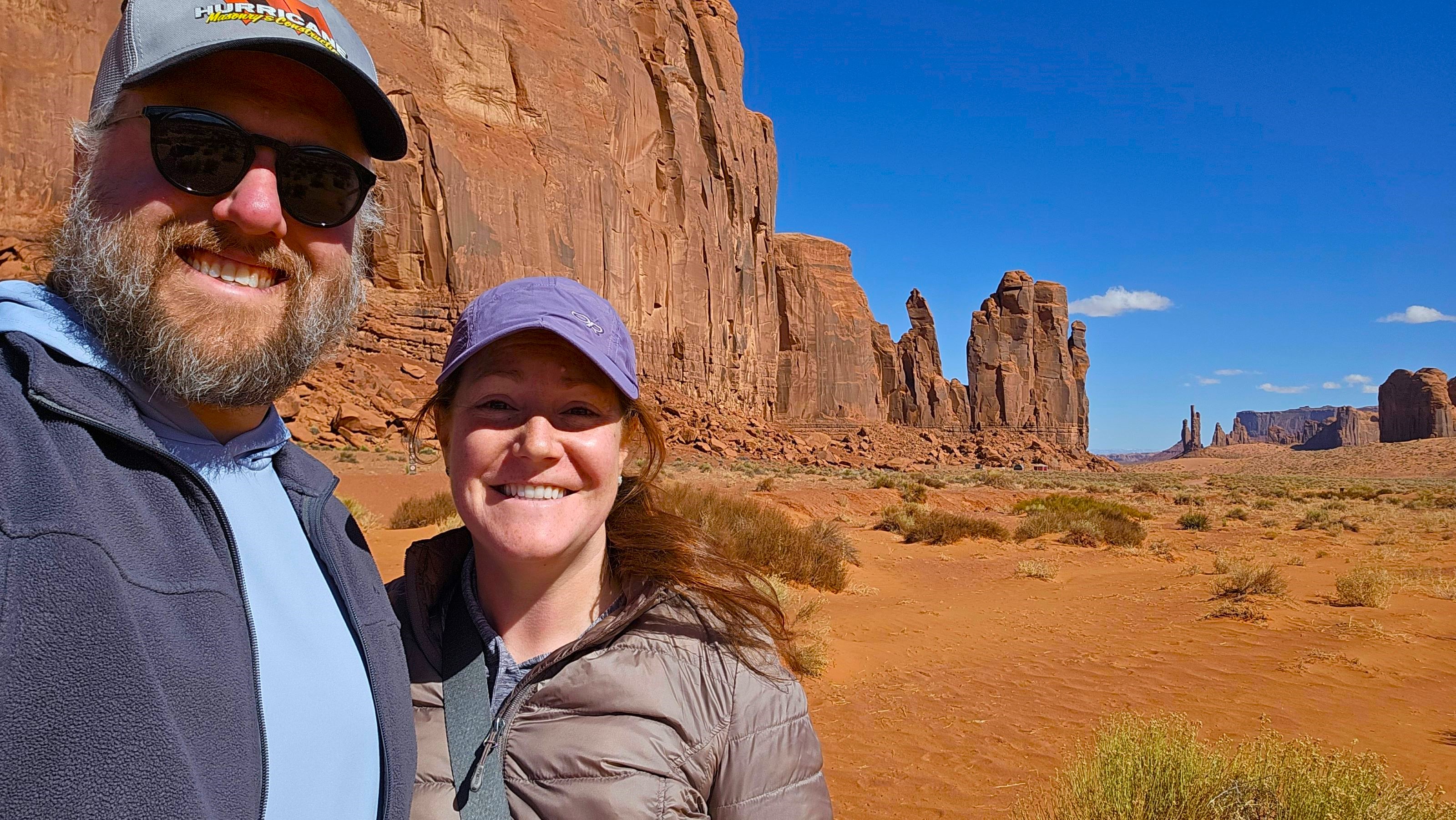
Our final stop in the Navajo Nation was the iconic Monument Valley Navajo Tribal Park, which spans northeast Arizona and southeast Utah. This location has become the face of the old west, having been featured in more than two dozen major Hollywood productions as well as countless TV shows and advertising mediums.
A few facts about this place:
- 1958 = the year the Navajo National Council established this preserve under the Division of Natural Resources
- 91,696 acres = park size, spanning Arizona and Utah
- 5,564 feet / 1,695 meters = position above sea level
- 100 to 1,500 feet / 30 to 457 meters = height of rock structures
- 26 to 98 degrees Fahrenheit / -3 to 37 degrees Celsius = the temperature range during the preserve’s four seasons
We paid at the entry booth and started at the visitor center and museum. Several services and area of the preserve were closed since we were in the off-season, which actually make it easier to narrow down how we wanted to spend the few hours we had to explore. While the views from the visitor center were remarkable – many people simply came to the visitor center, took a few photos of the landscape below and around them, and left – we decided to drive the Valley Road down among the rock formations for a different perspective.
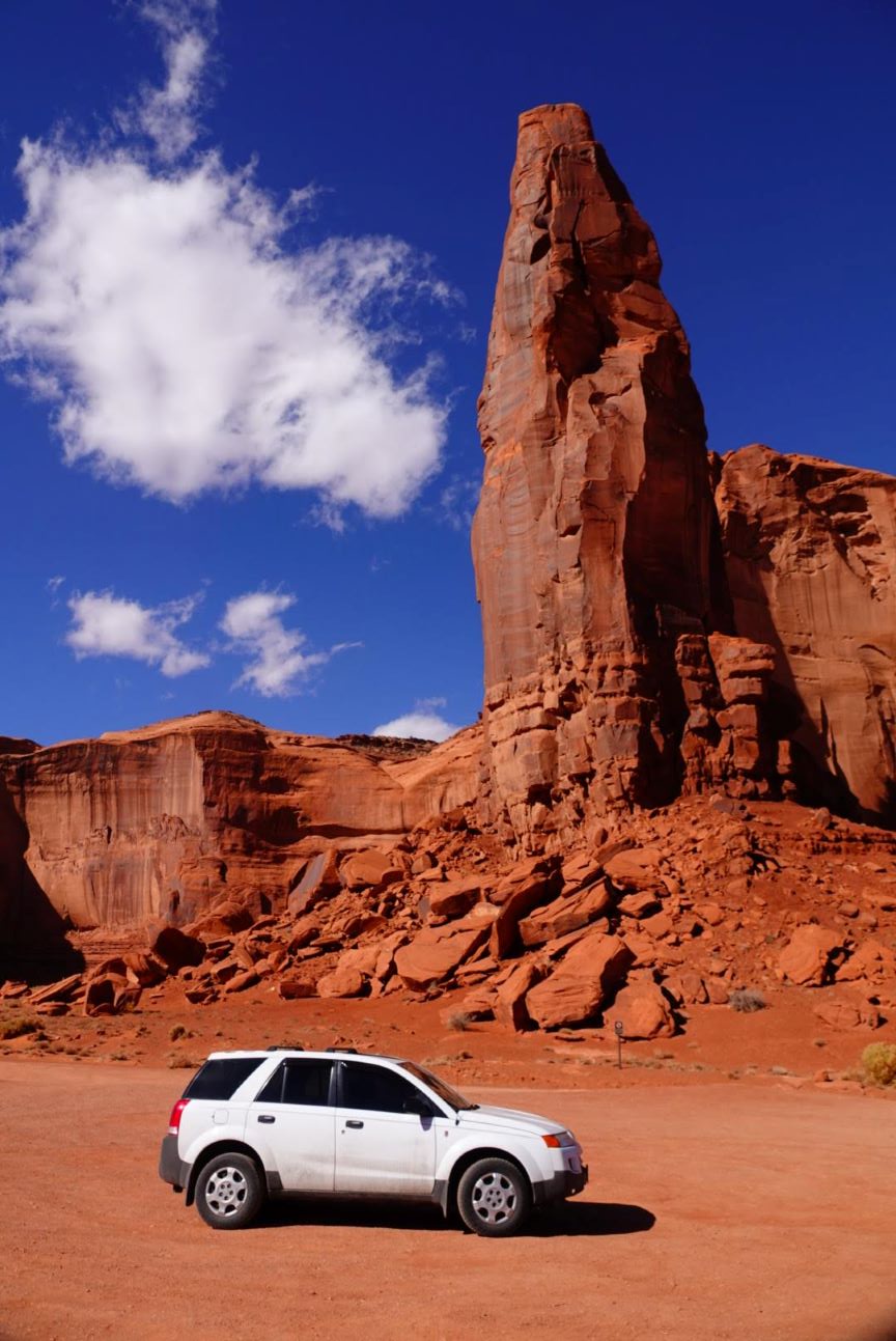
While the 17-mile / 27-kilometer, unpaved road doesn’t require a high-clearance, four-wheel drive vehicle, it would have been much more comfortable completing the loop in something more suitable for offroad driving than our 2005 Saturn Vue!
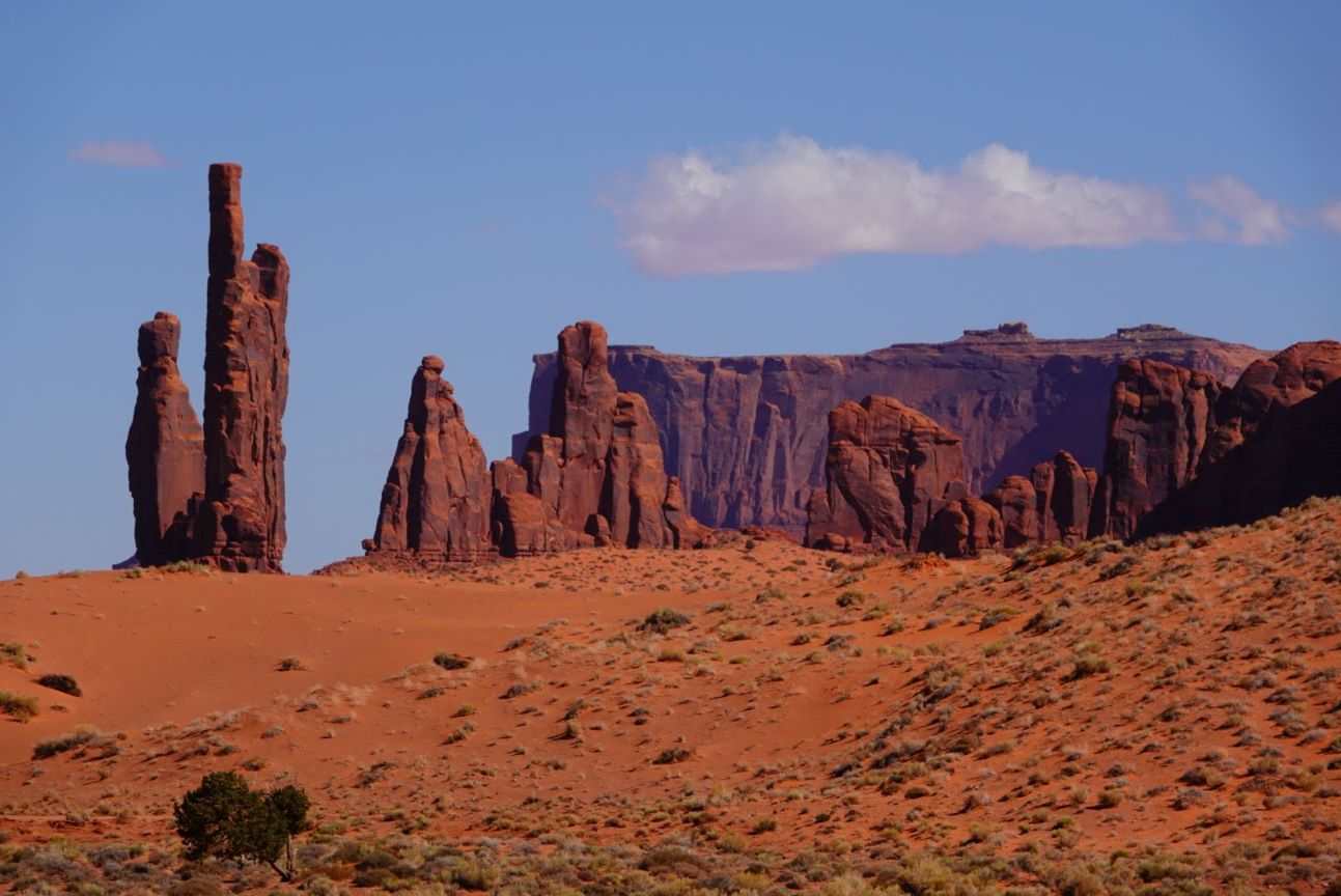
The section of road winding down into the valley was the most hazardous of our adventure, with lots of exposed rocks and deep holes and crevices. We managed to lurch our way down to the relatively flat, one-way loop portion of the drive and enjoyed wandering around at the red dirt pull-offs along the way.
Our preserve map highlighted 10 key stops along the drive, describing the names and history of some of the more iconic rock monuments. We learned that there are three stages of erosion that lead to the formations – mesa (wide, stable table of rock), butte (smaller, eroded version of a mesa), and spire (eroded butte that has become narrow and free standing). There were great examples of all three throughout our drive.
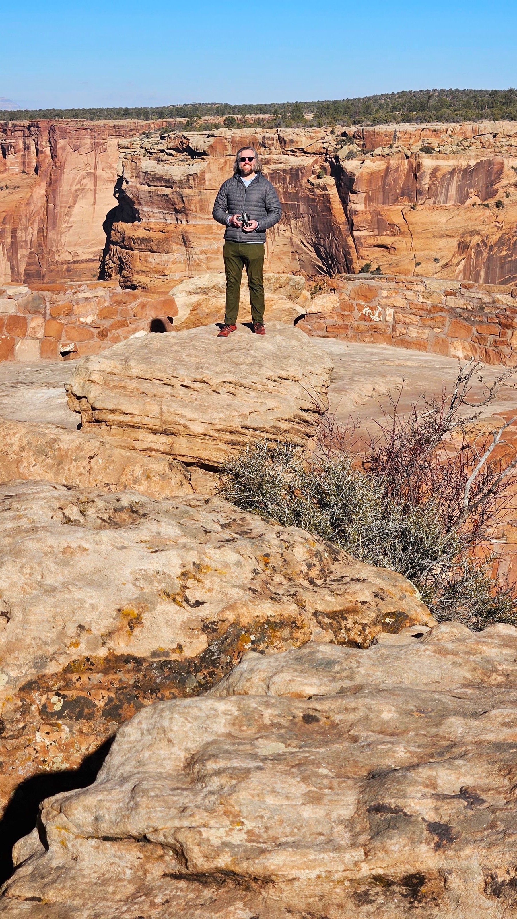
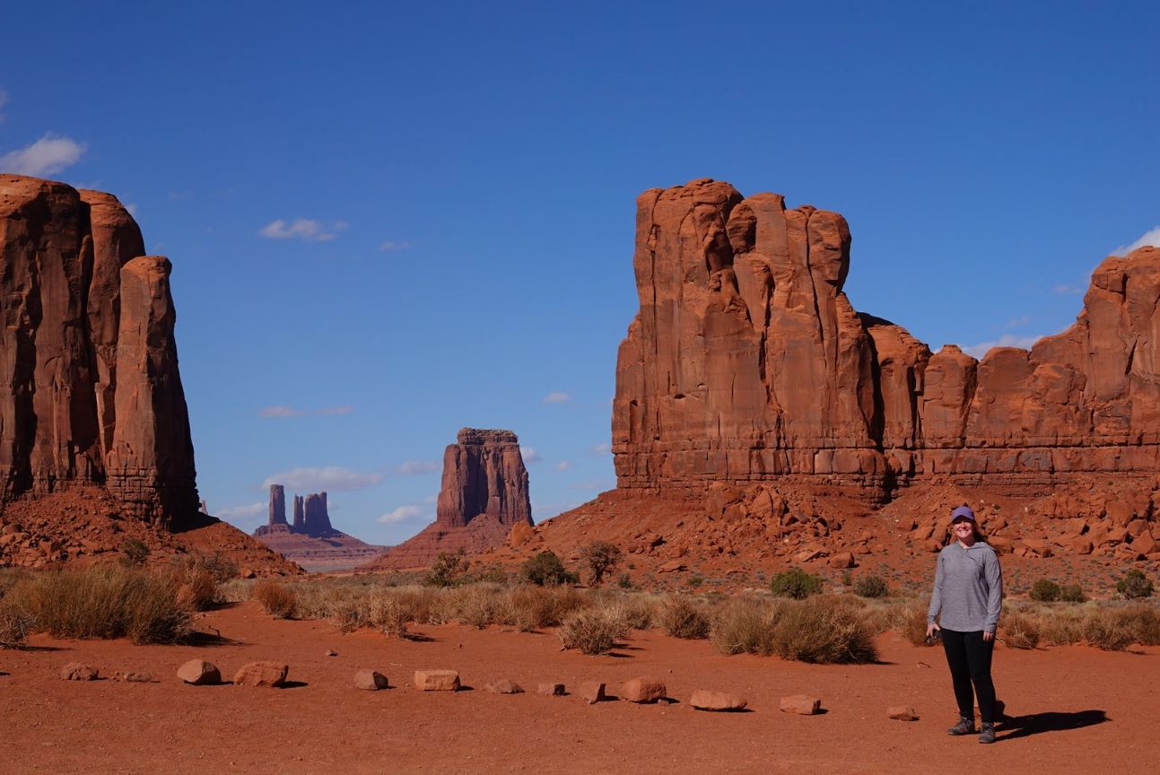
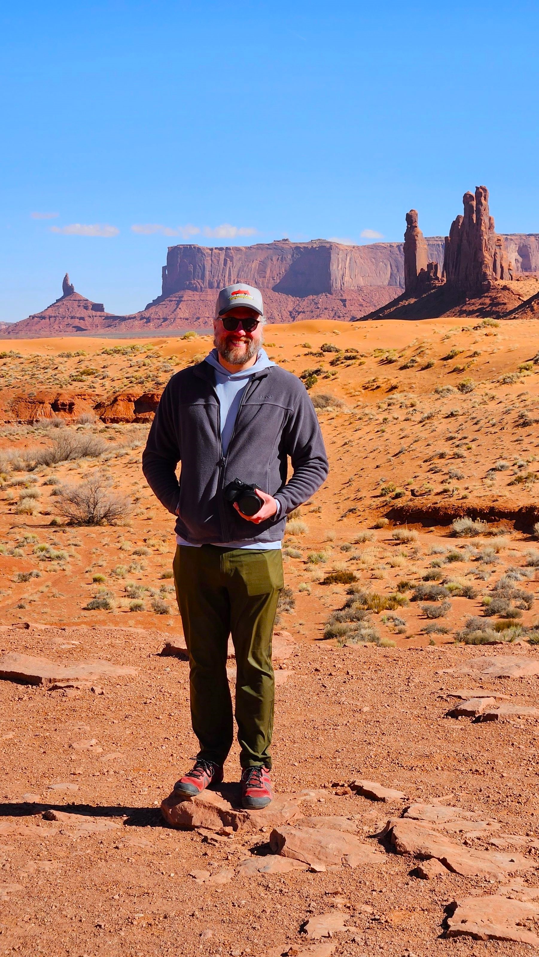
I especially enjoyed our final stop at the North Window overlook – I’m standing at this point in the photo of me below. It had great views of the buttes and spires to the north, and we had up-close looks at Elephant Butte, Camel Butte, and Cly Butte, which surrounded us to the east and west.

One day plus one evening wasn’t nearly long enough to explore the many sites throughout the Navajo Nation or to accomplish everything there was to do at the sites we prioritized.
While I wouldn’t want to visit Canyon de Chelly or Monument Valley in the summer heat, I would be interested in coming back further into the shoulder season when additional services and hikes are accessible to experience more of both of these places.

Pingback: Hiking in Capitol Reef National Park – Heather's Compass